|
|
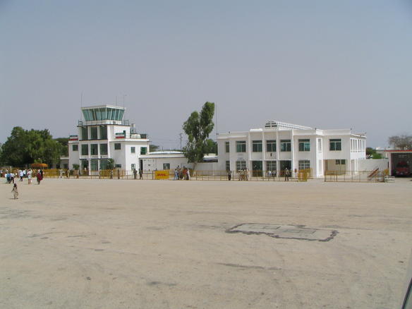
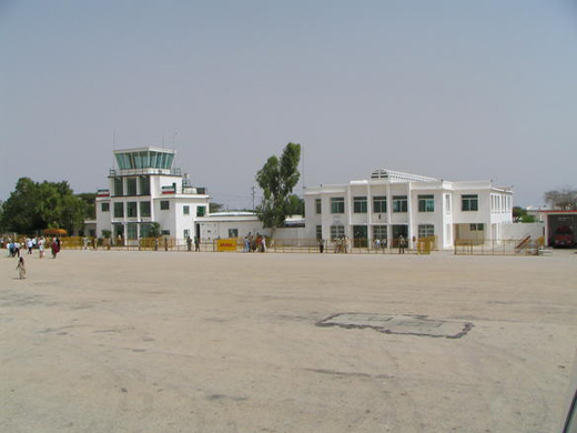
| Hargeisa Egal International Airport |
 |
| IATA: HGA – ICAO: HCMH |
| Summary |
| Airport type |
Public |
| Location |
Hargeisa |
| Elevation AMSL |
4,423 ft / 1,348 m |
| Coordinates |
09°31′05.40″N 44°05′19.53″E / 9.518167°N 44.0887583°E / 9.518167; 44.0887583Coordinates: 09°31′05.40″N 44°05′19.53″E / 9.518167°N 44.0887583°E / 9.518167; 44.0887583 |
| Runways |
| Direction |
Length |
Surface |
| ft |
m |
| 06/24 |
8,000 |
2,438 |
Paved Asphalt
(no ILS) |
Hargeisa Egal International Airport (IATA: HGA, ICAO: HCMH) (Somali: Madaarka Hargeysa ee Calaamiga) is an international airport in the city of Hargeisa in Somaliland, a de facto independent republic which is recognized as a part of Somalia. Hargeisa is Somalia's second largest city and Somaliland's capital and largest city.
The airport has been rebuilt since 1991 and is now a modern international airport. The airport serves only a few airlines because it is internationally unrecognised with only Ethiopia having foreign links with Somaliland.
The airport was named after the late President of Somaliland [[H.E Mr] Muhammad Haji Ibrahim Egal. Moxamed Xaaji Ibraahim Cigaal or Egal was a former Somali prime minister in the early 1960s. Mr. Egal found a new political awakening by becoming Somaliland region's second president.
The "Egal International Airport" has undergone some modernizing and rebuilding with the rest of the Somaliland region. However, the airport is still referred to by its old and more common name, Hargeisa International Airport.
Airlines and destinations
| Airlines |
Destinations |
| Daallo Airlines |
Addis Ababa, Djibouti, Mogadishu, Nairobi |
| Djibouti Airlines |
Bosaso, Djibouti |
| Jubba Airways |
Mogadishu |
The above content comes from Wikipedia and is published under free licenses – click here to read more.
| General Info
|
| Country |
Somalia
|
| ICAO ID |
HCMH
|
| Time |
UTC+3
|
| Latitude |
9.518167
09° 31' 05.40" N
|
| Longitude |
44.088758
044° 05' 19.53" E
|
| Elevation |
4423 feet
1348 meters
|
| Magnetic Variation |
001° E (01/06)
|
| Operating Agency |
CIVIL GOVERNMENT, (LANDING FEES AND DIPLOMATIC CLEARANCE MAY BE REQUIRED)
|
| Operating Hours |
SEE REMARKS FOR OPERATING HOURS OR COMMUNICATIONS FOR POSSIBLE HOURS
|
| Runways
|
| ID |
Dimensions |
Surface |
PCN |
ILS
|
| 06/24 |
8000 x 148 feet
2438 x 45 meters |
ASPHALT |
- |
NO
|
| Supplies/Equipment
|
| Fuel |
Jet A1, without icing nhibitor.
|
| Remarks
|
| CAUTION |
Excessive standing water on rwy and twy dur the rainy seasons. Ctn while ldg, tkof and taxiing due to pools of stagnant water on the rwys and twys during rainy season. Rwy sfc deteriorated, acft abv AUW 77 use Berbera arpt UFN. Possible presence of large birds on or at the vcnty of the afld.
|
| CSTMS/IMG |
Avbl.
|
| FUEL |
Avbl 0400-1400Z (NC-A1)
|
| OPR HOURS |
Opr 0330-1500Z.
|
The content above was published at Airports-Worldwide.com in 2010.
We don't guarantee the information is fresh and accurate. The data may be wrong or outdated.
For more up-to-date information please refer to other sources.
|
|