 |
|
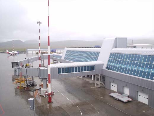
Ugolny Airport
Аэропорт Угольный |
 |
| IATA: DYR – ICAO: UHMA |
| Summary |
| Airport type |
Public / Military |
| Operator |
Federal State Unitary Enterprise "ChukotAVIA" |
| Serves |
Anadyr |
| Elevation AMSL |
194 ft / 59 m |
| Coordinates |
64°44′6″N 177°44′30″E / 64.735°N 177.74167°E / 64.735; 177.74167 |
| Runways |
| Direction |
Length |
Surface |
| m |
ft |
| 01/19 |
3,500 |
11,483 |
Concrete |
Ugolny Airport (Russian: Аэропорт Угольный) (also Leninka, Ugolnyye Kopi, Ugolnoye) (IATA: DYR, ICAO: UHMA) is a mixed-use military and civil airfield in Siberia located 11 km east of Anadyr. The airfield was originally constructed sometime in the 1950s as a staging base for intercontinental bombers such as the Tupolev Tu-95 and Tupolev Tu-22M (as the so-called 'bounce' airdrome), but during the Cold War years it become the primary hub for civilian flights in the Chukotka region.
Though the Soviet-built Ilyushin Il-62 was a workhorse of the route from Moscow Domodedovo International Airport to Anadyr for many decades, sometime in 2006 or 2007 Transaero began placing US-built Boeing 767-300 aircraft on the route (and from July 30, 2009 - the Boeing 777-200). There is occasional charter aircraft service from Nome, Alaska to Anadyr.
Anadyr's history as a bomber base dates back to the 1950s and the Russian Air Force's OGA (Arctic Control Group) is responsible for maintaining the facility. In 2001 the airfield was visited by Tupolev Tu-95MS and Ilyushin Il-78 aircraft on exercise from Engels air base. These aircraft regularly practice attack runs to the Canadian Arctic. Interceptors such as the Sukhoi Su-15TM were based at Anadyr from the 1960s to the early 1990s, but no fighters are currently based there.
It was featured in the American novel Flight of the Old Dog Airlines and destinations
| Airlines |
Destinations |
| Bering Air |
Anchorage, Nome |
| Chukotavia |
Egvekinot, Keperveyem, Lavrentiya, Markovo, Pevek, Provideniya |
| Transaero Airlines |
Moscow-Domodedovo |
| Vladivostok Air |
Khabarovsk, Vladivostok |
| Yakutia |
Magadan, Moscow-Vnukovo, Pevek, Khabarovsk |
Cargo airlines
| Airlines |
Destinations |
| Volga Dnepr |
|
The above content comes from Wikipedia and is published under free licenses – click here to read more.
| General Info
|
| Country |
Russia
|
| ICAO ID |
UHMA
|
| Time |
UTC+12(+13DT)
|
| Latitude |
64.734950
64° 44' 05.82" N
|
| Longitude |
177.741483
177° 44' 29.34" E
|
| Elevation |
194 feet
59 meters
|
| Type |
Civil
|
| Magnetic Variation |
003° E (01/06)
|
| Operating Agency |
CIVIL GOVERNMENT, (LANDING FEES AND DIPLOMATIC CLEARANCE MAY BE REQUIRED)
|
| Near City |
Anadyr
|
| Operating Hours |
SEE REMARKS FOR OPERATING HOURS OR COMMUNICATIONS FOR POSSIBLE HOURS
|
| Daylight Saving Time |
Last Sunday in March to last Sunday in October
|
| Communications
|
ANADYR TWR
Opr HO. Call START.
|
124.0
|
ANADYR APP
Opr HO.
|
124.0
|
| Runways
|
| ID |
Dimensions |
Surface |
PCN |
ILS
|
| 01/19 |
11483 x 197 feet
3500 x 60 meters |
CONCRETE. |
043RAXT |
NO
|
| Navaids
|
| Type |
ID |
Name |
Channel |
Freq |
Distance From Field |
Bearing From Navaid
|
| NDB |
UX |
ANADYR |
- |
790 |
3.1 NM |
193.7
|
| Remarks
|
| FUEL |
(NC-TS1)
|
| OIL |
O-MK8
|
| OPR HOURS |
Opr 2100-0700Z++ Thu-Tue, 2100-0800Z++ Wed.
|
| RSTD |
First 558' of Rwy 01-19 unuse for tkof.
|
| RWY |
First 2953' Rwy 01 PCN 58 R/A/X/T.
|
The content above was published at Airports-Worldwide.com in 2010.
We don't guarantee the information is fresh and accurate. The data may be wrong or outdated.
For more up-to-date information please refer to other sources.
|
|


