 |
|
Ufa International Airport
Международный аэропорт Уфа |
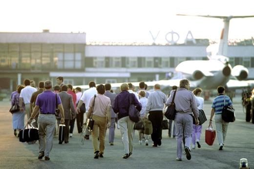 |
| Ufa International Airport in 1989 |
| IATA: UFA – ICAO: UWUU |
| Summary |
| Airport type |
Public |
| Operator |
Federal State Unitary Enterprise "Ufa International Airport" |
| Serves |
Ufa, Bashkortostan, Russia |
| Elevation AMSL |
449 ft / 137 m |
| Coordinates |
54°33′27″N 055°52′27″E / 54.5575°N 55.87417°E / 54.5575; 55.87417Coordinates: 54°33′27″N 055°52′27″E / 54.5575°N 55.87417°E / 54.5575; 55.87417 |
| Runways |
| Direction |
Length |
Surface |
| m |
ft |
| 01/19 |
675 |
2,215 |
Grass |
| 05/23 |
725 |
2,380 |
Grass |
| 14/32 |
645 |
2,115 |
Grass |
| 14R/32L |
3,761 |
12,340 |
Concrete |
| 14L/32R |
2,513 |
8,245 |
Concrete |
Ufa International Airport (Russian: Международный аэропорт Уфа) (IATA: UFA, ICAO: UWUU) is the primary airport serving Ufa, the capital of Bashkortostan, Russia.
It is the largest airport in the federal subject (republic) of the Republic of Bashkortostan.
In 2007, 1,180,000 passengers used the airport. Mass transit serving the airport
The following city bus line connect the airport:
- to Ufa:
- No. 101; to Ufa Main Railway Station via Ufa Main Bus Station.
- No. 110.
Airlines and destinations
| Airlines |
Destinations |
| Aeroflot |
Moscow-Sheremetyevo |
| Air Bashkortostan operated by VIM Airlines |
Moscow-Domodedovo |
| Armavia |
Yerevan |
| Avianova |
Moscow-Sheremetyevo |
| Kavminvodyavia |
Moscow-Vnukovo |
| Rossiya |
St Petersburg |
| S7 Airlines |
Moscow-Domodedovo |
| Tatarstan Airlines |
Sochi |
| Transaero Airlines |
Moscow-Domodedovo |
| Turkish Airlines |
Istanbul-Atatürk |
| Uzbekistan Airways |
Tashkent |
| UTair Aviation |
Anapa, Baku, Kazan, Krasnodar, Moscow-Domodedovo, Moscow-Vnukovo, Nizhnevartovsk, Novy Urengoy, St Petersburg, Samara, Sochi, Surgut, Tyumen |
The above content comes from Wikipedia and is published under free licenses – click here to read more.
| General Info
|
| Country |
Russia
|
| ICAO ID |
UWUU
|
| Time |
UTC+5(+6DT)
|
| Latitude |
54.557511
54° 33' 27.04" N
|
| Longitude |
55.874417
055° 52' 27.90" E
|
| Elevation |
449 feet
137 meters
|
| Type |
Civil
|
| Magnetic Variation |
012° E (01/06)
|
| Operating Agency |
CIVIL GOVERNMENT, (LANDING FEES AND DIPLOMATIC CLEARANCE MAY BE REQUIRED)
|
| Operating Hours |
24 HOUR OPERATIONS
|
| Daylight Saving Time |
Last Sunday in March to last Sunday in October
|
| Communications
|
START
(119.4 by ATC for Rwy 14R-32L)
|
120.9
119.4
124.0
|
| TRANSIT |
131.7
|
| TAXIING |
119.0
124.0
|
| ATIS |
124.8
|
KRUG
Also svc as TWR.
|
120.9
120.4
|
| Runways
|
| ID |
Dimensions |
Surface |
PCN |
ILS
|
| 01/19 |
2215 x 345 feet
675 x 105 meters |
GRADED OR ROLLED EARTH, GRASS ON GRADED EARTH. |
- |
NO
|
| 05/23 |
2380 x 300 feet
725 x 91 meters |
GRADED OR ROLLED EARTH, GRASS ON GRADED EARTH. |
- |
NO
|
| 14/32 |
2115 x 315 feet
645 x 96 meters |
GRADED OR ROLLED EARTH, GRASS ON GRADED EARTH. |
- |
NO
|
| 14R/32L |
12340 x 197 feet
3761 x 60 meters |
CONCRETE. |
057RAWT |
NO
|
| 14L/32R |
8245 x 164 feet
2513 x 50 meters |
CONCRETE. |
053RBXT |
NO
|
| Navaids
|
| Type |
ID |
Name |
Channel |
Freq |
Distance From Field |
Bearing From Navaid
|
| VOR-DME |
RG |
UFA |
070X |
112.3 |
1.1 NM |
327.9
|
| NDB |
RG |
UFA |
- |
212 |
2.8 NM |
158.1
|
The content above was published at Airports-Worldwide.com in 2010.
We don't guarantee the information is fresh and accurate. The data may be wrong or outdated.
For more up-to-date information please refer to other sources.
|
|


