|
|
Bratsk Airport
Аэропорт Братск |
 |
| IATA: BTK – ICAO: UIBB |
| Summary |
| Airport type |
Public/Military |
| Operator |
AeroBratsk |
| Location |
Bratsk |
| Elevation AMSL |
1598 ft / 487 m |
| Coordinates |
56°22′12″N 101°41′54″E / 56.37°N 101.69833°E / 56.37; 101.69833Coordinates: 56°22′12″N 101°41′54″E / 56.37°N 101.69833°E / 56.37; 101.69833 |
| Runways |
| Direction |
Length |
Surface |
| ft |
m |
| 12/30 |
10,368 |
3,160 |
Concrete |
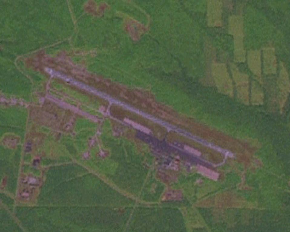
Bratsk Airport (Russian: Аэропорт Братск) (IATA: BTK, ICAO: UIBB) is an airport in Irkutsk Oblast, Russia located 8 kilometres (5 mi) north of Bratsk. It is a mixed use airfield, providing 32 parking spaces for medium-sized airliners, as well as a large number of branched fighter revetments.
The 350 IAP (350th Interceptor Aviation Regiment) arrived in 1984 with a number of Tupolev Tu-128 (Fiddler) aircraft. Bratsk was responsible for air defense of most of the Siberian interior region and depended on the long-range capability of the Tu-128 to cover this vast territory. By the 1990s the unit had been upgraded with MiG-31 jets. The 350 IAP was disbanded in 2002.
Currently Bratsk continues to serve a vital civil aviation role as a staging base for cargo flights to Kamchatka. Recent Google Imagery showed 7 Ilyushin Il-76 jets parked on the tarmac. The airport is operated by AeroBratsk, its major civilian tenant. Airlines and destinations
Passenger airlines
- AeroBratsk (Irkutsk, Lensk, Moscow-Domodedovo, Moscow-Vnukovo)
- Alrosa Mirny Air Enterprise (Lensk)
- VIM Airlines (Chita, Moscow-Domodedovo)
- Yakutia Airlines (Krasnodar, Moscow-Vnukovo)
Cargo airlines
- Atlant-Soyuz Airlines (Kogalym)
The above content comes from Wikipedia and is published under free licenses – click here to read more.
| General Info
|
| Country |
Russia
|
| ICAO ID |
UIBB
|
| Time |
UTC+8(+9DT)
|
| Latitude |
56.370556
56° 22' 14.00" N
|
| Longitude |
101.698331
101° 41' 53.99" E
|
| Elevation |
1610 feet
491 meters
|
| Type |
Civil
|
| Magnetic Variation |
001° W (01/06)
|
| Operating Agency |
CIVIL GOVERNMENT, (LANDING FEES AND DIPLOMATIC CLEARANCE MAY BE REQUIRED)
|
| Operating Hours |
24 HOUR OPERATIONS
|
| Daylight Saving Time |
Last Sunday in March to last Sunday in October
|
| Communications
|
KRUG
Svc as LANDING and START.
|
118.1
|
| METEO |
127.2
|
| TRANSIT |
131.8
|
| TAXIING |
121.8
|
| Runways
|
| ID |
Dimensions |
Surface |
PCN |
ILS
|
| 12/30 |
10368 x 197 feet
3160 x 60 meters |
CONCRETE. |
054RAWT |
YES
|
| Navaids
|
| Type |
ID |
Name |
Channel |
Freq |
Distance From Field |
Bearing From Navaid
|
| VOR-DME |
BRT |
BRATSK |
083X |
113.6 |
At Field |
-
|
| NDB |
GG |
BRATSK |
- |
374 |
3.1 NM |
114.1
|
| Remarks
|
| FUEL |
(NC- TS1)
|
| OIL |
O-MK8
|
| RSTD |
First 328' of Rwy 12-30 unuse for tkof.
|
The content above was published at Airports-Worldwide.com in 2010.
We don't guarantee the information is fresh and accurate. The data may be wrong or outdated.
For more up-to-date information please refer to other sources.
|
|