|
|
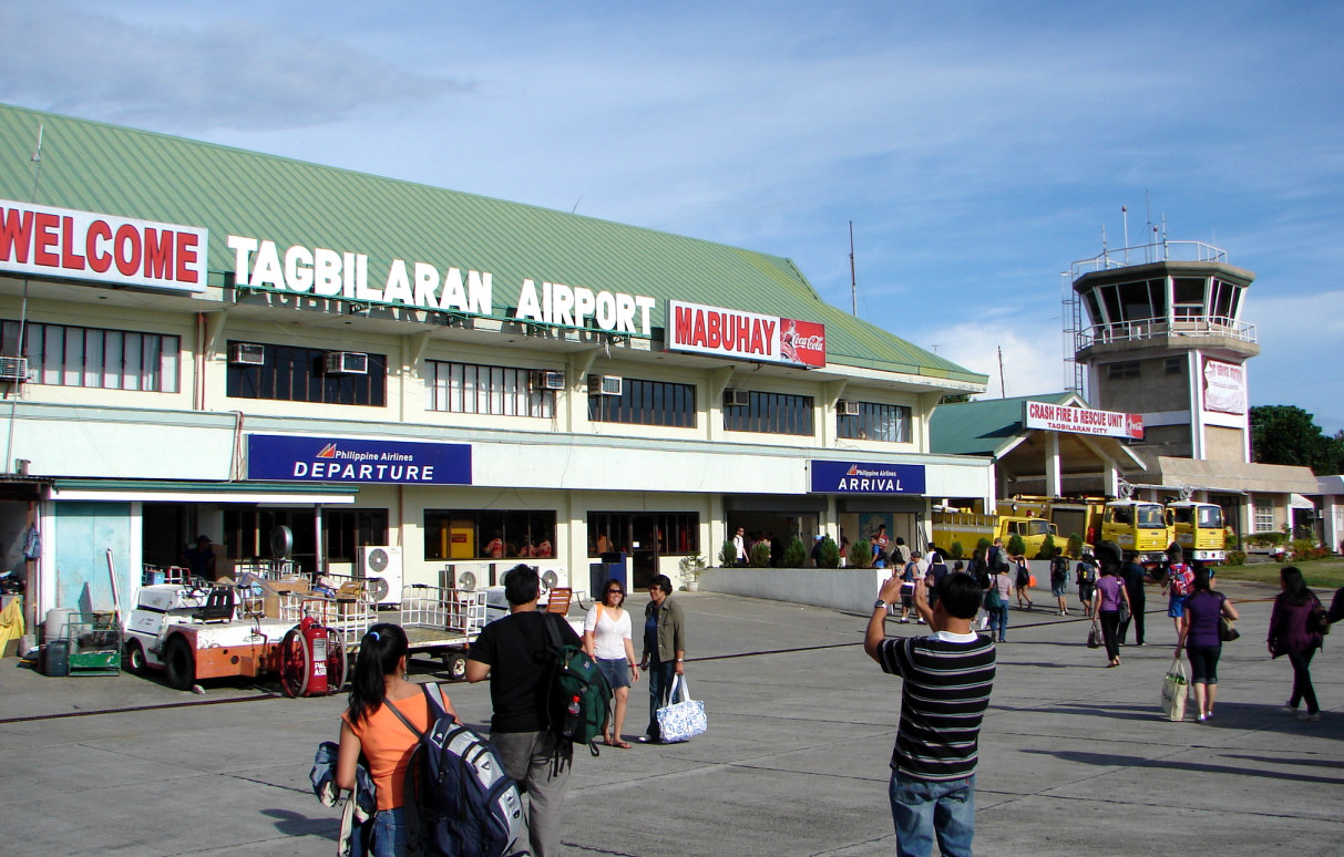
Tagbilaran Airport
Paliparan ng Tagbilaran
Tugpahanan sa Tagbilaran |
 |
| Tagbilaran Airport terminal building |
| IATA: TAG – ICAO: RPVT |
| Summary |
| Airport type |
Public |
| Operator |
Civil Aviation Authority of the Philippines |
| Serves |
Tagbilaran City |
| Location |
Barangay Taloto, Tagbilaran City |
| Elevation AMSL |
12 m / 38 ft |
| Coordinates |
09°39′50.69″N 123°51′11.69″E / 9.6640806°N 123.8532472°E / 9.6640806; 123.8532472Coordinates: 09°39′50.69″N 123°51′11.69″E / 9.6640806°N 123.8532472°E / 9.6640806; 123.8532472 |
| Runways |
| Direction |
Length |
Surface |
| m |
ft |
| 17/35 |
1,779 |
5,837 |
Asphalt |
| Statistics (2008) |
| Passengers |
400,814 |
| Aircraft movements |
5,612 |
| Metric tonnes of cargo |
5,496 |
| Statistics from the Civil Aviation Authority of the Philippines. |
Tagbilaran Airport (Filipino: Paliparan ng Tagbilaran, Cebuano: Tugpahanan sa Tagbilaran) (IATA: TAG, ICAO: RPVT) is an airport serving the general area of Tagbilaran City, located in the province of Bohol in the Philippines. The airport is classified as a Principal Airport Class 1 by the CAAP, a body of the Department of Transportation and Communications responsible for implementing policies on civil aviation to assure safe, economic and efficient air travel, and the handling of operations on all airports except major international airports. Airlines and destinations
| Airlines |
Destinations |
| Airphil Express |
Manila [begins October 21] |
| Cebu Pacific |
Manila |
| Philippine Airlines |
Manila |
| Zest Airways |
Manila |
Airport ramp
The above content comes from Wikipedia and is published under free licenses – click here to read more.
| General Info
|
| Country |
Philippines
|
| ICAO ID |
RPVT
|
| Time |
UTC+8
|
| Latitude |
9.664081
09° 39' 50.69" N
|
| Longitude |
123.853247
123° 51' 11.69" E
|
| Elevation |
38 feet
12 meters
|
| Magnetic Variation |
000° W (01/06)
|
| Operating Agency |
CIVIL GOVERNMENT, (LANDING FEES AND DIPLOMATIC CLEARANCE MAY BE REQUIRED)
|
| Island Group |
Bohol I
|
| Operating Hours |
SEE REMARKS FOR OPERATING HOURS OR COMMUNICATIONS FOR POSSIBLE HOURS
|
| Communications
|
| RDO |
122.2
5205
3872.5
|
| Runways
|
| ID |
Dimensions |
Surface |
PCN |
ILS
|
| 17/35 |
5837 x 98 feet
1779 x 30 meters |
ASPHALT |
049RBWU |
NO
|
| Remarks
|
| CAUTION |
Rwy 35 thld lts unsvc due to twy WIP. Trees each end of rwy. Rwy 35 apch obst by ant 470' high 5428', 433' high 2352'; 440' high bldg 4800' S of Rwy. Acft advs use N twy to avoid deteriorated pavement. Hi tension cable 2593' long acrossSan Juanico Strait aprx 1.2 NM NNW of arpt 157' mid span rising to 289' at bothends.
|
| LGT |
PAPI Rwy 17 GS 3.1 .
|
| OPR HOURS |
Opr 2200-1000Z
|
The content above was published at Airports-Worldwide.com in 2010.
We don't guarantee the information is fresh and accurate. The data may be wrong or outdated.
For more up-to-date information please refer to other sources.
|
|