|
|
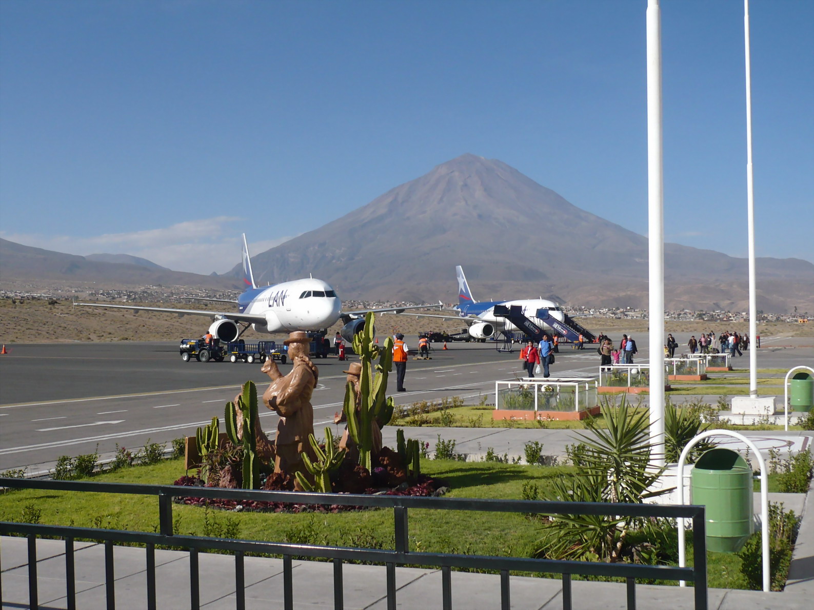
| Rodríguez Ballón International Airport |
 |
| IATA: AQP – ICAO: SPQU |
| Summary |
| Airport type |
Public |
| Operator |
CORPAC S.A |
| Location |
Arequipa |
| Elevation AMSL |
8,405 ft / 2,562 m |
| Coordinates |
16°20′27.86″S 71°34′59.1″W / 16.3410722°S 71.583083°W / -16.3410722; -71.583083Coordinates: 16°20′27.86″S 71°34′59.1″W / 16.3410722°S 71.583083°W / -16.3410722; -71.583083 |
| Runways |
| Direction |
Length |
Surface |
| ft |
m |
| 09/27 |
9,712 |
2,960 |
Asphalt |
Rodríguez Ballón International Airport (IATA: AQP, ICAO: SPQU), known as Aeropuerto Internacional Rodríguez Ballón in Spanish, is an airport serving Peru's second largest city, Arequipa. This airport and Cusco's Alejandro Velasco Astete International Airport are the main air hubs in southern Peru. This air terminal was used by 593,038 passengers in 2009, as reported by CORPAC, Peru's national airport corporation, who currently manages this and other non-privatized airports around the country. Its runway is fully paved. In the past it has had international flights to destinations such as La Paz in Bolivia. It is the main gateway for tourists visiting the city of Arequipa, spectacular nearby ruins, and the Colca Canyon, the world's second deepest canyon (only behind Cotahuasi Canyon, also located in Arequipa.) Airlines and destinations
| Airlines |
Destinations |
| LAN Perú |
Cusco, Juliaca, Lima, Tacna |
| Peruvian Airlines |
Lima |
| Sky Airline |
Arica, Iquique, Santiago de Chile |
| Star Perú |
Cusco, Lima [begins 16 October] |
Accidents and incidents
On 18 March 1983, Douglas C-47E FAP-356 of the Fuerza Aérea del Perú was damaged beyond repair in an accident at Arequipa Airport.
The above content comes from Wikipedia and is published under free licenses – click here to read more.
| General Info
|
| Country |
Peru
|
| ICAO ID |
SPQU
|
| Time |
UTC-5
|
| Latitude |
-16.341072
16° 20' 27.86" S
|
| Longitude |
-71.583083
071° 34' 59.10" W
|
| Elevation |
8405 feet
2562 meters
|
| Type |
Joint (Civil and Military)
|
| Magnetic Variation |
003° W (01/06)
|
| Beacon |
Yes
|
| Operating Agency |
MILITARY - CIVIL JOINT USE AIRPORT
|
| Near City |
Arequipa
|
| Operating Hours |
SEE REMARKS FOR OPERATING HOURS OR COMMUNICATIONS FOR POSSIBLE HOURS
|
| International Clearance Status |
Airport of Entry
|
| Communications
|
| AREQUIPA TWR |
118.7
|
| GND |
121.9
|
| AREQUIPA APP |
118.7
|
| Runways
|
| ID |
Dimensions |
Surface |
PCN |
ILS
|
| 09/27 |
9777 x 148 feet
2980 x 45 meters |
ASPHALT |
039FBXT |
YES
|
| Navaids
|
| Type |
ID |
Name |
Channel |
Freq |
Distance From Field |
Bearing From Navaid
|
| VOR-DME |
EQU |
AREQUIPA |
084X |
113.7 |
At Field |
-
|
| Supplies/Equipment
|
| Fuel |
Jet A1, without icing nhibitor.
100/130 MIL Spec, low lead, aviation gasoline (BLUE)
|
| Remarks
|
| CAUTION |
Mast 59 feet hi 1148 feet on final Rwy 09 417 feet rt of cntrln. Mast 39 feet hi1476 feet on final Rwy 27 377 feet rt of centerline.
|
| FUEL |
(NC-100LL, A1)
|
| LGT |
PAPI Rwy 27 GS 3.3 . PAPI Rwy 09 GS 2.2 .
|
| OPR HOURS |
Opr 1100-0300Z OT OR.
|
The content above was published at Airports-Worldwide.com in 2010.
We don't guarantee the information is fresh and accurate. The data may be wrong or outdated.
For more up-to-date information please refer to other sources.
|
|