 |
 |
|
||||
|
The airport is certificated under Civil Aviation Rules so that travellers and airline operators have assurance of the highest standards of safety and security backed up by quality control systems. An airport is a community of businesses. It is likely that your airport experience will be influenced by several of those businesses. We are all committed to helping you either use our services, or conduct your business at the airport. We welcome feedback (good or bad) as a constructive way to continuously improve, so do use this site, or one of our 'Customer Care' cards at the airport to let us know how your airport experience went.
Fast Facts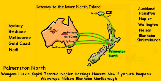
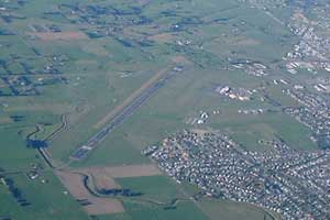
Area of Airport : 170 Hectares Length of sealed runway 07/25 : 1,902 metres Length of grass runway 07/25 : 608 metres Servicing 480,000 passengers per year Palmerston North International Airport is identified as NZPM and PMR 700 Scheduled flights per month operated by six commercial airlines Air Traffic Control Services provided by Airways Corporation of New Zealand The airport is only 5 Kilometres north-east of the City central area The main runway has a strength (Load Classification Number) of 48 designed for Boeing 737 aircraft The main apron has stands for nine commercial aircraft Carpark has capacity for 616 cars Milson Aerodrome Society Incorporated first established the airfield in 1931 Union Airways commenced the first commercial air services at Palmerston North in 1936 (See the display on the Union Airways Gallery) National Airways Corporation introduced scheduled jet services with the Boeing 737 aircraft in December 1975, and the first Boeing 767 to use the airport landed on 10 March 2003 New Terminal building commenced operation on Saturday, 14 December 1991. A $3 million project funded in part by a $3 Departure Charge, and became part of a $5 departure Development Levy from 1 August 2003 International flights commenced 27 April 1996 with the introduction of Freedom Air International trans-Tasman services The main runway was extended in length from 1,522m to 1,902m in May 1998. Scheduled services direct to Australia commenced June 1998 The Airport Master Plan provides for industrial site development and new roading access from John F Kennedy Drive through to Railway Road Central location for freight and mail distribution Very good weather characteristics for aviation Seven days a week, 24 hours a day operation
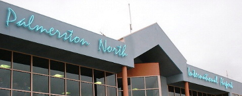
Images and information placed above are from http://www.pnairport.co.nz/ We thank www.airportsnewzealand.com for the data.
Runway 07R/25L 1995 x 197 feet
|
||||||||||||||||||||||||||||||||||||||||||||||||||||||||||||||||||||||||||||||||||||||||||||||||||||||||||||||||||||||||||||||||||||||||||||||||||||||||||||||||||||||||||||||||||||||||||||||||||||||||||||||||||||||||||||||||||||||||||||||||||||||||||||
| Runway 07R | |
|---|---|
| Surface | GRASS OR EARTH NOT GRADED OR ROLLED. |
| True Heading | 090.0 |
| Latitude | 0.000000 - |
| Longitude | 0.000000 - |
| Elevation | 115.0 feet 35 meters |
| Slope | 1.7° |
| Landing Distance | 1995 feet 608 meters |
| Takeoff Distance | 1995 feet 608 meters |
| Runway 25L | |
|---|---|
| Surface | GRASS OR EARTH NOT GRADED OR ROLLED. |
| True Heading | 270.0 |
| Latitude | 0.000000 - |
| Longitude | 0.000000 - |
| Elevation | 148.0 feet 45 meters |
| Slope | -1.7° |
| Landing Distance | 1995 feet 608 meters |
| Takeoff Distance | 1995 feet 608 meters |
| Runway 07L | |
|---|---|
| Surface | ASPHALT |
| True Heading | 090.0 |
| Latitude | -40.321389 40° 19' 17.00" S |
| Longitude | 175.603333 175° 36' 12.00" E |
| Elevation | 121.0 feet 37 meters |
| Slope | 0.4° |
| Landing Distance | 5784 feet 1763 meters |
| Takeoff Distance | 6240 feet 1902 meters |
| Displaced Threshold Length | 456 feet 139 meters |
| Lighting System | MIRL
REIL PAPI |
| Runway 25R | |
|---|---|
| Surface | ASPHALT |
| True Heading | 270.0 |
| Latitude | -40.321389 40° 19' 17.00" S |
| Longitude | 175.625694 175° 37' 32.50" E |
| Elevation | 148.0 feet 45 meters |
| Slope | -0.4° |
| Landing Distance | 5978 feet 1822 meters |
| Takeoff Distance | 6240 feet 1902 meters |
| Displaced Threshold Length | 262 feet 80 meters |
| Lighting System | MIRL
REIL PAPI |
| PALMERSTON NORTH | |||||
|---|---|---|---|---|---|
| Type | ID | Channel | Freq | Country | State |
| NDB | PM | - | 258 | New Zealand | - |
| Latitude | Longitude | Airport |
| -40.324286 40° 19' 27.43" S |
175.621183 175° 37' 16.26" E |
NZPM |
| PALMERSTON NORTH | |||||
|---|---|---|---|---|---|
| Type | ID | Channel | Freq | Country | State |
| VOR-DME | PM | 081X | 113.4 | New Zealand | - |
| Latitude | Longitude | Airport |
| -40.318500 40° 19' 06.60" S |
175.638031 175° 38' 16.91" E |
NZPM |
The content above was published at Airports-Worldwide.com in 2004.
We don't guarantee the information is fresh and accurate. The data may be wrong or outdated.
For more up-to-date information please refer to other sources.
 Palmerston North Airport Ltd can be contacted at :