 |
|
 Hamilton International Airport is a growing airport, with a catchment area of almost two million people. Operationally, Hamilton International Airport has much to offer with the third longest runway in New Zealand.
Hamilton International Airport is the closest international airport to the steaming geysers and boiling mud of Rotorua, Lake Taupo and all its attractions, Tauranga and Mount Manganui, and the famous Waitomo Caves.
History
Hamilton International Airport started out prior to 1935 as a "flying paddock" and later served as a maintenance base for aircraft during World War II.
Scheduled domestic passenger services commenced in the early 1950's, increasing each year, and Hamilton is now the fourth busiest international airport in New Zealand.
Waikato Regional Airport Limited was formed in 1989 when the airport was sold by the crown to five local authorities. The Shareholders are Hamilton City Council, Waipa, Waikato, Matamata-Piako and Otorohanga District Councils.
Hamilton's airport has grown rapidly since the introduction of international operations in 1996. The Airport Company extended both its terminal building and runway to cater for the increased services.
 Trans-Tasman Airline Operations
Kiwi International conducted a series of charter flights in 1994 and ran scheduled flights from April 1995 to September 1996.
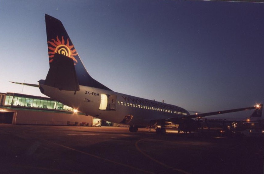
Freedom Air International started trans-Tasman flights in December 1995 and is still operating, flying to four Australian ports out of Hamilton.
K2000 operated trans-Tasman flights from Hamilton from December 1999 to January 2000.
Domestic Airlines
Air New Zealand, Origin Pacific and Sun Air offer domestic travel connections to destinations throughout NZ.
A further domestic terminal was built in 1995 when Ansett NZ commenced scheduled services from Hamilton Airport.
Qantas NZ took over the Ansett operation in September 2000 and closed in April 2001.
Origin Pacific took over the lease of the terminal building in March 2002 and has increased its flight rotations to fill the gap left by Qantas NZ.
Terminal Expansion
The main terminal building was extended in 1996 to cater for full international services.
The main runway 36/18 was extended in length from 1740m to 1960m in 1988 to cater for scheduled services direct to Australia.
General Aviation/Industrial Development
The western side of the airfield is the home of general aviation users and hosts a small industrial estate with airside access. Eagle Air, Aeromotive, Hamilton Aero Maintenance, Rotocraft and Super Air provide valuable maintenance services for the aviation industry.
 Operator:
Waikato Regional Airport Ltd,Hamilton Airport
Operator:
Waikato Regional Airport Ltd,Hamilton Airport
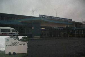
Hamilton International Airport's Management Office is located upstairs in the main terminal building, is open from 8 am to 5 pm weekdays
Address:
Airport Road
RD 2
Hamilton
New Zealand
Phone: +64 7 8489027
Fax:
(07) 834 3627
E-mail: wral at hamiltonairport co nz
Certificated Aerodrome 5NM SSE of Hamilton at an elevation of 172 feet.
Images and information placed above are from http://www.hamiltonairport.co.nz/
We thank
www.airportsnewzealand.com
for the data.
| General Info
|
| Country |
New Zealand
|
| ICAO ID |
NZHN
|
| Time |
UTC+12(+13DT)
|
| Latitude |
-37.866661
37° 51' 59.98" S
|
| Longitude |
175.332056
175° 19' 55.40" E
|
| Elevation |
172 feet
52 meters
|
| Type |
Civil
|
| Magnetic Variation |
020° E (01/04)
|
| Beacon |
Yes
|
| Operating Agency |
NEW ZEALAND CIVIL AVIATION AUTHORITY
|
| Operating Hours |
SEE REMARKS FOR OPERATING HOURS OR COMMUNICATIONS FOR POSSIBLE HOURS
|
| Communications
|
TWR
Opr 1800-0810Z++ Sat-Fri; 1800Z++Fri- 0715Z++ Sat.
|
122.9
125.9
|
| CTAF |
122.9
|
ATIS
Opr HO.
|
128.6
|
| APP |
125.3
123.8
|
| Communications Remarks |
|
| TWR |
Provides FIS.
|
| APP |
(0900-1800Z++ AUCKLAND APP) (1800-0900Z++ CHRISTCHURCH APP) Provides FIS.
|
| Runways
|
| ID |
Dimensions |
Surface |
PCN |
ILS
|
| 08/26 |
2339 x 95 feet
713 x 29 meters |
GRASS OR EARTH NOT GRADED OR ROLLED. |
- |
NO
|
| 18L/36R |
6431 x 148 feet
1960 x 45 meters |
ASPHALT |
039FBXT |
NO
|
| Navaids
|
| Type |
ID |
Name |
Channel |
Freq |
Distance From Field |
Bearing From Navaid
|
| VOR-DME |
HN |
HAMILTON |
087X |
114 |
1.1 NM |
176.5
|
| NDB |
HN |
HAMILTON |
- |
390 |
At Field |
-
|
| Supplies/Equipment
|
| Fuel |
Jet A1, without icing nhibitor.
100/130 octane gasoline, leaded, MIL-L-5572F (GREEN)
|
| Remarks
|
| CAUTION |
Turb/wind shear possible thld Rwy 26. Bird haz. Hard sfc twy reduces to 16'.
|
| FUEL |
(NC-100, A1)
|
| LGT |
Remote ctl of lgt avbl btn 0900-1700Z++ fone opr C 025-961-750 OT fone C(07) 843-4340.
|
| MISC |
Arpt opr fone C(07) 843-3623.
|
| RSTD |
Simultaneous parl opr on paved and grass rwy only for acft blw 5070 lb VFR cond and ATC on duty.
|
Runway 08/26
2339 x 95 feet
713 x 29 meters
| Runway 08
|
| Surface |
GRASS OR EARTH NOT GRADED OR ROLLED.
|
| True Heading |
096.0
|
| Latitude |
-37.862853
37° 51' 46.27" S
|
| Longitude |
175.324775
175° 19' 29.19" E
|
| Elevation |
169.0 feet
52 meters
|
| Slope |
0.1°
|
| Landing Distance |
2339 feet
713 meters
|
| Takeoff Distance |
2339 feet
713 meters
|
| Runway 26
|
| Surface |
GRASS OR EARTH NOT GRADED OR ROLLED.
|
| True Heading |
276.0
|
| Latitude |
-37.863556
37° 51' 48.80" S
|
| Longitude |
175.332869
175° 19' 58.33" E
|
| Elevation |
171.0 feet
52 meters
|
| Slope |
-0.1°
|
| Landing Distance |
2339 feet
713 meters
|
| Takeoff Distance |
2339 feet
713 meters
|
Runway 18L/36R
6431 x 148 feet
1960 x 45 meters
| Runway 18L
|
| Surface |
ASPHALT
|
| True Heading |
196.0
|
| Latitude |
-37.858169
37° 51' 29.41" S
|
| Longitude |
175.335133
175° 20' 06.48" E
|
| Elevation |
172.0 feet
52 meters
|
| Slope |
-0.1°
|
| Landing Distance |
6051 feet
1844 meters
|
| Takeoff Distance |
6431 feet
1960 meters
|
| Displaced Threshold Length |
380 feet
116 meters
|
| Lighting System |
MIRL
REIL
M
PAPI |
| Runway 36R
|
| Surface |
ASPHALT
|
| True Heading |
016.0
|
| Latitude |
-37.875156
37° 52' 30.56" S
|
| Longitude |
175.328978
175° 19' 44.32" E
|
| Elevation |
164.0 feet
50 meters
|
| Slope |
0.1°
|
| Landing Distance |
5996 feet
1828 meters
|
| Takeoff Distance |
6431 feet
1960 meters
|
| Displaced Threshold Length |
435 feet
133 meters
|
| Lighting System |
MIRL
REIL
PAPI |
Navaids
| HAMILTON
|
| Type |
ID |
Channel |
Freq |
Country |
State
|
| NDB |
MNZ |
- |
251 |
United States |
TEXAS
|
| Latitude |
Longitude |
Airport
|
31.620156
31° 37' 12.56" N |
-98.147533
098° 08' 51.12" W |
MNZ
|
| HAMILTON
|
| Type |
ID |
Channel |
Freq |
Country |
State
|
| NDB |
HN |
- |
390 |
New Zealand |
-
|
| Latitude |
Longitude |
Airport
|
-37.860642
37° 51' 38.31" S |
175.330917
175° 19' 51.30" E |
NZHN
|
| HAMILTON
|
| Type |
ID |
Channel |
Freq |
Country |
State
|
| VOR-DME |
HN |
087X |
114 |
New Zealand |
-
|
| Latitude |
Longitude |
Airport
|
-37.849264
37° 50' 57.35" S |
175.338528
175° 20' 18.70" E |
NZHN
|
| HAMILTON
|
| Type |
ID |
Channel |
Freq |
Country |
State
|
| NDB |
HMM |
- |
410 |
United States |
MONTANA
|
| Latitude |
Longitude |
Airport
|
46.256867
46° 15' 24.72" N |
-114.134261
114° 08' 03.34" W |
6S5
|
| HAMILTON
|
| Type |
ID |
Channel |
Freq |
Country |
State
|
| NDB |
HML |
- |
203 |
Australia |
-
|
| Latitude |
Longitude |
Airport
|
-37.649167
37° 38' 57.00" S |
142.057778
142° 03' 28.00" E |
YHML
|
| HAMILTON
|
| Type |
ID |
Channel |
Freq |
Country |
State
|
| NDB |
HM |
- |
221 |
Canada |
-
|
| Latitude |
Longitude |
Airport
|
43.121161
43° 07' 16.18" N |
-80.006753
080° 00' 24.31" W |
CYHM
|
| HAMILTON
|
| Type |
ID |
Channel |
Freq |
Country |
State
|
| NDB |
HAO |
- |
260 |
United States |
OHIO
|
| Latitude |
Longitude |
Airport
|
39.372556
39° 22' 21.20" N |
-84.572447
084° 34' 20.81" W |
HAO
|
| HAMILTON
|
| Type |
ID |
Channel |
Freq |
Country |
State
|
| VORTAC |
HAB |
041X |
110.4 |
United States |
ALABAMA
|
| Latitude |
Longitude |
Airport
|
34.195100
34° 11' 42.36" N |
-88.012533
088° 00' 45.12" W |
1M4
|
The content above was published at Airports-Worldwide.com in 2004.
We don't guarantee the information is fresh and accurate. The data may be wrong or outdated.
For more up-to-date information please refer to other sources.
|
 |


