 |
 |
|
||||
|
Address: PO Box 23 Mount Cook New Zealand Phone: (03) 435 1855 Fax: (03) 435 1854 E-mail:
-
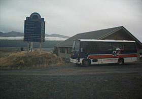
Images and information placed above are from http://www.airportsnewzealand.com/ Thanks to: www.airportsnewzealand.com for the data.
Runway 15/33 3166 x 98 feet
|
||||||||||||||||||||||||||||||||||||||||||||||||||||||||||||||||||||||||||||||||||||||||||||||||||||||||||||||||||||||||
| Runway 15 | |
|---|---|
| Surface | ASPHALT |
| True Heading | 171.0 |
| Latitude | -43.906139 43° 54' 22.10" S |
| Longitude | 170.127331 170° 07' 38.39" E |
| Elevation | 1754.0 feet 535 meters |
| Slope | 0.8° |
| Landing Distance | 3166 feet 965 meters |
| Takeoff Distance | 3166 feet 965 meters |
| Runway 33 | |
|---|---|
| Surface | ASPHALT |
| True Heading | 351.0 |
| Latitude | -43.914750 43° 54' 53.10" S |
| Longitude | 170.129811 170° 07' 47.32" E |
| Elevation | 1778.0 feet 542 meters |
| Slope | -0.8° |
| Landing Distance | 3166 feet 965 meters |
| Takeoff Distance | 3166 feet 965 meters |
The content above was published at Airports-Worldwide.com in 2004.
We don't guarantee the information is fresh and accurate. The data may be wrong or outdated.
For more up-to-date information please refer to other sources.

 |
|
Copyright 2004-2026 © by Airports-Worldwide.com, Vyshenskoho st. 36, Lviv 79010, Ukraine Legal Disclaimer |
 Operator:
Mr R K Ivey Glentanner Station
Operator:
Mr R K Ivey Glentanner Station