|
 |
|
||||
|
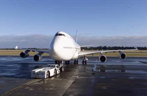
Airport HistoryDevelopment of the aerodrome at Harewood commenced in 1936. By 1946 the form of the terminal area development was established with hangars, a small terminal building, the water tower and some barracks buildings. The two runways and parallel taxiway concept was established in the early 1950's and in 1960 a new terminal building was in operation. Since that time, additions to the buildings, development of parking and access and extensions to the runway/ taxiway/ apron system have been almost continuous.1935 Christchurch City Countil selected the present site at Harewood.
Distance and direction from City: 5 NM WNW of Christchurch Elevation: 123 ft Aerodrome reference temperature: 22.4�C (January) Magnetic variation: 22�05'E (July 2000) annual change -0�00.2' Transition altitude: 11000ft QNH Transition level: FL130
Runways:
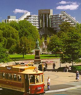
Marketing OpportunitiesChristchurch International Airport Limited (CIAL) is committed to promoting Christchurch as an international gateway to New Zealand with the aim of:
POSTAL ADDRESS
Images and information placed above are from http://www.christchurch-airport.co.nz/ We thank http://www.christchurch-airport.co.nz/ for the data.
Runway 01/19 1690 x 180 feet
|
|||||||||||||||||||||||||||||||||||||||||||||||||||||||||||||||||||||||||||||||||||||||||||||||||||||||||||||||||||||||||||||||||||||||||||||||||||||||||||||||||||||||||||||||||||||||||||||||||||||||||||||||||||||||||||||||||||||||||||||||||||||||||||||||||||||||||||||||||||||||||||||||||||||||||||||||||||
| Runway 01 | |
|---|---|
| Surface | GRASS OR EARTH NOT GRADED OR ROLLED. |
| True Heading | 037.7 |
| Latitude | -43.486614 43° 29' 11.81" S |
| Longitude | 172.531267 172° 31' 52.56" E |
| Landing Distance | 1690 feet 515 meters |
| Takeoff Distance | 1690 feet 515 meters |
| Runway 19 | |
|---|---|
| Surface | GRASS OR EARTH NOT GRADED OR ROLLED. |
| True Heading | 217.7 |
| Latitude | -43.482658 43° 28' 57.57" S |
| Longitude | 172.535464 172° 32' 07.67" E |
| Landing Distance | 1690 feet 515 meters |
| Takeoff Distance | 1690 feet 515 meters |
| Runway 02 | |
|---|---|
| Surface | ASPHALT |
| True Heading | 040.0 |
| Latitude | -43.497639 43° 29' 51.50" S |
| Longitude | 172.522111 172° 31' 19.60" E |
| Elevation | 123.0 feet 37 meters |
| Slope | -0.3° |
| Landing Distance | 10785 feet 3287 meters |
| Takeoff Distance | 10785 feet 3287 meters |
| Lighting System | HIRL
J PAPI |
| Runway 20 | |
|---|---|
| Surface | ASPHALT |
| True Heading | 220.0 |
| Latitude | -43.475000 43° 28' 30.00" S |
| Longitude | 172.548278 172° 32' 53.80" E |
| Elevation | 93.0 feet 28 meters |
| Slope | 0.3° |
| Landing Distance | 10785 feet 3287 meters |
| Takeoff Distance | 10785 feet 3287 meters |
| Lighting System | HIRL
J PAPI |
| Runway 11 | |
|---|---|
| Surface | ASPHALT |
| True Heading | 130.0 |
| Latitude | -43.484628 43° 29' 04.66" S |
| Longitude | 172.524533 172° 31' 28.32" E |
| Elevation | 115.0 feet 35 meters |
| Slope | -0.4° |
| Landing Distance | 5712 feet 1741 meters |
| Takeoff Distance | 5712 feet 1741 meters |
| Lighting System | LIRL
S PAPI |
| Runway 29 | |
|---|---|
| Surface | ASPHALT |
| True Heading | 310.0 |
| Latitude | -43.494739 43° 29' 41.06" S |
| Longitude | 172.540992 172° 32' 27.57" E |
| Elevation | 95.0 feet 29 meters |
| Slope | 0.4° |
| Landing Distance | 5712 feet 1741 meters |
| Takeoff Distance | 5712 feet 1741 meters |
| Lighting System | LIRL
S PAPI |
| EYREWELL | |||||
|---|---|---|---|---|---|
| Type | ID | Channel | Freq | Country | State |
| VOR-DME | YW | 113X | 116.6 | New Zealand | - |
| Latitude | Longitude | Airport |
| -43.398797 43° 23' 55.67" S |
172.385278 172° 23' 07.00" E |
NZCH |
| WOODEND | |||||
|---|---|---|---|---|---|
| Type | ID | Channel | Freq | Country | State |
| NDB | OD | - | 262 | New Zealand | - |
| Latitude | Longitude | Airport |
| -43.342383 43° 20' 32.58" S |
172.700986 172° 42' 03.55" E |
NZCH |
The content above was published at Airports-Worldwide.com in 2004.
We don't guarantee the information is fresh and accurate. The data may be wrong or outdated.
For more up-to-date information please refer to other sources.

 |
|
Copyright 2004-2024 © by Airports-Worldwide.com, Vyshenskoho st. 36, Lviv 79010, Ukraine Legal Disclaimer |
 Reference Point: Latitude: 43�29'20"S Longitude: 172�32'E