 |
 |
|
||||
|
Address: PO Box 122 Alexandra New Zealand Phone: (03) 448 6979 Fax: (03) 448 9196 E-mail: centralsoaring at xtra co nz Images and information placed above are from http://www.airportsnewzealand.com/ We thank www.airportsnewzealand.com, Central Otago Flying Club for the data.
Runway 01/19 2139 x 197 feet
|
||||||||||||||||||||||||||||||||||||||||||||||||||||||||||||||||||||||||||||||||||||||||||||||||||||||||||||||||||||||||||||||||||||||||||||||||||||||||||||||||||||||||||||||||||||||||||||||||||||||||||||||||||||||||||||||||||||||||||||||||||||||||||||||||
| Runway 01 | |
|---|---|
| Surface | GRASS OR EARTH NOT GRADED OR ROLLED. |
| True Heading | 034.0 |
| Latitude | -45.213333 45° 12' 48.00" S |
| Longitude | 169.367781 169° 22' 04.01" E |
| Elevation | 750.0 feet 229 meters |
| Slope | 0.1° |
| Landing Distance | 1903 feet 580 meters |
| Takeoff Distance | 2139 feet 652 meters |
| Displaced Threshold Length | 236 feet 72 meters |
| Runway 19 | |
|---|---|
| Surface | GRASS OR EARTH NOT GRADED OR ROLLED. |
| True Heading | 214.0 |
| Latitude | -45.207778 45° 12' 28.00" S |
| Longitude | 169.371950 169° 22' 19.02" E |
| Elevation | 752.0 feet 229 meters |
| Slope | -0.1° |
| Landing Distance | 2139 feet 652 meters |
| Takeoff Distance | 2139 feet 652 meters |
| Runway 14R | |
|---|---|
| Surface | ASPHALT |
| True Heading | 160.0 |
| Latitude | -45.205639 45° 12' 20.30" S |
| Longitude | 169.368969 169° 22' 08.29" E |
| Elevation | 749.0 feet 228 meters |
| Slope | 0.0° |
| Landing Distance | 3937 feet 1200 meters |
| Takeoff Distance | 3937 feet 1200 meters |
| Runway 32L | |
|---|---|
| Surface | ASPHALT |
| True Heading | 340.0 |
| Latitude | -45.215917 45° 12' 57.30" S |
| Longitude | 169.374250 169° 22' 27.30" E |
| Elevation | 750.0 feet 229 meters |
| Slope | 0.0° |
| Landing Distance | 3937 feet 1200 meters |
| Takeoff Distance | 3937 feet 1200 meters |
| Runway 14L | |
|---|---|
| Surface | GRASS OR EARTH NOT GRADED OR ROLLED. |
| True Heading | 160.0 |
| Latitude | -45.205833 45° 12' 21.00" S |
| Longitude | 169.369719 169° 22' 10.99" E |
| Elevation | 749.0 feet 228 meters |
| Slope | 0.0° |
| Landing Distance | 3937 feet 1200 meters |
| Takeoff Distance | 3937 feet 1200 meters |
| Runway 32R | |
|---|---|
| Surface | GRASS OR EARTH NOT GRADED OR ROLLED. |
| True Heading | 340.0 |
| Latitude | -45.215833 45° 12' 57.00" S |
| Longitude | 169.375000 169° 22' 30.00" E |
| Elevation | 750.0 feet 229 meters |
| Slope | 0.0° |
| Landing Distance | 3937 feet 1200 meters |
| Takeoff Distance | 3937 feet 1200 meters |
| ALEXANDRA | |||||
|---|---|---|---|---|---|
| Type | ID | Channel | Freq | Country | State |
| NDB-DME | LX | 118X | 386 | New Zealand | - |
| Latitude | Longitude | Airport |
| -45.165539 45° 09' 55.94" S |
169.479847 169° 28' 47.45" E |
NZLX |
The content above was published at Airports-Worldwide.com in 2004.
We don't guarantee the information is fresh and accurate. The data may be wrong or outdated.
For more up-to-date information please refer to other sources.

 |
|
Copyright 2004-2026 © by Airports-Worldwide.com, Vyshenskoho st. 36, Lviv 79010, Ukraine Legal Disclaimer |
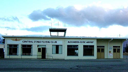
 Central Otago Flying Club (Inc)