|
|
|
 |
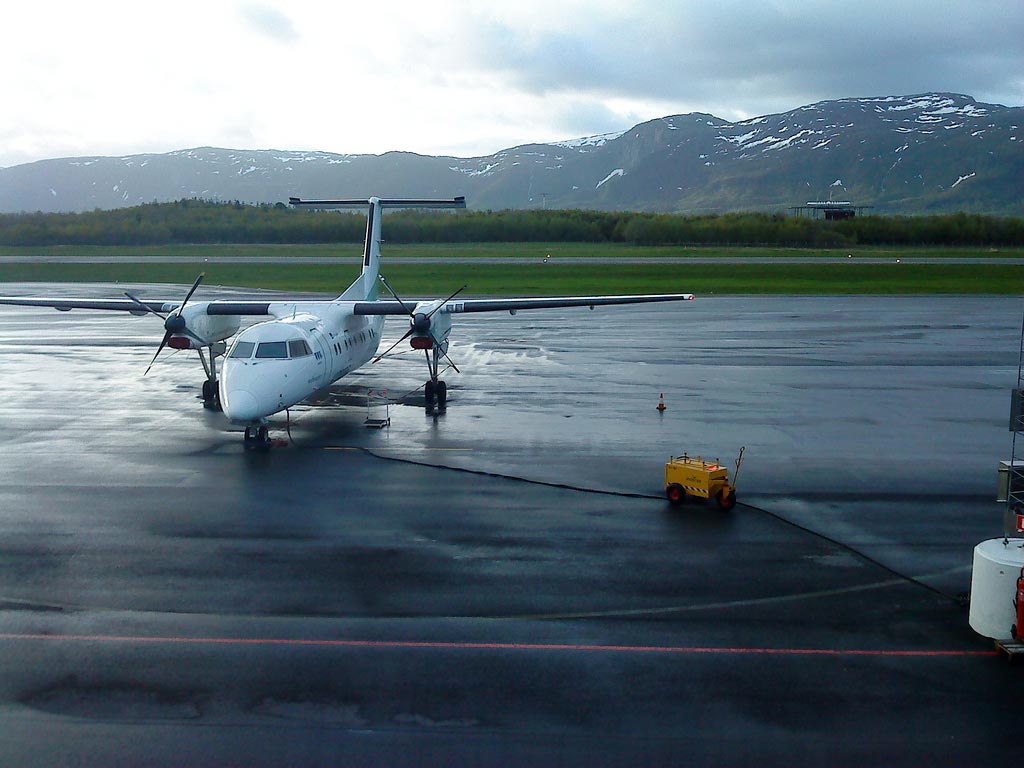
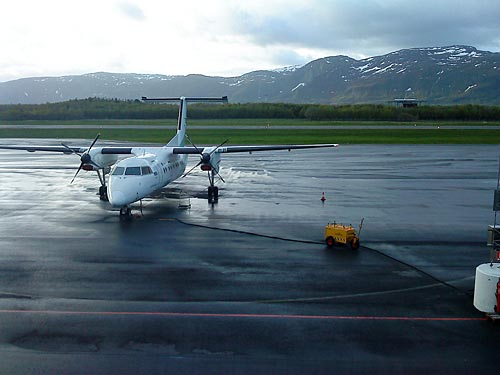
Brønnøysund
Airport, Brønnøy
(Click on the photo to enlarge) |
Brønnøysund
Airport, Brønnøy (IATA: BNN, ICAO: ENBN)
is the airport serving the town of Brønnøysund in the Brønnøy municipality
in Nordland, Norway. The airport is located southeast of the town centre
and opened in 1968. Brønnøy is operated by Avinor The
airport terminal has been expanded numerous times and can now handle 90
passengers an hour. The current control tower was opened in 2000. The
airport served 79,330 passengers in 2004. In addition to scheduled passenger
flights, the airport handles helicopter operations for offshore installations.
|
 |
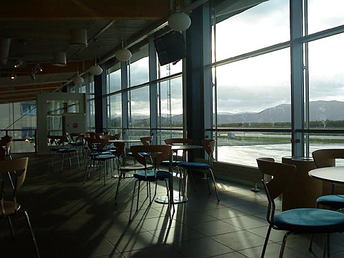
Widerøe
has the only scheduled services
(Click on the photo to enlarge) |
Airport information
Travel time to centre:
10 minutes
Airport bus:No
Taxi: Yes
Restaurant: No
Airport Charges / Weekly Season Card: Purchable at this airport
Location
City: Brønnøysund, Norway
Name: Brønnøy
ICAO / IATA: ENBN / BNN
Details
Type: Airport (Aerodrome, Airfield)
Use: Public/Civil
Latitude: 65°27'40"N (65.461111)
Longitude: 12°13'03"E (12.217500)
Datum: WGS 1984
Elevation: 25 ft (8 m)
Timezone: UTC+1 (DST+2)
Runways: 1
Longest: 3937 * 98 ft (1200 * 30 m)
Contact us
Airport service hours
Monday - Friday: 05:30 - 23:00
Saturday: 05:30 - 16:30
Sunday: 12:00 - 22:00
Inquiries about Avinor Brønnøysund Airport
Phone : (+47) 67 03 33 00
Fax : (+47) 67 03 33 01
Visiting address
Avinor, Brønnøysund Airport, 8900 Brønnøysund, Norway
Mailing address
Avinor, Brønnøysund Airport, Postboks 150, 2061 Gardermoen,
Norway
URL: http://www.avinor.no/en/airport/bronnoysund
Images and information
placed above are from
http://gc.kls2.com/airport/BNN
http://www.avinor.no/en/airport/bronnoysund
http://en.wikipedia.org/wiki/Bronnoysund_Airport
We thank them for the data!
Text from Wikipedia is available under the Creative
Commons Attribution/Share-Alike License; additional terms may apply.
| General
Info
|
| Country |
Norway
|
| ICAO
ID |
ENBN
|
| Time |
UTC+1(+2DT)
|
| Latitude |
65.461111
65° 27' 40.00" N |
| Longitude |
12.217500
012° 13' 03.00" E |
| Elevation |
25
feet
8 meters
|
| Type |
Civil
|
| Magnetic
Variation |
002°
E (01/06) |
| Operating
Agency |
CIVIL
GOVERNMENT, (LANDING FEES AND DIPLOMATIC CLEARANCE MAY BE REQUIRED)
|
| Alternate
Name |
BRONNOYSUND
BRONNOY
|
| Near
City |
Bronnoysund
|
| Operating
Hours |
24
HOUR OPERATIONS
|
| Daylight
Saving Time |
Last
Sunday in March to last Sunday in October |
| Communications
|
INFO
0450-2140Z++ Mon-Fri, 0450-1540Z++ Sat, 0920-2215Z++ Sun.
|
119.6
|
| Runways
|
| ID |
Dimensions |
Surface |
PCN |
ILS
|
| 04/22
|
3937
x 98 feet
1200 x 30 meters |
ASPHALT |
015FCXU |
YES
|
| Navaids
|
| Type |
ID |
Name |
Channel |
Freq |
Distance
From Field |
Bearing
From Navaid
|
| VOR-DME |
BNN |
BRONNOY |
100X |
115.3 |
At
Field |
-
|
| Supplies/Equipment
|
| Fuel |
Jet
A1, without icing nhibitor.
100/130 MIL Spec, low lead, aviation gasoline (BLUE) |
| Remarks
|
| CAUTION |
Windshear/eddies
may occur in wind 120 -250 abv 15 Kt.
|
| FUEL |
Avbl
0500-2230Z++ Mon-Fri; 0500-0630++, 0800-1530Z++ Sat; 1000-1545++,
1745-2200Z++ Sun. (NC-100LL, A1)
|
| LGT |
ACTIVATE-Apch,
PVASI and rwy lgt both rwy, press trans for 5 sec on 119.6. Cir
guidance lgt to Rwy 22. All PVASI GS 4.5 . Do not use PVASI Rwy
04 outside 4 DME . Rwy 22 apch lgt offset 12 N of cntrline. |
The content above was published at Airports-Worldwide.com in 2009.
We don't guarantee the information is fresh and accurate. The data may be wrong or outdated.
For more up-to-date information please refer to other sources.
|
|