 |
|
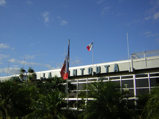
Tontouta International Airport
Aéroport de Nouméa - La Tontouta |
 |
| IATA: NOU – ICAO: NWWW |
| Summary |
| Airport type |
Public |
| Operator |
New Caledonia Chamber of Commerce & Industry |
| Location |
Païta, New Caledonia |
| Elevation AMSL |
52 ft / 16 m |
| Coordinates |
22°00′59″S 166°12′58″E / 22.01639°S 166.21611°E / -22.01639; 166.21611Coordinates: 22°00′59″S 166°12′58″E / 22.01639°S 166.21611°E / -22.01639; 166.21611 |
| Runways |
| Direction |
Length |
Surface |
| ft |
m |
| 11/29 |
10,663 |
3,250 |
Asphalt |
La Tontouta International Airport or Nouméa - La Tontouta International Airport (French: Aéroport de Nouméa - La Tontouta) (IATA: NOU, ICAO: NWWW) is the main international airport on New Caledonia, serving the city of Nouméa. The airport is located in the municipality of Païta, approximately 52 km northwest of Nouméa. In 2006, 415,813 passengers used the airport. [1] Airlines and destinations
| Airlines |
Destinations |
| Air Austral |
Paris-Charles de Gaulle, Saint-Denis-de-la-Réunion, Sydney |
| Air New Zealand |
Auckland |
| Air Vanuatu |
Port Vila |
| Aircalin |
Auckland, Brisbane, Nadi, Osaka-Kansai, Papeete, Port Vila, Seoul-Incheon, Sydney, Tokyo-Narita, Wallis |
| Qantas |
Brisbane, Sydney |
Cargo airlines
- ACT
- Cotrans
- Mirage Transit
- Nouméa Transit
- Socatrans
- TTI
The above content comes from Wikipedia and is published under free licenses – click here to read more.
| General Info
|
| Country |
New Caledonia
|
| ICAO ID |
NWWW
|
| Time |
UTC+11
|
| Latitude |
-22.014553
22° 00' 52.39" S
|
| Longitude |
166.212972
166° 12' 46.70" E
|
| Elevation |
52 feet
16 meters
|
| Type |
Civil
|
| Magnetic Variation |
012° E (01/06)
|
| Beacon |
Yes
|
| Operating Agency |
CIVIL GOVERNMENT, (LANDING FEES AND DIPLOMATIC CLEARANCE MAY BE REQUIRED)
|
| Near City |
Noumea
|
| Island Group |
Grand Terre I
|
| Operating Hours |
24 HOUR OPERATIONS
|
| International Clearance Status |
Airport of Entry
|
| Communications
|
| TONTOUTA TWR |
118.1
|
| VDF |
118.1
119.7
|
| TONTOUTA INFO |
128.2
128.3
3023
5680
(128.2 North) (128.3 South) SAR 3023, 5680
|
| GND |
121.7
|
| TONTOUTA APP |
119.7
128.3
128.2
125.1
(128.2 North) (128.3 South) (125.1 Loyalty Island)
|
| Communications Remarks |
|
| INFO |
Opr 1830-0000Z and 0130-0600Z, FIS and Alerting Svc provided. Outside these hr FIS for IFR flt only and Alerting Svc for all flt provided on 5680. (128.3 SAR) (North 128.2)(South 128.3)
|
| Runways
|
| ID |
Dimensions |
Surface |
PCN |
ILS
|
| 11/29 |
10663 x 148 feet
3250 x 45 meters |
ASPHALT |
065FCWT |
YES
|
| Navaids
|
| Type |
ID |
Name |
Channel |
Freq |
Distance From Field |
Bearing From Navaid
|
| VOR-DME |
LTO |
LA TONTOUTA |
076X |
112.9 |
At Field |
-
|
| NDB |
NW |
LA TONTOUTA |
- |
325.5 |
8.9 NM |
108.6
|
| Supplies/Equipment
|
| Fuel |
Unknown fuel type or whether there is any fuel.
|
| Remarks
|
| CAUTION |
Glider act within CTA and CTLZ. AD use by motorized Ultra Lights with radio after ctl clnc.
|
| FUEL |
(NC-100LL, A1)
|
| LGT |
PAPI Rwy 11 MEHT 75'; Rwy 29, GS 4.0 , MEHT 73'.
|
| MISC |
Rainy season Dec to Apr.
|
| OPR HOURS |
H24
|
| RSTD |
Ngt VFR arr from N on VOR/DME btn 290 and 128 proh. Other ngt arr, LIL obstacle lgt working, pat S of afld, pat hgt 1500' AMSL. AD not use off rwy.
|
The content above was published at Airports-Worldwide.com in 2010.
We don't guarantee the information is fresh and accurate. The data may be wrong or outdated.
For more up-to-date information please refer to other sources.
|
|


