|
|
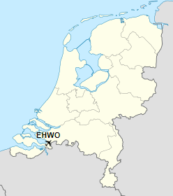
Woensdrecht Air Base (Dutch: Vliegbasis Woensdrecht) (IATA: WOE, ICAO: EHWO) is a military airport between the villages of Woensdrecht and Huijbergen, about 10 km (6 miles) south of the city of Bergen op Zoom in the Netherlands. It is located near the A58 motorway and the border with Belgium.
The airport was founded in 1934 as a glider and training airfield for the Royal Netherlands Air Force. During German occupation in the Second World War, the airfield was expanded. Messerschmitt Bf 109 and later Focke-Wulf Fw 190aircraft were deployed here by the Luftwaffe. The airfield was captured by allied forces in December 1944 and used as an Advanced Landing Ground. After the war, it was used once again by the Royal Netherlands Air Force for training purposes. In 1983 it was decided that Woensdrecht would house 48 Ground Launched Cruise Missiles fitted with nuclear warheads for the 486th Tactical Missile Wing of the U.S. Seventeenth Air Force. The missile wing would have had a maximum complement of 1100 personnel. However, just after completion of the required facilities, the Intermediate-Range Nuclear Forces Treaty put a halt to these plans.
The airport currently has one runway, 07/25, which is 2,440 meters (8,005 feet) long. It is now mainly used by the Royal Netherlands Air Force as a training and logistical base and normally does not house any combat units. It currently also has one civilian user, Fokker Services, a company providing maintenance, primarily but not exclusively for Fokker aircraft. Because of the presence of Fokker Services, a large number of Fokker aircraft are usually present at the airfield. The Royal Netherlands Air Force mainly operates the Pilatus PC-7 for initial training from this Air Base.
Woensdrecht Air Base

Vliegbasis Woensdrecht
(Advanced Landing Ground B-79) |
|
|
| Summary |
| Airport type |
Military |
| Operator |
Royal Netherlands Air Force |
| Serves |
Bergen op Zoom, Netherlands |
| Location |
Woensdrecht |
| Elevation AMSL |
63 ft / 19 m |
| Coordinates |
51°26′56″N
004°20′30″E |
| Map |
Location of Woensdrecht Air Base
|
| Runways |
| Direction |
Length |
Surface |
| m |
ft |
| 07/25 |
2,440 |
8,005 |
Concrete/Asphalt |
|
The above content comes from Wikipedia and is published under free licenses – click here to read more.
* * *
| General Info
|
| Country |
Netherlands
|
| ICAO ID |
EHWO
|
| Time |
UTC+1(+2DT)
|
| Latitude |
51.449092
51° 26' 56.73" N
|
| Longitude |
4.342031
004° 20' 31.31" E
|
| Elevation |
63 feet
19 meters
|
| Type |
Military
|
| Magnetic Variation |
000° W (01/06)
|
| Operating Agency |
MILITARY
|
| Operating Hours |
SEE REMARKS FOR OPERATING HOURS OR COMMUNICATIONS FOR POSSIBLE HOURS
|
| Daylight Saving Time |
Last Sunday in March to last Sunday in October
|
| Communications
|
| TWR |
118.5
339.0
|
| ARRIVAL |
123.575
378.65
|
| RAPCON WEST |
123.575
281.475
|
| Runways
|
| ID |
Dimensions |
Surface |
PCN |
ILS
|
| 07/25 |
7996 x 148 feet
2437 x 45 meters |
ASPHALT |
- |
YES
|
| Navaids
|
| Type |
ID |
Name |
Channel |
Freq |
Distance From Field |
Bearing From Navaid
|
| TACAN |
WDT |
WOENSDRECHT |
097X |
- |
At Field |
-
|
| Supplies/Equipment
|
| Fuel |
Unknown fuel type or whether there is any fuel.
|
| Oil |
O-148, MIL L 7808 (Synthetic Base), Turboprop/Turboshaft Engine
|
| Other Fluids |
OX, Indicates oxygen servicing when type of servicing is unknown
|
| JASU |
DSA 150
28v DC 25 amp, 115/208v AC 15kva 400hz 3 phase 4 wire
ST-56
56kw 28v DC 700-1500 amp
|
| Remarks
|
| CSTMS/IMG |
CSTMS avbl 30 min PN.
|
| FLUID |
OX
|
| FUEL |
A1+
|
| JASU |
1(DSA 150) 1( ST-56)
|
| LGT |
Parl twy lgt are W.
|
| MISC |
Gldr and model act SR-SS exc for opr hr.
|
| OIL |
0-148
|
| OPR HOURS |
Opr 0700-1545Z++ Mon-Fri, clsd hol.
|
| RSTD |
PPR
|
The content above was published at Airports-Worldwide.com in 2018.
We don't guarantee the information is fresh and accurate. The data may be wrong or outdated.
For more up-to-date information please refer to other sources.
|
|