|
 |
|
||||
|
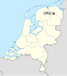
Groningen Airport Eelde (IATA: GRQ, ICAO: EHGG) is a minor international airport near Eelde in the province of Drenthe in the northeastern Netherlands. It is 4.8 nautical miles (8.9 km; 5.5 mi) south of the city of Groningen. In 2015, the airport handled 220,710 passengers. The airport is also the home base of the KLM Flight Academy, Noord Nederlandse Aero Club (NNAC) and General Enterprises. The airport started under the name «Hakenkampsveld» in 1928 and was officially opened in 1931. It was renamed «Luchthaven Eelde» in 1933. During World War II, the German military occupied the airport. Since 1958, there are European destinations from the airport. Since 1988, the airport has been called Groningen Airport Eelde.
History1920s–1930s: The First YearsGroningen Airport Eelde’s (GAE) history can be traced back to 1927, when Hayo Hindriks, an ex-alderman of the municipality Eelde, approaches the KLM (without informing the community’s council). He knew that the KLM would be interested in an air link between Rotterdam, Amsterdam and Groningen. On July 13, 1928, the community’s council agrees on a proposal to allocate ‘Hakenkampsveld’, a 12 hectare terrain within the municipality of Eelde, as an airport. The airport was officially opened by mayor Jan Gerard Legro on May 23, 1931. 40,000 visitors watched the air show, which was held to celebrate the opening. On August 15 of the same year the first scheduled service between Eelde and Amsterdam/Schiphol started, which did not appear to be viable. In 1933, the airport’s name was changed into «NV Luchthaven Eelde». Stockholders being the provinces of Groningen and Drenthe, the municipalities of Groningen, Eelde and Assen and the Chambers of Commerce and Factories for Groningen, Drenthe and the peat-colonies. Now there was money to expand the airport. At that time the airport’s area covered 12 hectares. Furthermore, a new service between the airport and Amsterdam/Schiphol was set up. 1940s: In and after World War II
The Irish Regiment of Canadasalutes General Crerar during a review at the airport in 1945. During World War II, between 1940 and 1945, the airport was occupied by the German Military. However, the Airport’s hangars were completely destroyed by Dutch soldiers, when they retreated from the militarily superior invaders. The occupation was a severe blow to the airport’s promising expectations, but the airport played an important role in the war. During the occupation, the airport was expanded considerably by the Germans. Many hangars were built and the apron was expanded to accommodate fighter aircraft. Early 1945, the Germans abandoned their «Fliegerhorst«. During the German retreat, a member of the local resistance, W.W. Krijthe, prevented the airport from being blown up, by cutting the explosives’ ignition wires. In the summer of 1945 Canadian soldiers used the airport to store vehicles of the 5th Canadian (Armoured) Division. The Canadians called the site «Finitocamp« The airfield returned to the hands of the NV Luchtvaartterrein Noord-Nederland. The national government shouldered most of the cost of restoring the damaged drainage system in the airfield. In addition, the government subsidized further developments at the airport so that it could meet international standards and remain registered for aviation. The airport was appointed as an alternative airport for flights bound for Amsterdam/Schiphol, in 1948. To cater for these deviating aircraft, a new base plan had to be designed for the egalisation and drainage of the runways (with an 1,800 metres long main runway and a secondary measuring 1,500 metres), taxiways and apron. The new runways were finally ready for service in 1953, making the site an official aerodrome. 1950sOn August 16, 1954, the Rijksluchtvaartschool (RLS) – or National Aviation Academy in English – moved to the airport from Gilze-Rijen. The KLM would acquire ownership of the RLS in 1991, becoming the KLM Flight Academy. In the course of the next two years after 1954, (amongst others) a flight theory school, the secondary and final flight education as well as other branches transferred to Eelde, making the Airport an important aviation training site. In 1956, the airport was renamed as «Luchthaven Eelde NV». The official opening of the airport building complex took place the following year on May 15, by Prince Bernard. The first landing of a European aeroplane took place on July 13, 1958. Twelve passengers boarded the aircraft, making a trip to Mallorca for a fourteen days vacation. In the same year, a new air traffic control tower was taken into use. 1960s–1970s
An NLM Fokker F.27 Friendship on a national flight in March 1967 showing the terminal and facilities. During he 1960s, the regular scheduled services were restored, initially national flights operated by NLM. The airfield was seen to have the potential to operate usefully as a regional airport and it could play a role in the infrastructure of northern part of the Netherlands. The «Study Committee for the Development of Eelde Airport» is established. The committee suggests that there should be taken a closer look to regional airports in other countries and see how they have developed. Eelde airport seemed to be a key part of a larger system of infrastructure in the region. Another finding was that aircraft noise is a bigger problem at Eelde than at similar airports. Therefore, a noise pollution committee was established. In 1977, a new passenger terminal opened and more parking space for cars was constructed. Adding to this, a bus link to the city of Groningen was established, improving the airport’s accessibility. Furthermore, work started to expand the apron and adding a hangar. In the same year, the Dutch ministry of infrastructure and the environment published the Structural Plan for Civil Aerodromes. This plan stated that an expansion of the main runway by 500 metres should be taken into account. This would make flights of all aircraft types possible. 1980s–1990s
Boeing 737-229 of Trans European Airways at the airport in 1988. During the period 1979−1982, the buildings housing the State Aviation Service (Rijksluchtvaartdienst) and the meteorological service were modernised. Adding to this, a new air traffic control tower was constructed. The aerodrome’s name was changed once again in 1988, becoming officially «Groningen Airport Eelde NV». This was decided because of the airport’s international significance had steadily increased through the years. With the airport becoming more crowded due to holiday flights, it was decided to join the two existing passenger halls together. This created a single departure hall capable of holding 200 passengers. The merge also resulted in an arrivals hall with a conveyor belt. As part of the project, a new car park was added as well. Groningen Airport Eelde received a sum of 2.5 million guilders for a new passage hall. This sum was donated by the European support fund ISP, which was granted by the province of Drenthe. This would finance almost one third of the costs for the new hall. In 1997, the Dutch government planned to stop financial support to most regional airports. Despite this, the airport was still entitled to 25 million guilders (about 11.3 million euros) for the expansion of its main runway. On November 12, 1999, the government agreed with the proposal to extend the runway, provided that the flying of training circuits by large aircraft be terminated. 2000s–2010s
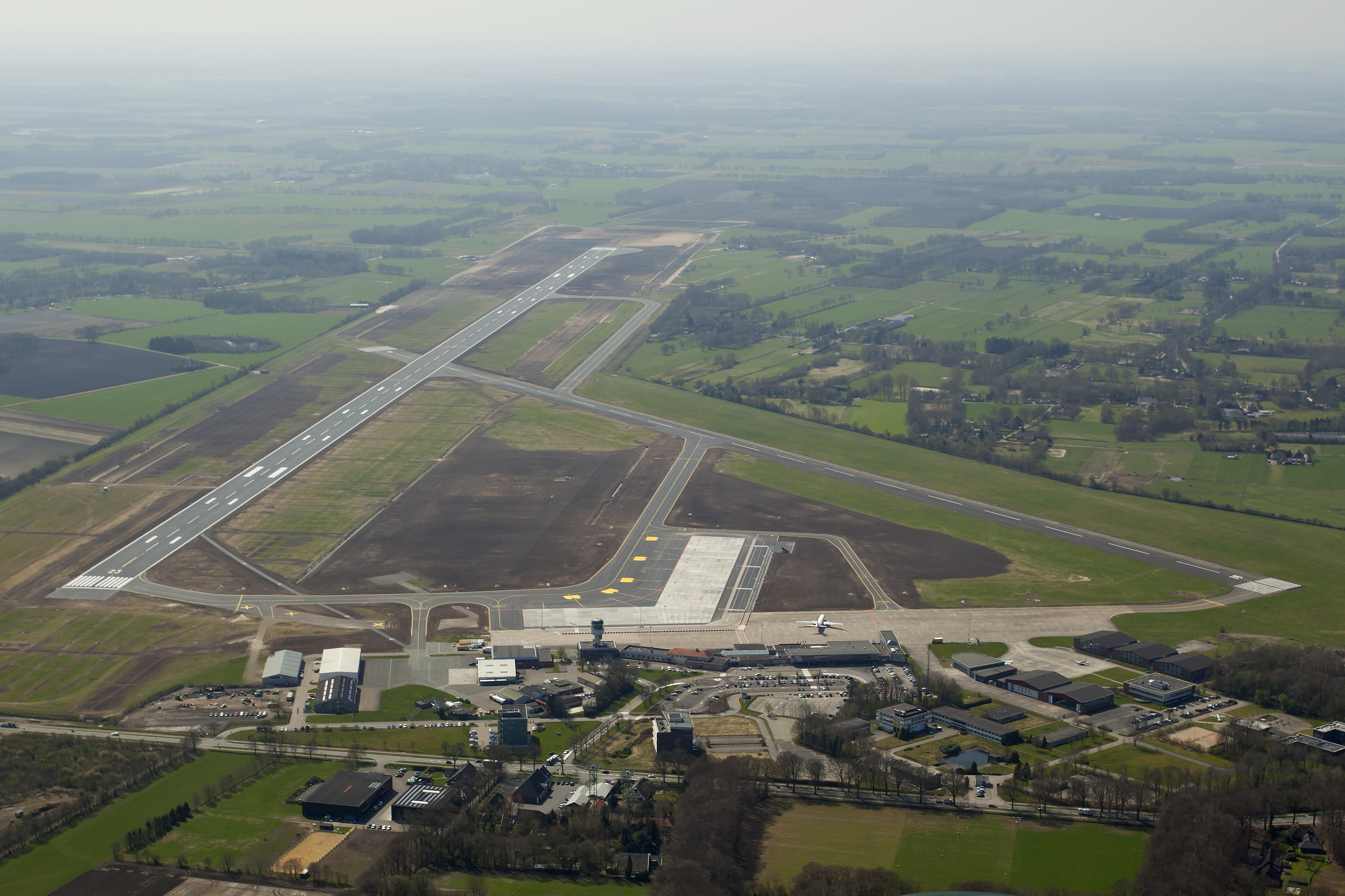
Transavia Boeing 737-800 in 2007. April 2000: the majority of the Dutch parliament had no objection against the runway extension, but due to changing environmental legislation and civil objection procedures, it would take 12 more years until the project was actually started. Ryanair started a scheduled service to its London Stansted base in 2003. This service attracted many passengers to the airport. However, this service did not last long, Ryanair terminated the service in May 2004. One reason leading to this decision was the limited length of the main runway, limiting the aircraft’s effective range and maximum load. Finally, the province’s State of Council gave the final go ahead for the runway extension on February 15, 2012. After this approval was given, Ryanair announced three new routes, returning to the airport after eight years. The extended runway was put into service on April 24, 2013. However once again Ryanair did not operate from Eelde for long, the last flight being in November 2014. In June 2014, UK low-cost carrier Flybe commenced a new year-round service to London-Southend. From March 2018 this service will be greatly expanded, from six to 18 flights per week. From 19 September 2016 Nordica started operating two flights a day between Groningen and Copenhagen. RunwaysGroningen Airport Eelde has two asphalt paved runways. Runway 05/23 measures 2,500 m × 45 m (8,202 ft × 148 ft), which has recently been extended from 1,800 meters. Runway 01/19 is shorter, measuring 1,500 m × 45 m (4,921 ft × 148 ft). Only runway 23 has a DME/ILS (localizer at 109,9 MHz, no markers). Airlines and destinations
StatisticsTop destinations
Annual passenger and aircraft movementsFrom CBS Statistics Netherlands and annual reports Groningen Airport Eelde
Ground transportationCarGroningen Airport Eelde is accessible by car using exit 37 of the Motorway A28. BicycleSeparated bicycle infrastructure exists almost the entire way from the City of Groningen to Groningen Airport Eelde using either the Groningerweg/Hoofdweg or the bicycle paths parallel to the A28/E232 motorway Public transportThe closest major railway stations are in Assen and Groningen. Buses connect the airport with Groningen. A bus connection to Assen is possible with a change in De Punt.
* * *
The content above was published at Airports-Worldwide.com in 2018.
|
||||||||||||||||||||||||||||||||||||||||||||||||||||||||||||||||||||||||||||||||||||||||||||||||||||||||||||||||||||||||||||||||||||||||||||||||||||||||||||||||||||||||||||||||||||||||||||||||||||||||||||||||||||||||||||||||||||||||||||||||||||||||||||||||||||||||||||||||||||||||||||||||||||||||||||||||||||||||||||||||||||||||||||||||||

 |
|
Copyright 2004-2024 © by Airports-Worldwide.com, Vyshenskoho st. 36, Lviv 79010, Ukraine Legal Disclaimer |