|
|
| Henderson Field |
 |
| IATA: MDY – ICAO: PMDY |
| Summary |
| Airport type |
Public |
| Owner |
U.S. Dept. of the Interior
Fish and Wildlife Service |
| Operator |
American Airports Corp.
(under sub-contract with Chugach Industries, Inc.) |
| Serves |
Midway Atoll |
| Location |
Sand Island, Midway Atoll |
| Coordinates |
28°12′13.21″N 177°22′46.26″W / 28.2036694°N 177.3795167°W / 28.2036694; -177.3795167Coordinates: 28°12′13.21″N 177°22′46.26″W / 28.2036694°N 177.3795167°W / 28.2036694; -177.3795167 |
| Website |
www.americanairports.com |
| Runways |
| Direction |
Length |
Surface |
| ft |
m |
| 6/24 |
7,904 |
2,409 |
Asphalt |
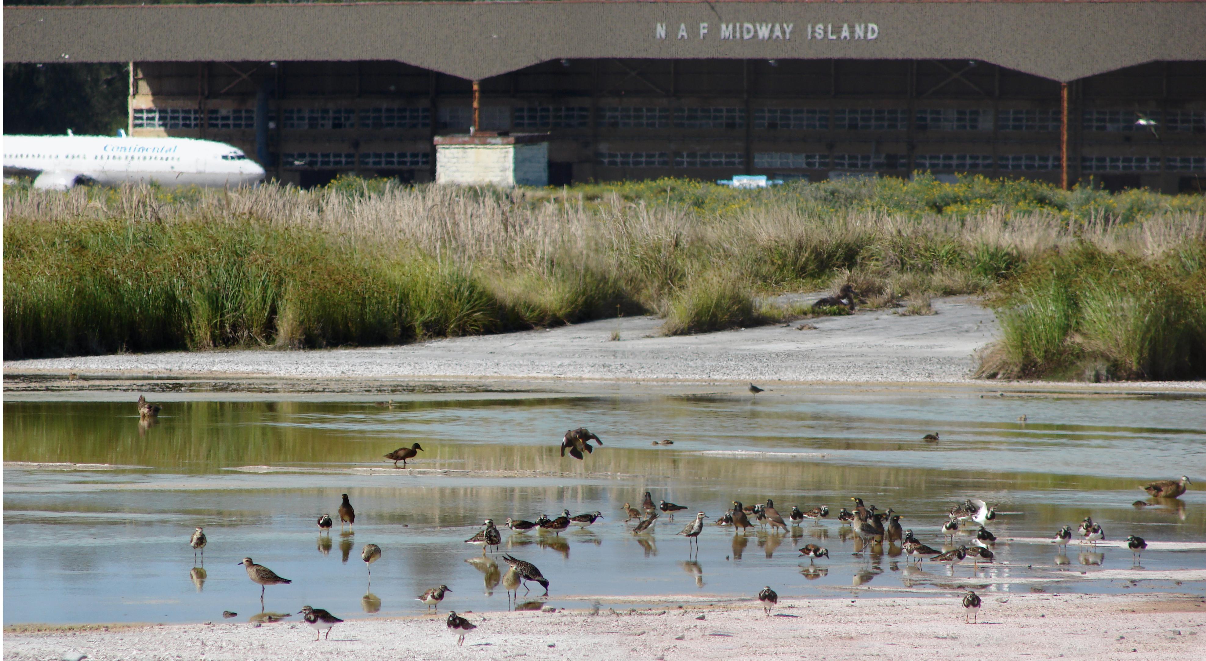
Henderson Field (IATA: MDY, ICAO: PMDY) is a public airport located on Sand Island in Midway Atoll, an unincorporated territory of the United States. In the past, the airport was used as an emergency diversion point for ETOPS operations. It is subsidized by Boeing.
Facilities
Henderson Field covers 1,200 acres (486 ha) and has one runway:
- Runway 6/24: 7,904 x 200 ft (2,409 x 61 m), Surface: Asphalt
Continental Airlines Boeing 737The field is no longer closed. See http://www.the-airport-guide.com/airport.php?airports_id=7462
The above content comes from Wikipedia and is published under free licenses – click here to read more.
| General Info
|
| Country |
Midway Islands
|
| ICAO ID |
PMDY
|
| Time |
UTC-11
|
| Latitude |
28.201725
28° 12' 06.21" N
|
| Longitude |
-177.380636
177° 22' 50.29" W
|
| Elevation |
13 feet
4 meters
|
| Type |
Civil
|
| Magnetic Variation |
008° E (01/06)
|
| Beacon |
Yes
|
| Operating Agency |
U.S.CIVIL AIRPORT WHEREIN PERMIT COVERS USE BY TRANSIT MILITARY AIRCRAFT
|
| Alternate Name |
HENDERSON FLD
|
| Island Group |
Sand I
|
| Communications
|
RDO
Mnt 1900-0400Z.
|
126.2
|
| CTAF |
122.9
|
| AWOS 3 |
118.325
|
| Communications Remarks |
|
| CTAF |
CTAF unmnt.
|
| RDO |
Inbd acft ctc 100 NM out for advsy svc and svc req. Use 126.2 for all inbd and outbd com. Freq 126.2 mnt 1900-0400Z dly and dur apv acft ops.
|
| AWOS |
C808-674-8237.
|
| Runways
|
| ID |
Dimensions |
Surface |
PCN |
ILS
|
| 06/24 |
7904 x 200 feet
2409 x 61 meters |
ASPHALT |
- |
NO
|
| Navaids
|
| Type |
ID |
Name |
Channel |
Freq |
Distance From Field |
Bearing From Navaid
|
| NDB |
MDY |
MIDWAY |
- |
400 |
At Field |
-
|
| Supplies/Equipment
|
| Fuel |
JP-5, Keroscene MIL Spec T-5624
|
| Other Fluids |
LHOX, Low and high pressure oxygen servicing
|
| Remarks
|
| CAUTION |
Water on twy dur and after hvy rain. Sked acft ops permitted only dur hrs of darkness NOV-JUN due to heavy bird activity. Req current winds and bird act C808-674-1237 x315 and on 126.2 inbd.
|
| FUEL |
J5. 24 hr pn rqr C808-674-1237 x315. Exc for emerg PPR for fuel ctc AMGR 808-674-1237.
|
| JASU |
1(GTC-85)
|
| LGT |
ACTIVATE- HIRL Rwy 06-24-126.2.
|
| MISC |
Ctc arpt 1900-0400Z; C808-674-1237. Pager H24; C480-768-2500, ID881631492770. Ldg fee. PPR for ldg fr arpt mgr 24 hr in advance due to heavy bird haz, ctc C808-674-1237.
|
| OPR HOURS |
Attended 1900-0400Z; ngt ops only dur Nov-Jun.
|
| RSTD |
PPR for all opr 24 hr PN due hvy bird act, fone C808-674-1237 x315. Rwy 15-33 clsd. Exc tkof/ldg maint min 1500' AGL within 5 NM.
|
| TRAN ALERT |
Ltd svc avbl. No maint avbl.
|
The content above was published at Airports-Worldwide.com in 2010.
We don't guarantee the information is fresh and accurate. The data may be wrong or outdated.
For more up-to-date information please refer to other sources.
|
|