|
|
Quetzalcoatl Intl Airport |
| Quetzalcóatl International Airport |
 |
| IATA: NLD – ICAO: MMNL |
| Summary |
| Airport type |
Public |
| Operator |
Aeropuertos y Servicios Auxiliares |
| Location |
Nuevo Laredo |
| Elevation AMSL |
484 ft / 148 m |
| Coordinates |
27°26′38″N 99°34′14″W / 27.44389°N 99.57056°W / 27.44389; -99.57056Coordinates: 27°26′38″N 99°34′14″W / 27.44389°N 99.57056°W / 27.44389; -99.57056 |
| Runways |
| Direction |
Length |
Surface |
| ft |
m |
| 14/32 |
6,562 |
2,000 |
Asphalt |
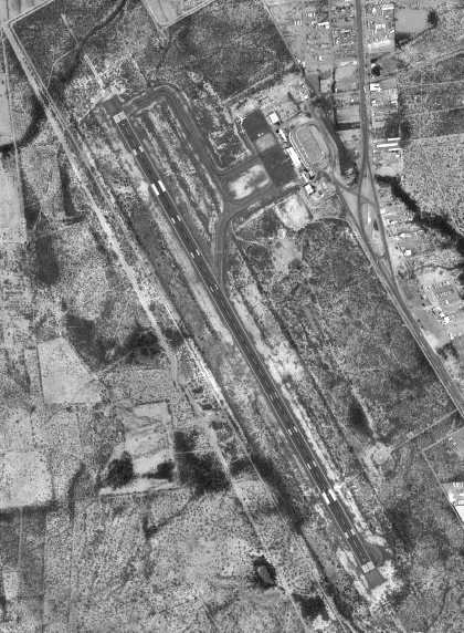
Quetzalcóatl International Airport (Nahuatl pronunciation: [ketsalˈkoːaːtɬ]) (IATA: NLD, ICAO: MMNL) is an international airport located in Nuevo Laredo, Tamaulipas, Mexico. It is situated near the U.S.-Mexico border border, opposite Laredo, Texas and handles national and international air traffic for the city of Nuevo Laredo. It is operated by Aeropuertos y Servicios Auxiliares, a federal government-owned corporation. History
Quetzalcóatl International Airport was named after Quetzalcoatl in Aztec Religion was a benefactor god, considered a leader among the deities, that would come back after his departure to take back the empire.
Airlines and destinations
Air taxi services
| Airlines |
Destinations |
| GID Explore |
Ciudad Victoria |
Domestic services
| Airlines |
Destinations |
| Aeroméxico Connect |
Mexico City |
Flights
| Flight # |
Frequency |
Time |
Departure |
Arrival |
Type |
Duration |
| 7220 |
Daily |
6:45 AM |
Mexico City MMMX |
Nuevo Laredo MMNL |
Nonstop |
1hr 35min |
| 7221 |
Daily |
8:45 AM |
Nuevo Laredo MMNL |
Mexico City MMMX |
Nonstop |
1hr 40min |
| 7222 |
Daily |
5:40 PM |
Mexico City MMMX |
Nuevo Laredo MMNL |
Nonstop |
1hr 35min |
| 7223 |
Daily |
7:40 PM |
Nuevo Laredo MMNL |
Mexico City MMMX |
Nonstop |
1hr 40min |
The above content comes from Wikipedia and is published under free licenses – click here to read more.
| General Info
|
| Country |
Mexico
|
| ICAO ID |
MMNL
|
| Time |
UTC-6(-5DT)
|
| Latitude |
27.443918
27° 26' 38.11" N
|
| Longitude |
-99.570460
099° 34' 13.66" W
|
| Elevation |
484 feet
148 meters
|
| Type |
Civil
|
| Magnetic Variation |
006° E (01/06)
|
| Beacon |
Yes
|
| Operating Agency |
CIVIL GOVERNMENT, (LANDING FEES AND DIPLOMATIC CLEARANCE MAY BE REQUIRED)
|
| Alternate Name |
NUEVO LAREDO INTL
|
| Near City |
Nuevo Laredo
|
| Operating Hours |
SEE REMARKS FOR OPERATING HOURS OR COMMUNICATIONS FOR POSSIBLE HOURS
|
| International Clearance Status |
Airport of Entry
|
| Daylight Saving Time |
First Sunday in April to the last Saturday in October
|
| Communications
|
| NUEVO LAREDO APP/TWR |
118.3
|
| Runways
|
| ID |
Dimensions |
Surface |
PCN |
ILS
|
| 14/32 |
6562 x 148 feet
2000 x 45 meters |
ASPHALT |
048FBXT |
NO
|
| Navaids
|
| Type |
ID |
Name |
Channel |
Freq |
Distance From Field |
Bearing From Navaid
|
| VOR-DME |
NLD |
NUEVO LAREDO |
073X |
112.6 |
At Field |
-
|
| Remarks
|
| FUEL |
(NC-100LL, A1)
|
| OPR HOURS |
Opr 1400-0200Z++.
|
| RSTD |
All US mil acft diverting to this afld must ctc the Defense Attache Office duty officer at the US Embassy Mexico City. Thru ctl agcy call 011-52-555-080-2000. This afld can accept US mil ldg after proper coord.
|
The content above was published at Airports-Worldwide.com in 2010.
We don't guarantee the information is fresh and accurate. The data may be wrong or outdated.
For more up-to-date information please refer to other sources.
|
|