 |
|
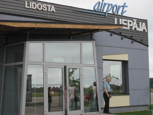
| Liepāja International Airport |
 |
| IATA: LPX – ICAO: EVLA |
| Summary |
| Airport type |
Public |
| Operator |
Aviacompany Liepaja Ltd |
| Location |
Liepāja |
| Elevation AMSL |
16 ft / 5 m |
| Coordinates |
56°31′03″N 021°05′49″E / 56.5175°N 21.09694°E / 56.5175; 21.09694 (Liepāja International Airport)Coordinates: 56°31′03″N 021°05′49″E / 56.5175°N 21.09694°E / 56.5175; 21.09694 (Liepāja International Airport) |
| Runways |
| Direction |
Length |
Surface |
| m |
ft |
| 06/24 |
2,002 |
6,568 |
Asphalt/Concrete |
Source: Aerodrome chart
Latvian AIP at EUROCONTROL |
Liepāja International Airport (IATA: LPX, ICAO: EVLA) is a regional airport in western Latvia which is certified for international air traffic. Together with Riga International Airport and Ventspils Airport this airport is one of the three notable airports in Latvia.
Liepāja International Airport is situated 2.7 NM (5.0 km; 3.1 mi) east of Liepāja, 210 km (130 mi) from the capital of Latvia, Riga, and 60 km (37 mi) from the Lithuanian border. The territory of the airport covers 2.2 km (0.85 sq mi) and is integrated within the Liepāja Special Economic Zone. In September 2005, flights from Liepaja to Riga were resumed (as seasonal) after 14 years. From 2007 flights to Riga became regular, and opened new routes to Copenhagen and Hamburg. airBaltic is currently the only airline to have regular flights from Liepaja. It uses Fokker 50 and DAT Danish Air Transport aircraft ATR 42-300 on routes.
Early during the Cold War, the airfield was a Soviet Anti-Air Defense (PVO) base. Its aircraft shot down a U.S. Air Force PB4Y-2 Privateer BuNo 59645 on April 8, 1950 . Ground transport
- Bus
- Bus route #2 is running between Liepaja International Airport and the city center.
The above content comes from Wikipedia and is published under free licenses – click here to read more.
| General Info
|
| Country |
Latvia
|
| ICAO ID |
EVLA
|
| Time |
UTC+2(+3DT)
|
| Latitude |
56.517500
56° 31' 03.00" N
|
| Longitude |
21.096944
021° 05' 49.00" E
|
| Elevation |
16 feet
5 meters
|
| Type |
Civil
|
| Magnetic Variation |
005° E (01/06)
|
| Operating Agency |
CIVIL GOVERNMENT, (LANDING FEES AND DIPLOMATIC CLEARANCE MAY BE REQUIRED)
|
| Operating Hours |
SEE REMARKS FOR OPERATING HOURS OR COMMUNICATIONS FOR POSSIBLE HOURS
|
| International Clearance Status |
Airport of Entry
|
| Daylight Saving Time |
Last Sunday in March to last Sunday in September
|
| Communications
|
| METEO INFO |
124.8
|
| APP/TWR |
129.4
|
| Runways
|
| ID |
Dimensions |
Surface |
PCN |
ILS
|
| 07/25 |
6568 x 131 feet
2002 x 40 meters |
ASPHALT |
024FCYT |
NO
|
| Navaids
|
| Type |
ID |
Name |
Channel |
Freq |
Distance From Field |
Bearing From Navaid
|
| VOR-DME |
LIE |
LIEPAJA |
070X |
112.3 |
At Field |
-
|
| Supplies/Equipment
|
| Fuel |
Jet A1, without icing nhibitor.
100/130 MIL Spec, low lead, aviation gasoline (BLUE)
|
| Remarks
|
| CAUTION |
Unlgtd obst 455' wind turbines, 1-2NM E of afld.
|
| FLUID |
De-Ice
|
| FUEL |
(NC- A1, 100LL)
|
| MISC |
Ldg fees.
|
| OPR HOURS |
Opr 0700-1430Z++ Mon-Fri (0700-1430Z++ Sun-Fri 1 May-31 Oct), OT O/R during HO.Fone/fax C(371-34)07592. Twr fax C(371-34)84074.
|
The content above was published at Airports-Worldwide.com in 2009.
We don't guarantee the information is fresh and accurate. The data may be wrong or outdated.
For more up-to-date information please refer to other sources.
|
|


