 |
|
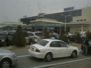
Gwangju Airport
광주공항
光州空港
Gwangju Gonghang
Kwangju Konghang |
 |
| IATA: KWJ – ICAO: RKJJ |
| Summary |
| Airport type |
Military/Public |
| Operator |
Korea Airports Coorporation |
| Location |
Gwangju |
| Elevation AMSL |
39 ft / 12 m |
| Coordinates |
35°07′35″N 126°48′32″E / 35.12639°N 126.80889°E / 35.12639; 126.80889 |
| Website |
gwangju airport |
| Runways |
| Direction |
Length |
Surface |
| m |
ft |
| 04R/22L |
2,835 |
9,300 |
Concrete |
| 04L/22R |
2,835 |
9,300 |
Concrete |
| Statistics (2007) |
| Passengers |
1,539,187 |
Sources: World Aero Data
Korea Airports Corporation |
Gwangju Airport (Hangul: 광주공항, Hanja: 光州空港, Revised Romanization of Korean: Gwangju Gonghang, McCune-Reischauer: Kwangju Konghang) (IATA: KWJ, ICAO: RKJJ) is an airport in the city of Gwangju, South Korea and is managed by the Korea Airports Corporation. This airport is planned to close when Muan International Airport becomes more established. Airlines and destinations
| Airlines |
Destinations |
| Asiana Airlines |
Jeju, Seoul-Gimpo |
| Korean Air |
Jeju, Seoul-Gimpo |
History
The airport was established in November 1948. It saw its first commercial flight in 1950. At the time, however, it was not located in Gwangju but in neighboring Jangseong, on a military training facility. The airport moved to its present location in Sinchon-dong, Gwangsan-gu, in 1964. It was taken over by the Korea Airports Corporation in 1990. The Airport terminal now has been constructed on 1994. The old terminal turned into the Cargo terminal.
Location
Situated 11 kilometers west of downtown Gwangju, Gwangju International Airport has two terminals for passenger and cargo, a runway, taxi stops, and parking lot accommodating about 820 vehicles. A subway station is in the vicinity.
Parking lot
Customers should pick up a parking ticket from a printing machine on the way into the lot. If customers do not pick up the ticket, they have to pay the full fare.
The above content comes from Wikipedia and is published under free licenses – click here to read more.
| General Info
|
| Country |
Korea, Republic of
|
| ICAO ID |
RKJJ
|
| Time |
UTC+9
|
| Latitude |
35.126389
35° 07' 35.00" N
|
| Longitude |
126.808889
126° 48' 32.00" E
|
| Elevation |
39 feet
12 meters
|
| Type |
Military
|
| Magnetic Variation |
007° W (01/06)
|
| Beacon |
Yes
|
| Operating Agency |
MILITARY
|
| Alternate Name |
K 57
|
| Operating Hours |
SEE REMARKS FOR OPERATING HOURS OR COMMUNICATIONS FOR POSSIBLE HOURS
|
| Communications
|
| TWR |
126.2
236.6
254.6
|
| GND |
118.05
275.8
|
| EMR |
121.5
243.0
|
| DEP |
124.0
347.2
|
ATIS
Opr 2200-1200Z
|
128.875
234.7
|
| GWANJU ARRIVAL |
132.25
132.5
268.0
331.4
379.8
|
| APP |
130.0
228.9
319.2
|
| Communications Remarks |
|
| ATIS |
Digital ATIS svc avail.
|
| TWR |
(267.6 Emerg aux recovery for F4 acft).
|
| Runways
|
| ID |
Dimensions |
Surface |
PCN |
ILS
|
| 04R/22L |
9300 x 150 feet
2835 x 46 meters |
CONCRETE. |
075RCXT |
YES
|
| 04L/22R |
9300 x 150 feet
2835 x 46 meters |
CONCRETE. |
060RBWT |
NO
|
| Navaids
|
| Type |
ID |
Name |
Channel |
Freq |
Distance From Field |
Bearing From Navaid
|
| TACAN |
KWJ |
GWANGJU |
088X |
- |
At Field |
-
|
| VOR-DME |
KWA |
GWANGJU |
091X |
114.4 |
At Field |
-
|
| Supplies/Equipment
|
| Fuel |
JP-8, SemiKeroscene MIL Spec T-83133, without icing inhibitor
|
| Oil |
O-123, 1065,(Dispersant)Reciprocating Engine Oil(MIL L 22851 Type III)
O-148, MIL L 7808 (Synthetic Base), Turboprop/Turboshaft Engine
|
| Other Fluids |
LPHOX, Low pressure oxygen servicing
LOX, Liquid oxygen servicing
OX, Indicates oxygen servicing when type of servicing is unknown
|
| JASU |
A/M32A-86
AC:115/200v, 3 phase, 90 kva, 0.8pf, 4 wire, DC: 28v,1500 amp, 72kw
MA-1A
82lb/min (1123cfm) at 130 deg air inlet temp,45psia(min) air outlet
MC-1A
AC:115/208v,400 cycle, 3 phase, 37.5kva,0.8pf, 108 amp, 4 wire, DC: 28v, 500 amp, 14kw
|
| Remarks
|
| A-GEAR |
BAK-12 Rwy 04-22 rqr 15 min PN to activate.
|
| CAUTION |
Extv bird act vcnty of afld. Use extreme caution fld is sur by hi angle frng rng (RK)R14, (RK)R129 on N and NW. All 4 eng convl and turbo jet acft will taxi with outboard eng at idle or shutdown and exer caution to minimize jet blast andpotential FOD haz. N portion of maint twy btn 4000' and 9300' fr end of Rwy 04is not vis fr twr. Day and ngt stu trng conducted in the trml area. 352' chimney lctd left side of final apch 1.7 NM fr Rwy 22.
|
| FLUID |
LPOX LOX OX
|
| FUEL |
Opr 2230-0800Z Mon-Fri. J8,
|
| JASU |
1(MA-1A), 4(MC-1A), 2(A-M32A-60), 3(A-M32A-86) , 1(MD-2), 1(MD-3).
|
| LGT |
5 min PN rqr.
|
| OIL |
O-123-148
|
| OPR HOURS |
ROKAF Opr H24.
|
| RSTD |
OFFL BUS ONLY. 72 hr PPR all US mil acft, ctc Command Post D 786-6000/6137. Rwy clsd 2250-2330Z Apr thru Sep; 2320-2400Z, Oct thru Mar ev Mon due to FOD clean-up. Special VFR not auth. Aero Club not auth to use arpt or to opr within thearpt tfc area.
|
| TFC PAT |
All acft use rgt tfc pat Rwy 04 and left tfc pat Rwy 22. Alt-jet 1700', convl-1000'. Semi-circular jet tfc pat E part of 10 NM rad cntr of arpt fr 2000' to 9000' Mon-Sat, VFR only.
|
| TRAN ALERT |
No USAF tran maint avbl.
|
The content above was published at Airports-Worldwide.com in 2010.
We don't guarantee the information is fresh and accurate. The data may be wrong or outdated.
For more up-to-date information please refer to other sources.
|
|


