 |
|
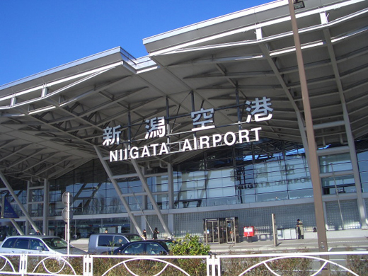
Niigata Airport
新潟空港
Niigata Kūkō |
 |
| IATA: KIJ – ICAO: RJSN |
| Summary |
| Airport type |
Public |
| Operator |
Ministry of Land, Infrastructure, Transport and Tourism |
| Location |
Niigata, Niigata |
| Elevation AMSL |
5 ft / 2 m |
| Coordinates |
37°57′21″N 139°06′42″E / 37.95583°N 139.11167°E / 37.95583; 139.11167 (Niigata Airport)Coordinates: 37°57′21″N 139°06′42″E / 37.95583°N 139.11167°E / 37.95583; 139.11167 (Niigata Airport) |
| Runways |
| Direction |
Length |
Surface |
| m |
ft |
| 04/22 |
1,314 |
4,311 |
Asphalt concrete |
| 10/28 |
2,500 |
8,202 |
Asphalt concrete |
| Source: Japanese AIP at AIS Japan |
Niigata Airport (新潟空港, Niigata Kūkō) (IATA: KIJ, ICAO: RJSN) is a second class airport located 6.7 km (4.2 mi) northeast of Niigata Station in Niigata, Japan.
Airlines and destinations
The following destinations are served from Niigata (as of December 2008):
| Airlines |
Destinations |
| All Nippon Airways |
Fukuoka, Nagoya-Centrair, Naha [seasonal], Osaka-Itami, Sapporo-Chitose [seasonal] |
| China Eastern Airlines |
Shanghai-Pudong, Xi'an |
| China Southern Airlines |
Harbin |
| Continental Airlines operated by Continental Micronesia |
Guam |
| Hokkaido International Airlines |
Sapporo-Chitose |
| Japan Airlines |
Osaka-Itami |
| Japan Airlines operated by J-Air |
Nagoya-Komaki |
| Korean Air |
Seoul-Incheon |
| Vladivostok Air |
Khabarovsk, Vladivostok |
The above content comes from Wikipedia and is published under free licenses – click here to read more.
| General Info
|
| Country |
Japan
|
| ICAO ID |
RJSN
|
| Time |
UTC+9
|
| Latitude |
37.955892
37° 57' 21.21" N
|
| Longitude |
139.120717
139° 07' 14.58" E
|
| Elevation |
29 feet
9 meters
|
| Type |
Joint (Civil and Military)
|
| Magnetic Variation |
007° W (01/06)
|
| Beacon |
Yes
|
| Operating Agency |
MILITARY - CIVIL JOINT USE AIRPORT
|
| Island Group |
Honshu I
|
| Operating Hours |
SEE REMARKS FOR OPERATING HOURS OR COMMUNICATIONS FOR POSSIBLE HOURS
|
| International Clearance Status |
Airport of Entry
|
| Communications
|
| TWR |
118.0
126.2
|
| DEP |
119.05
|
| ATIS |
128.45
|
| APP |
121.4
261.2
|
| Runways
|
| ID |
Dimensions |
Surface |
PCN |
ILS
|
| 04/22 |
4300 x 150 feet
1311 x 46 meters |
ASPHALT |
012FCYT |
NO
|
| 10/28 |
8200 x 150 feet
2499 x 46 meters |
ASPHALT |
083FCXT |
YES
|
| Navaids
|
| Type |
ID |
Name |
Channel |
Freq |
Distance From Field |
Bearing From Navaid
|
| VORTAC |
GTC |
NIIGATA |
102X |
115.5 |
At Field |
-
|
| NDB |
GT |
NIIGATA |
- |
253 |
At Field |
-
|
| Supplies/Equipment
|
| Fuel |
Jet A1+, Jet A1 with icing inhibitor.
100/130 octane gasoline, leaded, MIL-L-5572F (GREEN)
80/87 octane gasoline, leaded, MIL-L-5572F (RED)
|
| Remarks
|
| CAUTION |
Oil twr 186' 081 1.9 NM, 272' 355 4.9 NM fr rwy INT. Crane 307' MSL 099 2.8 NM fr Rwy 28 thld.
|
| FUEL |
(NC-100LL, J)
|
| LGT |
Ovrn lgt all rwy. Thld lgt Rwy 10-28. PAPI Rwy 10 MEHT 74', Rwy 22 - 61', Rwy 28- 69'.
|
| MISC |
Rwy 10-28 grooved.
|
| OPR HOURS |
Opr 2230-1130Z.
|
| TRAN ALERT |
Tran acft maint and hgr fac not avbl. Cargo handling fac avbl by prior arng.
|
The content above was published at Airports-Worldwide.com in 2010.
We don't guarantee the information is fresh and accurate. The data may be wrong or outdated.
For more up-to-date information please refer to other sources.
|
|


