|
|
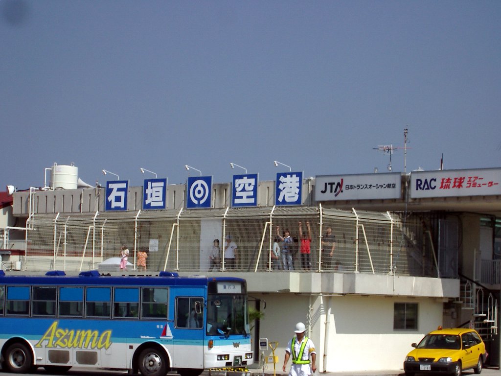
Ishigaki Airport
Ishigaki Jima Airport
石垣空港
Ishigaki Kūkō |
 |
| IATA: ISG – ICAO: ROIG |
| Summary |
| Operator |
Ministry of Land, Infrastructure and Transport |
| Location |
Ishigaki, Okinawa, Japan |
| Elevation AMSL |
86 ft / 26 m |
| Coordinates |
24°20′41″N 124°11′13″E / 24.34472°N 124.18694°E / 24.34472; 124.18694 (Ishigaki Airport)Coordinates: 24°20′41″N 124°11′13″E / 24.34472°N 124.18694°E / 24.34472; 124.18694 (Ishigaki Airport) |
| Runways |
| Direction |
Length |
Surface |
| m |
ft |
| 04/22 |
1,500 |
4,921 |
Asphalt/Concrete |
| Source: Japanese AIP at AIS Japan |
Ishigaki Airport (石垣空港, Ishigaki Kūkō), (IATA: ISG, ICAO: ROIG) is a third-class airport located 1 NM (1.9 km; 1.2 mi) from Ishigaki city centre in Okinawa Prefecture, Japan. The airport fields flights to major cities on the Japanese mainland as well as destinations throughout Okinawa Prefecture and the Yaeyama Islands. History
The airport was opened in 1943 for military use, and converted to a civilian airport in 1956. The runway was extended from 1,200 to 1,500 m (3,937 to 4,921 ft) in 1968, allowing YS-11 aircraft to land.
Future
The airport presently serves about 1.8 million passengers a year, making it the busiest third-class airport in Japan, and traffic has been growing steadily as the Yaeyama Islands have become a popular tourist destination. However, the current runway cannot accommodate planes larger than a Boeing 737, and the present site is not suitable for expansion due to urban encroachment. The airport also does not have facilities for handling standard cargo containers.
To meet these needs, New Ishigaki Airport (新石垣空港, Shin-Ishigaki Kūkō) is under construction on the eastern side of the island. Plans for the new airport date back to 1979, when the prefectural government planned to build a 2,500 m (8,202 ft) runway by the shore at Shiraho (白保).
The new airport will have a 2,000 m (6,562 ft) runway, expandable to 2,500 m (8,202 ft). Construction started in October 2006, for completion by 2013.
Airlines and destinations
| Airlines |
Destinations |
| All Nippon Airways |
Naha |
| Japan Airlines operated by Japan Transocean Air |
Osaka-Kansai, Kobe, Miyakojima, Naha, Tokyo-Haneda, Yonaguni |
| Japan Transocean Air operated by Ryukyu Air Commuter |
Miyako, Yonaguni |
| Mandarin Airlines |
Taipei [seasonal charters] |
| Transasia Airways |
Hualien [charter] |
The above content comes from Wikipedia and is published under free licenses – click here to read more.
| General Info
|
| Country |
Japan
|
| ICAO ID |
ROIG
|
| Time |
UTC+9
|
| Latitude |
24.344525
24° 20' 40.29" N
|
| Longitude |
124.186983
124° 11' 13.14" E
|
| Elevation |
93 feet
28 meters
|
| Magnetic Variation |
003° W (01/06)
|
| Beacon |
Yes
|
| Operating Agency |
CIVIL GOVERNMENT, (LANDING FEES AND DIPLOMATIC CLEARANCE MAY BE REQUIRED)
|
| Island Group |
Ishigaki I
|
| Operating Hours |
SEE REMARKS FOR OPERATING HOURS OR COMMUNICATIONS FOR POSSIBLE HOURS
|
| Communications
|
| TWR |
118.0
126.2
|
| Runways
|
| ID |
Dimensions |
Surface |
PCN |
ILS
|
| 04/22 |
4920 x 150 feet
1500 x 46 meters |
ASPHALT |
033FBXT |
NO
|
| Navaids
|
| Type |
ID |
Name |
Channel |
Freq |
Distance From Field |
Bearing From Navaid
|
| VOR-DME |
GKE |
ISHIGAKI |
124X |
117.7 |
At Field |
-
|
| Supplies/Equipment
|
| Fuel |
Jet A, without icing inhibitor.
100/130 octane gasoline, leaded, MIL-L-5572F (GREEN)
|
| Remarks
|
| FUEL |
(NC-100, A1)
|
| LGT |
PAPI Rwy 04-22 MEHT 49'. Thld Lgts Rwy 04-22.
|
| MISC |
Rwy grooved.
|
| OPR HOURS |
Opr 2300-1200Z.
|
The content above was published at Airports-Worldwide.com in 2010.
We don't guarantee the information is fresh and accurate. The data may be wrong or outdated.
For more up-to-date information please refer to other sources.
|
|