|
|
Hamamatsu Air Base
浜松基地
Hamamatsu-kichi |
 |
| IATA: none – ICAO: RJNH |
| Summary |
| Airport type |
Military |
| Owner |
Ministry of Defense |
| Operator |
JASDF |
| Location |
Hamamatsu, Shizuoka, Japan |
| Elevation AMSL |
150 ft / 46 m |
| Coordinates |
34°45′01″N 137°42′11″E / 34.75028°N 137.70306°E / 34.75028; 137.70306 (Hamamatsu Air Base)Coordinates: 34°45′01″N 137°42′11″E / 34.75028°N 137.70306°E / 34.75028; 137.70306 (Hamamatsu Air Base) |
| Runways |
| Direction |
Length |
Surface |
| m |
ft |
| 09/27 |
2,550 |
8,366 |
Concrete |
| Source: Japanese AIP at AIS Japan |
Hamamatsu Air Base (浜松基地, Hamamatsu-kichi) (ICAO: RJNH) is a Japan Air Self-Defense Force base located 3.0 NM (5.6 km; 3.5 mi) north of the city of Hamamatsu, Shizuoka Prefecture, in central Japan. History
Hamamatsu Air Base was established in 1925 as an Imperial Japanese Army Air Force base to be home to the newly-formed IJAAF No.7 Air Regiment. In 1933, it was designated as the primary flight school for Japanese army aviation. After World War II, the base facilities were used as an emergency landing strip by the United States Air Force, and were returned to the Japanese government in 1952 for use as a flight training school for the nascent Japan Air Self-Defense Force. The training syllabus was transformed in 1954 into separate schools for flight training, aircraft maintenance and communications. The base was divided into northern and southern areas in 1958, with the operational area in the north housing the First Air Wing, and from 1960, the Blue Impulse aerobatic squadron and the southern area housing the administrative and training facilities.
The Blue Impulse squadron was transferred to Matsushima Air Base in 1981; however the team suffered from a fatal mid-air collision during a farewell performance at Hamamatsu in 1982.
The First Air Wing transitioned from Lockheed T-33A trainers to Kawasaki T-4 trainers in 1988. In a fiscal reform in 1989, the northern and southern halves of the base were reunited into a single administrative entity. From 1998, Hamamatsu Air Base became the home base of Japan’s small force of Boeing E-767 AWACS aircraft.
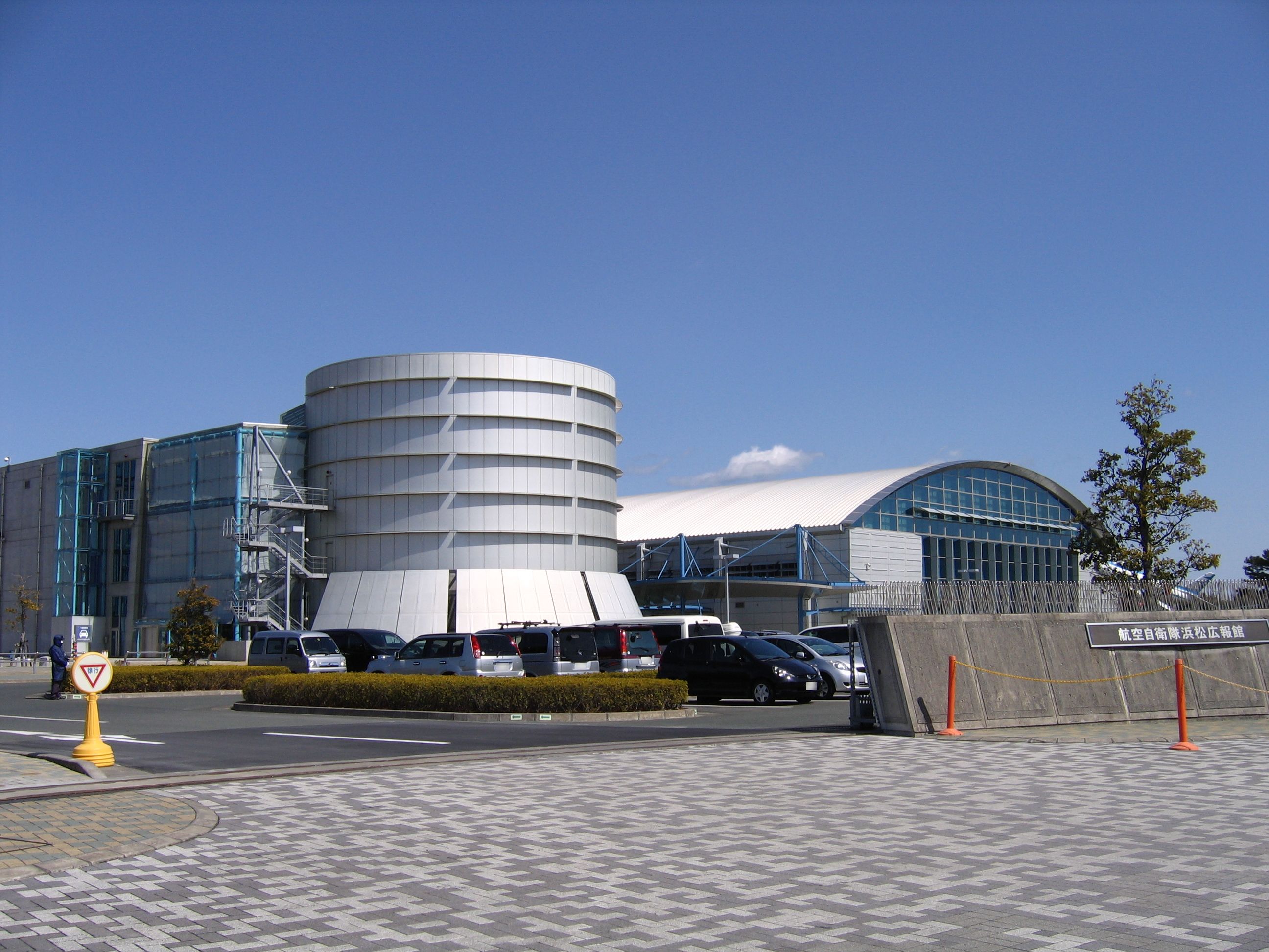
In 1999, an aviation museum, the JASDF Hamamatsu Air Base Publication Center (航空自衛隊浜松広報館, Hamamatsu Kōhōkan), was established. It has many aircraft from the history of the Japan Air Self-Defense Force on static display, and also a restored example of a World War II era A6M6 Zero.
In 2004, in celebration of the 50th anniversary of the Japan Air Self-Defense Force, Hamamatsu Air Base hosted a display by the U.S. Air Force Thunderbirds aerobatic display team.
From 2008, the MIM-104 Patriot missile has been deployed at Hamamatsu Air Base.
Organization
Hamamatsu Air Base is currently headquarters to the JASDF Air Training Command. Units currently based at Hamamatsu currently include:
- JASDF 1st Air Wing
- 31st Squadron (Kawasaki T-4)
- 32nd Squadron (Kawasaki T-4)
- Airborne Early Warning Group (E-767)
- Air Basic Training Wing
- Hamamatsu Air Rescue Squadron (U-125A, UH-60J)
- Hamamatsu Anti-Aircraft Missile Group
- Air Officer Training School
- 1st & 2nd Technical School
- Air Training Aids Group
- Air Traffic Control Group
- Air Weather Service Group
- Hamamatsu Air Police Group
The above content comes from Wikipedia and is published under free licenses – click here to read more.
| General Info
|
| Country |
Japan
|
| ICAO ID |
RJNH
|
| Time |
UTC+9
|
| Latitude |
34.750239
34° 45' 00.86" N
|
| Longitude |
137.703083
137° 42' 11.10" E
|
| Elevation |
150 feet
46 meters
|
| Type |
Military
|
| Magnetic Variation |
007° W (01/06)
|
| Beacon |
Yes
|
| Operating Agency |
MILITARY
|
| Island Group |
Honshu I
|
| Communications
|
| TWR |
126.2
236.8
304.5
|
TCA
Opr 2300-1100Z Mon-Fri
|
127.95
288.1
|
PMSV
Opr 2030-1230Z dly. OT PPR.
|
344.6
|
| GND |
126.2
275.8
|
| DEP |
120.1
302.4
362.3
|
| APP |
120.1
250.4
261.2
|
| Communications Remarks |
|
| TWR |
(123.1x 138.05 247.0x for rescue only).
|
| Runways
|
| ID |
Dimensions |
Surface |
PCN |
ILS
|
| 09/27 |
8366 x 148 feet
2550 x 45 meters |
CONCRETE. |
- |
NO
|
| Navaids
|
| Type |
ID |
Name |
Channel |
Freq |
Distance From Field |
Bearing From Navaid
|
| TACAN |
LHT |
HAMAMATSU |
094X |
- |
At Field |
-
|
| VOR-DME |
LHE |
HAMAMATSU |
037X |
110 |
1.1 NM |
089.6
|
| Supplies/Equipment
|
| Other Fluids |
LHOX, Low and high pressure oxygen servicing
LOX, Liquid oxygen servicing
|
| Remarks
|
| CAUTION |
Extn stu jet trng.
|
| FUEL |
(NC-100LL, J4)
|
| JASU |
1(C-1C) 1(C-2B) 1(C-3) 1(KM-1) 1(KM-3) 1(KM-4) JEAS
|
| LGT |
PAPI Rwy 09 MEHT 51', Rwy 27 54'.
|
| MISC |
Rwy 09 ovrn 990' (495' concrete/495' sod) Rwy 27 ovrn 885' (495' concrete/390' sod). E portion of N twy and Twy 1 not vis fr Twr.
|
The content above was published at Airports-Worldwide.com in 2010.
We don't guarantee the information is fresh and accurate. The data may be wrong or outdated.
For more up-to-date information please refer to other sources.
|
|