|
|
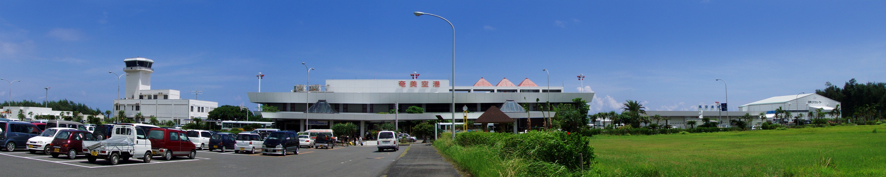
Amami Airport
奄美空港
Amami Kūkō |
 |
IATA: ASJ – ICAO: RJKA
 |
| Summary |
| Airport type |
Public |
| Operator |
Government |
| Serves |
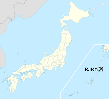
Amami Ōshima (Amami Island), Japan |
| Elevation AMSL |
14 ft / 4 m |
| Coordinates |
28°25′51″N 129°42′45″E / 28.43083°N 129.7125°E / 28.43083; 129.7125 (Amami Airport)Coordinates: 28°25′51″N 129°42′45″E / 28.43083°N 129.7125°E / 28.43083; 129.7125 (Amami Airport) |
| Runways |
| Direction |
Length |
Surface |
| m |
ft |
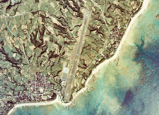
| 03/21 |
2,000 |
6,562 |
Asphalt concrete |
| Source: Japanese AIP at AIS Japan |
Amami Airport (奄美空港, Amami Kūkō) (IATA: ASJ, ICAO: RJKA) is an airport located 21.9 km (13.6 mi) east northeast Amami, a city on Amami Ōshima (Amami Island) in the Kagoshima Prefecture of Japan. It was previously named Amami Oshima Airport (奄美大島空港, Amami-Ōshima Kūkō).

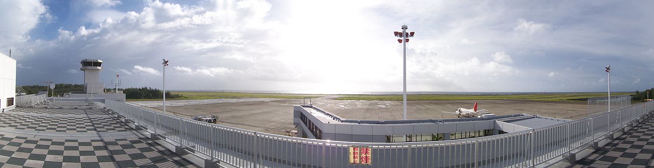
Amami Airport
Click to enlarge
Amami Airport
Click to enlarge
Airlines and destinations
| Airlines |
Destinations |
| Japan Airlines |
Kagoshima, Osaka-Itami [seasonal], Tokyo-Haneda |
| JAL Express |
Osaka-Itami |
| Japan Air Commuter |
Kagoshima, Kikai, Tokunoshima, Okinoerabu |
| Ryukyu Air Commuter |
Naha |
| Skymark Airlines |
Kagoshima |
The above content comes from Wikipedia and is published under free licenses – click here to read more.
| General Info
|
| Country |
Japan
|
| ICAO ID |
RJKA
|
| Time |
UTC+9
|
| Latitude |
28.430633
28° 25' 50.28" N
|
| Longitude |
129.712542
129° 42' 45.15" E
|
| Elevation |
27 feet
8 meters
|
| Magnetic Variation |
005° W (01/06)
|
| Beacon |
Yes
|
| Operating Agency |
CIVIL GOVERNMENT, (LANDING FEES AND DIPLOMATIC CLEARANCE MAY BE REQUIRED)
|
| Island Group |
Amami I
|
| Operating Hours |
SEE REMARKS FOR OPERATING HOURS OR COMMUNICATIONS FOR POSSIBLE HOURS
|
| Communications
|
NAHA INFO
Opr H24.
|
134.8
|
NAHA CON
Opr H24.
|
132.3
255.2
|
| RDO |
118.15
126.2
|
| Runways
|
| ID |
Dimensions |
Surface |
PCN |
ILS
|
| 03/21 |
6560 x 150 feet
1999 x 46 meters |
ASPHALT |
042FAXT |
YES
|
| Navaids
|
| Type |
ID |
Name |
Channel |
Freq |
Distance From Field |
Bearing From Navaid
|
| VORTAC |
ALC |
AMAMI |
102X |
115.5 |
6.8 NM |
101.5
|
| VOR-DME |
AME |
KASARI |
086Y |
113.95 |
At Field |
-
|
| Supplies/Equipment
|
| Fuel |
Jet A, without icing inhibitor.
JP-4, Wide cut turbine fuel MIL Spec T-5624
100/130 octane gasoline, leaded, MIL-L-5572F (GREEN)
|
| Remarks
|
| CAUTION |
Abandoned Rwy 0.6 NM W of final apch Rwy 03.
|
| FUEL |
(NC-100, A1) (J4 JSDF only).
|
| LGT |
PAPI Rwy 03-21 MEHT 61'. Thld lgt Rwy 03-21.
|
| OPR HOURS |
Opr 2300-1030Z.
|
| RSTD |
PPR for tran acft rqr fr arpt administrator C099-763-0277.
|
The content above was published at Airports-Worldwide.com in 2010.
We don't guarantee the information is fresh and accurate. The data may be wrong or outdated.
For more up-to-date information please refer to other sources.
|
|