|
|
Linate Airport
Airport Enrico Forlanini |
 |
| IATA: LIN – ICAO: LIML |
| Summary |
| Airport type |
Public |
| Operator |
SEA - Aeroporti di Milano |
| Location |
Milan, Italy |
| Elevation AMSL |
353 ft / 108 m |
| Coordinates |
45°26′58″N 009°16′42″E / 45.44944°N 9.27833°E / 45.44944; 9.27833 (Linate Airport)Coordinates: 45°26′58″N 009°16′42″E / 45.44944°N 9.27833°E / 45.44944; 9.27833 (Linate Airport) |
| Runways |
| Direction |
Length |
Surface |
| m |
ft |
| 18/36 |
2,442 |
8,012 |
Asphalt |
| 17/35 |
601 |
1,972 |
Bitumen |
| Helipads |
| Number |
Length |
Surface |
| m |
ft |
| H1 |
28 |
92 |
Asphalt |
| Source: AIP at EUROCONTROL |
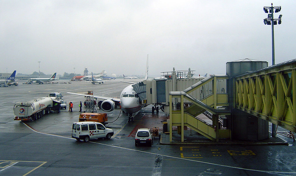
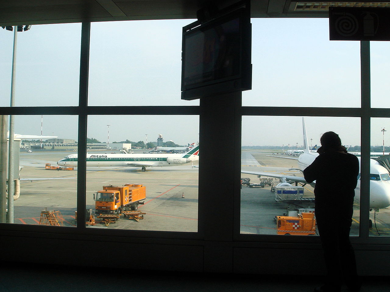
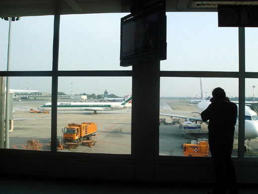
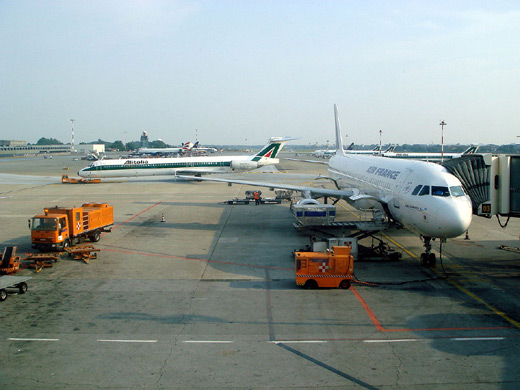
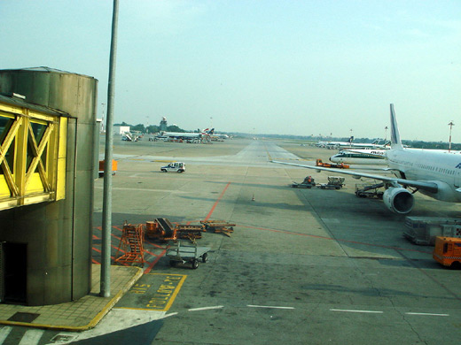
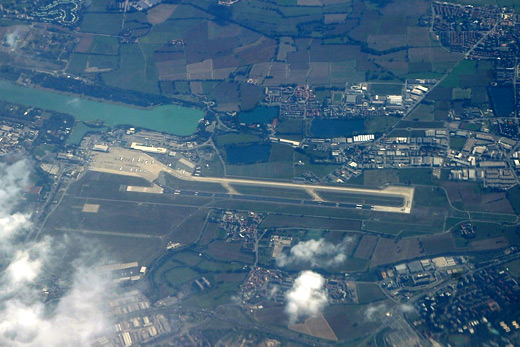
Linate Airport (IATA: LIN, ICAO: LIML) is one of the three major airports of Milan, Italy, along with Malpensa Airport and Orio al Serio Airport. Due to its closer proximity to Milan—it is 4.2 NM (7.8 km; 4.8 mi) east southeast of the city, compared with Malpensa, which is 21.58 NM (39.97 km; 24.83 mi) northwest of the city—it is mainly used for domestic and short-haul international flights, with over 9.6 million passengers in 2006. Its name comes from the small village where it is located in the town of Peschiera Borromeo. Its real name is "Airport Enrico Forlanini", after the Italian inventor and aeronautical pioneer born in Milan. Linate airport buildings are located in the Segrate Municipality, and the field is located for a large part in the Peschiera Borromeo Municipality.
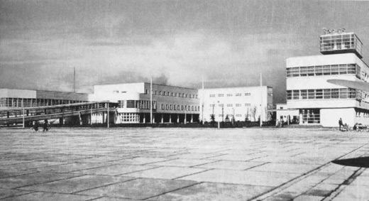
It was built next to Idroscalo of Milan in the 1930s when Taliedo Airport (located 1 km (0.62 mi) from the southern border of Milan, and one of the world's first aerodromes and airports) became too small for commercial traffic. Linate was completely rebuilt in the 1950s and again in the 1980s.
The larger airport serving Milan is Malpensa Airport (IATA: MXP, ICAO: LIMC). Linate and Malpensa airports are connected by highways and by service buses. The third airport of the Greater Milan area is Orio al Serio, located 1 km (0.62 mi) east of Bergamo, 42 km (26 mi) east of Milan. Airlines and destinations
| Airlines |
Destinations |
| Aer Lingus |
Dublin |
| airBaltic |
Riga [begins 31 October] |
| Air France |
Paris-Charles de Gaulle |
| Air Malta |
Malta [begins 31 October] |
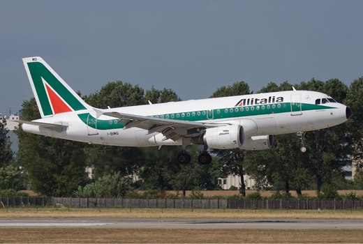
| Alitalia |
Alghero, Amsterdam, Barcelona, Bari, Brindisi, Brussels, Bucharest-Otopeni, Cagliari, Catania, Crotone, Frankfurt, Lamezia Terme, Lampedusa, London-City, London-Heathrow, Madrid, Naples, Palermo, Pantelleria, Paris-Charles de Gaulle, Paris-Orly, Pescara, Reggio Calabria, Rome-Fiumicino, Trieste |
| Italian Airlines |
Vienna |
| British Airways |
London-Heathrow |
| Brussels Airlines |
Brussels |
| easyJet |
London-Gatwick, Paris-Orly |
| Iberia Airlines |
Madrid |
| ItAli Airlines |
Pescara |
| KLM |
Amsterdam |
| Lufthansa |
Frankfurt |
| Meridiana Fly |
Bari, Brindisi, Cagliari, Catania, Naples, Olbia, Palermo |
| Scandinavian Airlines |
Copenhagen, Stockholm-Arlanda |
| TAP Portugal |
Lisbon |
| Windjet |
Catania, Palermo |
Traffic
2005
- Passengers: 9,088,607
- Movements: 122,221
- Cargo: 25,345 tons
2006
- Passengers: 9,696,515 (+6.7%)
- Movements: 131,615 (+7.7%)
- Cargo: 27,468 tons (+9.7%)
2007 (January to November)
- Passengers: 9,206,826 (+2.8%)
- Movements: 120,498 (-1.1%)
- Cargo: 21,751 tons (-13.7%)
Incidents and accidents
- Linate Airport was the site of the Linate Airport disaster on 8 October 2001, when Scandinavian Airlines Flight 686, which was bound for Copenhagen Airport, collided with a business jet that, in fog, had inadvertently taxied onto the runway already in use. This collision later resulted in criminal legal proceedings.
- On June 15, 2005, a light aircraft safely landed on taxiway 'T' after its pilot had mistaken it for runway 36R. Following that incident, a safety recommendation was issued. It suggested the use of different numbers to help differentiate between runways. This change was enacted at the beginning of July 2007, when 18R/36L became 17/35 and 18L/36R became 18/36.
Linate Airport
Click to enlarge
Linate Airport
Click to enlarge
Linate Airport
Click to enlarge
Linate Airport
Click to enlarge
Linate Airport
Click to enlarge
Linate Airport
Click to enlarge
Linate Airport
Click to enlarge
The above content comes from Wikipedia and is published under free licenses – click here to read more.
| General Info
|
| Country |
Italy
|
| ICAO ID |
LIML
|
| Time |
UTC+1(+2DT)
|
| Latitude |
45.445103
45° 26' 42.37" N
|
| Longitude |
9.276739
009° 16' 36.26" E
|
| Elevation |
353 feet
108 meters
|
| Type |
Civil
|
| Magnetic Variation |
001° E (01/06)
|
| Beacon |
Yes
|
| Operating Agency |
CIVIL GOVERNMENT, (LANDING FEES AND DIPLOMATIC CLEARANCE MAY BE REQUIRED)
|
| Alternate Name |
E FORLANINI
|
| Near City |
Milano
|
| Operating Hours |
24 HOUR OPERATIONS
|
| International Clearance Status |
Airport of Entry
|
| Daylight Saving Time |
Last Sunday in March to last Sunday in October
|
| Communications
|
| TWR |
118.1
119.25
257.8
|
| GND |
121.8
119.25
|
MILANO DEP
(North 126.75)(South 126.3 Opr 0600-2200Z++) |
126.75
126.3
|
| ATIS |
135.55
|
MILANO APP
Call MILANO ARRIVAL (Opr 0600-2200Z++) |
132.7
125.275
374.875
|
| Runways
|
| ID |
Dimensions |
Surface |
PCN |
ILS
|
| 18R/36L |
1972 x 72 feet
601 x 22 meters |
BITUMINOUS, TAR OR ASPHALT MIXED IN PLACE, OILED. |
020FBWT |
NO
|
| 18L/36R |
8005 x 197 feet
2440 x 60 meters |
ASPHALT |
040FAWT |
YES
|
| Navaids
|
| Type |
ID |
Name |
Channel |
Freq |
Distance From Field |
Bearing From Navaid
|
| VOR-DME |
LIN |
LINATE |
107X |
116 |
1.0 NM |
175.5
|
| NDB |
LIN |
LINATE |
- |
386 |
6.1 NM |
354.3
|
| Supplies/Equipment
|
| Fuel |
Jet A1, without icing nhibitor.
100/130 MIL Spec, low lead, aviation gasoline (BLUE)
|
| Remarks
|
| CAUTION |
Some ILS users rpt false LOC capture. Obst crane 144' AGL 1.6 NM NW thld Rwy 18L. Obst crane 141' AGL 1.1 NM S thld Rwy 36R.
|
| FUEL |
Avbl 0600-2030Z++. (NC-100LL, A1)
|
| LGT |
PAPI Rwy 18L, 36R MEHT 67'.
|
| MISC |
Rwy 36 pref for tkof and ldg. Rwy 18R/36L avbl for pvt tfc only. Sfc movement radar avbl on twr and gnd freq. Acft ctc GND prior to entering twy N; advs if tail abv 30' hi.
|
| RSTD |
PPR mil jet. Cir E only. Only acft equipped with working TD with Modes A and C are allowed to opr on A/D. Twy H clsd. No copter airtaxi W apn, ctc ATC for exc.
|
The content above was published at Airports-Worldwide.com in 2010.
We don't guarantee the information is fresh and accurate. The data may be wrong or outdated.
For more up-to-date information please refer to other sources.
|
|