 |
|
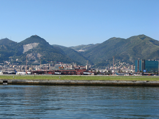
| Genoa Cristoforo Colombo Airport |
 |
| IATA: GOA – ICAO: LIMJ |
| Summary |
| Airport type |
Public |
| Operator |
Aeroporto di Genova Spa plc |
| Location |
Genoa, Italy |
| Elevation AMSL |
13 ft / 4 m |
| Coordinates |
44°24′48″N 008°50′15″E / 44.41333°N 8.8375°E / 44.41333; 8.8375 (Genoa Cristoforo Colombo Airport)Coordinates: 44°24′48″N 008°50′15″E / 44.41333°N 8.8375°E / 44.41333; 8.8375 (Genoa Cristoforo Colombo Airport) |
| Runways |
| Direction |
Length |
Surface |
| m |
ft |
| 11/29 |
2,915 |
9,564 |
Bitumen |
| Source: Italian AIP at EUROCONTROL |
Genoa Cristoforo Colombo Airport (IATA: GOA, ICAO: LIMJ) is built on an artificial peninsula, 4 NM (7.4 km; 4.6 mi) west of Genoa, Italy. The airport serves the Port of Genoa, and is currently operated by Aeroporto di Genova S.P.A., which has recently upgraded the airport complex. In 2008, 1,202,168 passengers travelled through the airport.
Airlines and destinations
| Airlines |
Destinations |
| Air France operated by Brit Air |
Paris-Charles de Gaulle |
| Air Italy |
Palermo |
| Air Malta |
Malta, Reggio Calabria |
| Alitalia |
Rome-Fiumicino |
| Alitalia operated by Air One |
Catania, Naples, Rome-Fiumicino |
| Blu-express |
Rome-Fiumicino |
| British Airways |
London-Gatwick |
| Iberia Airlines operated by Air Nostrum |
Madrid |
| Lufthansa Regional operated by Air Dolomiti |
Munich |
| Ryanair |
Bari, Cagliari, London-Stansted, Trapani |
The above content comes from Wikipedia and is published under free licenses – click here to read more.
| General Info
|
| Country |
Italy
|
| ICAO ID |
LIMJ
|
| Time |
UTC+1(+2DT)
|
| Latitude |
44.413333
44° 24' 48.00" N
|
| Longitude |
8.837500
008° 50' 15.00" E
|
| Elevation |
13 feet
4 meters
|
| Type |
Civil
|
| Magnetic Variation |
001° E (01/06)
|
| Operating Agency |
CIVIL GOVERNMENT, (LANDING FEES AND DIPLOMATIC CLEARANCE MAY BE REQUIRED)
|
| Alternate Name |
CRISTOFORO COLOMBO
|
| Near City |
Genova
|
| Operating Hours |
SUNRISE TO SUNSET (SR-SS)
|
| International Clearance Status |
Airport of Entry
|
| Daylight Saving Time |
Last Sunday in March to last Sunday in October
|
| Communications
|
| TWR |
118.6
257.8
(257.8 Opr SR-30 to SS+30, OT O/R thru FPL.)
|
| ATIS |
122.825
|
| APP |
119.6
119.85
362.3
|
| Runways
|
| ID |
Dimensions |
Surface |
PCN |
ILS
|
| 11/29 |
9564 x 148 feet
2915 x 45 meters |
ASPHALT |
069FAWT |
YES
|
| Navaids
|
| Type |
ID |
Name |
Channel |
Freq |
Distance From Field |
Bearing From Navaid
|
| VOR-DME |
SES |
GENOVA SESTRI |
023X |
108.6 |
At Field |
-
|
| NDB |
GEN |
GENOVA |
- |
318 |
9.9 NM |
265.6
|
| Supplies/Equipment
|
| Fuel |
Jet A1, without icing nhibitor.
100/130 MIL Spec, low lead, aviation gasoline (BLUE)
|
| Other Fluids |
SP, Single Point Refueling
|
| Remarks
|
| CAUTION |
Bird act. Wind exceeding 15 Kt fr N sctr and 20 Kt fr S sctr may generate turbulence or windshear and tailwinds on Rwy 11-29 thld. Taxi with ctn and use flw-mecar and marshal instr.
|
| FLUID |
De-Ice, 40 min PN for hot fluid.
|
| FUEL |
A1 (Eni S.p.A. avbl 0515-2300Z++ Mon-Fri, OT 2 hr PN $72 ea occurence). (NC-100LL).
|
| LGT |
PAPI compul for cir Rwy 11, unuse byd 5.0 DME Rwy 29 LLZ, obst clnc sfc pent by terrain. PAPI Rwy 11 GS 3.3 MEHT 66', Rwy 29 GS 3.2 MEHT 59'.
|
| MISC |
For Special Pro see FLIP Planning AP/2.
|
| NS ABTMT |
APU not auth til 60 min before ETD or 20 min aft ATA.
|
| RSTD |
Twy A-D, G max wingspan 118' . Twy F max wingspan 213'. Max wingspan 213'+ use rwy/twy E.
|
The content above was published at Airports-Worldwide.com in 2010.
We don't guarantee the information is fresh and accurate. The data may be wrong or outdated.
For more up-to-date information please refer to other sources.
|
|


