 |
 |
|
||||
|
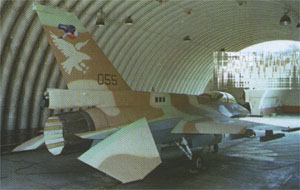
Ramat David Airbase Images and information placed above are from
Runway 09/278550 x 170 feet
|
||||||||||||||||||||||||||||||||||||||||||||||||||||||||||||||||||||||||||||||||||||||||||||||||||||||||||||||||||||||||||||||||||||||||||||||||||||||||||||||||||||||||||||||||||||||||||||||||||||||||||||||||||||||||||||||||||||
| Runway 09 | |
|---|---|
| Surface | ASPHALT |
| True Heading | 086.0 |
| Latitude | 32.665928 32° 39' 57.34" N |
| Longitude | 35.163658 035° 09' 49.17" E |
| Elevation | 131.0 feet 40 meters |
| Slope | 0.6° |
| Landing Distance | 8550 feet 2606 meters |
| Takeoff Distance | 8960 feet 2731 meters |
| Overrun Length | 410 feet 125 meters |
| Overrun Surface | ASPHALT |
| Lighting System | LIRL
V |
| Runway 27 | |
|---|---|
| Surface | ASPHALT |
| True Heading | 266.0 |
| Latitude | 32.667658 32° 40' 03.57" N |
| Longitude | 35.191361 035° 11' 28.90" E |
| Elevation | 185.0 feet 56 meters |
| Slope | -0.6° |
| Landing Distance | 8550 feet 2606 meters |
| Takeoff Distance | 9430 feet 2874 meters |
| Overrun Length | 880 feet 268 meters |
| Overrun Surface | ASPHALT |
| Lighting System | LIRL
V |
| Runway 11 | |
|---|---|
| Surface | ASPHALT |
| True Heading | 108.0 |
| Latitude | 32.662906 32° 39' 46.46" N |
| Longitude | 35.162686 035° 09' 45.67" E |
| Elevation | 128.0 feet 39 meters |
| Slope | 0.4° |
| Landing Distance | 7975 feet 2431 meters |
| Takeoff Distance | 8820 feet 2688 meters |
| Overrun Length | 845 feet 258 meters |
| Overrun Surface | ASPHALT |
| Lighting System | LIRL
V |
| Runway 29 | |
|---|---|
| Surface | ASPHALT |
| True Heading | 288.0 |
| Latitude | 32.656211 32° 39' 22.36" N |
| Longitude | 35.187356 035° 11' 14.48" E |
| Elevation | 158.0 feet 48 meters |
| Slope | -0.4° |
| Landing Distance | 7975 feet 2431 meters |
| Takeoff Distance | 8630 feet 2630 meters |
| Overrun Length | 655 feet 200 meters |
| Overrun Surface | ASPHALT |
| Lighting System | LIRL
V |
| Runway 15 | |
|---|---|
| Surface | ASPHALT |
| True Heading | 145.0 |
| Latitude | 32.675636 32° 40' 32.29" N |
| Longitude | 35.176939 035° 10' 36.98" E |
| Elevation | 164.0 feet 50 meters |
| Slope | 0.0° |
| Landing Distance | 7895 feet 2406 meters |
| Takeoff Distance | 7895 feet 2406 meters |
| Lighting System | LIRL
V |
| Runway 33 | |
|---|---|
| Surface | ASPHALT |
| True Heading | 325.0 |
| Latitude | 32.657961 32° 39' 28.66" N |
| Longitude | 35.191825 035° 11' 30.57" E |
| Elevation | 164.0 feet 50 meters |
| Slope | 0.0° |
| Landing Distance | 7895 feet 2406 meters |
| Takeoff Distance | 8410 feet 2563 meters |
| Overrun Length | 515 feet 157 meters |
| Overrun Surface | ASPHALT |
| Lighting System | LIRL
V |
The content above was published at Airports-Worldwide.com in 2005.
We don't guarantee the information is fresh and accurate. The data may be wrong or outdated.
For more up-to-date information please refer to other sources.

 |
|
Copyright 2004-2025 © by Airports-Worldwide.com, Vyshenskoho st. 36, Lviv 79010, Ukraine Legal Disclaimer |
 Ramat
David Military Air Base is located in the center of Northern
Israel, SE of Haifa, near Megiddo and bordered with the West Bank.
Ramat
David Military Air Base is located in the center of Northern
Israel, SE of Haifa, near Megiddo and bordered with the West Bank.