 |
 |
|
||||
|
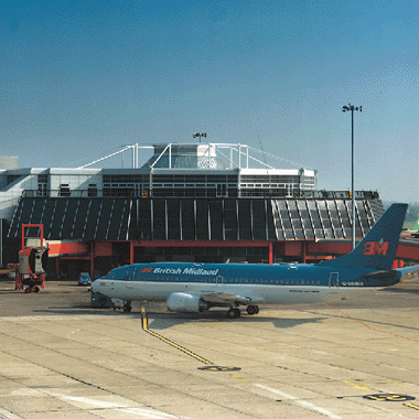
Airport Facts and Figures Dublin Airport enjoyed another record-breaking year with close to 15.9 million passengers through the airport in 2003. This continued growth was driven, to a significant extent, by the launch of 33 new routes and services from the Airport and the commencement of operations by 10 airlines new to Dublin. U.K.Traffic Passenger numbers between Dublin and the UK rose by 1% to nearly 8 million accounting for over half of Dublin's total traffic in 2002. European Traffic The European market provided the largest volume growth last year with more than 500,000 additional passengers, bringing the total to over 6.1 million. Transatlantic Traffic The transatlantic market rose by 27% to just over one million passengers. This growth was underpinned by a new US Airways service to Philadelphia and by the re-opening of the Aer Lingus service to Baltimore-Washington. Domestic Traffic The numbers travelling on domestic flights out of Dublin grew by 4% in 2003 to 676,000. Airfield Data: 3 RunwaysRunway 1: Heading 28/10, 2,637m (8,651ft), ICAO Cat. 3, Aircraft size max: B747 Runway 2: Heading 16/34, 2,073m (6,801ft), ICAO Cat. 3 Runway 3: Heading 11/29, 1,356m (4,448ft) Cargo Facilities: Bonded Warehouse, Transit Zone, EU Border Post, Mechanical Handling, Refrigerated Storage, Mortuary, Animal Quarantine, Fresh Meat Inspection, Health Officials, Dangerous Goods, Very Large/Heavy Cargo, Express/Courier Centre, 2 transit sheds 70,000 sq ft and 33,000 sq ft Customs Tel: +353 (0)1 808 0400 Op. Hours: 24 hours Cargo Handling Agents: Aer Lingus Cargo, Servisair (Dublin) Ltd Passenger Facilities: Bank, Restaurants, Bars, Duty Free Shop, Gift Shop, Car Rental Tel: +353 1 8141111 Fax: +353 (0)1 814 4364 E-mail: webmaster at dublinairport com E-mail: information at dublinairport com WWW: Dublin Airport Images and information placed above are from http://www.azworldairports.com/ http://www.omp.ie/Commercial/Dublin_Airport.htm We thank them for the data!
Runway 10/288652 x 148 feet
|
||||||||||||||||||||||||||||||||||||||||||||||||||||||||||||||||||||||||||||||||||||||||||||||||||||||||||||||||||||||||||||||||||||||||||||||||||||||||||||||||||||||||||||||||||||||||||||||||||||||||||||||||||||||||||||||||||||||||||||||||||||||||||||||||||||||||||||||||||||||||||||||||||||||||||||||||||||||||||||||||||||||||||||||||||||||||||||||
| Runway 10 | |
|---|---|
| Surface | CONCRETE. |
| True Heading | 095.0 |
| Latitude | 53.422431 53° 25' 20.75" N |
| Longitude | -6.290075 006° 17' 24.27" W |
| Elevation | 242.0 feet 74 meters |
| Slope | -0.5° |
| Landing Distance | 8652 feet 2637 meters |
| Takeoff Distance | 8652 feet 2637 meters |
| Lighting System | TDZL
CL HIRL A PAPI |
| Runway 28 | |
|---|---|
| Surface | CONCRETE. |
| True Heading | 275.0 |
| Latitude | 53.420261 53° 25' 12.94" N |
| Longitude | -6.250578 006° 15' 02.08" W |
| Elevation | 202.0 feet 62 meters |
| Slope | 0.5° |
| Landing Distance | 8652 feet 2637 meters |
| Takeoff Distance | 8652 feet 2637 meters |
| Lighting System | TDZL
CL HIRL A PAPI |
| Runway 11 | |
|---|---|
| Surface | ASPHALT |
| True Heading | 105.0 |
| Latitude | 53.436553 53° 26' 11.59" N |
| Longitude | -6.262269 006° 15' 44.17" W |
| Elevation | 217.0 feet 66 meters |
| Slope | 0.0° |
| Landing Distance | 4114 feet 1254 meters |
| Takeoff Distance | 4393 feet 1339 meters |
| Displaced Threshold Length | 279 feet 85 meters |
| Lighting System | HIRL
A4 PAPI |
| Runway 29 | |
|---|---|
| Surface | ASPHALT |
| True Heading | 285.0 |
| Latitude | 53.433442 53° 26' 00.39" N |
| Longitude | -6.242808 006° 14' 34.11" W |
| Elevation | 216.0 feet 66 meters |
| Slope | 0.0° |
| Landing Distance | 4393 feet 1339 meters |
| Takeoff Distance | 4393 feet 1339 meters |
| Lighting System | HIRL
A4 PAPI |
| Runway 16 | |
|---|---|
| Surface | ASPHALT |
| True Heading | 157.0 |
| Latitude | 53.436989 53° 26' 13.16" N |
| Longitude | -6.261978 006° 15' 43.12" W |
| Elevation | 217.0 feet 66 meters |
| Slope | -0.2° |
| Landing Distance | 6798 feet 2072 meters |
| Takeoff Distance | 6798 feet 2072 meters |
| Lighting System | HIRL
A1 PAPI |
| Runway 34 | |
|---|---|
| Surface | ASPHALT |
| True Heading | 337.0 |
| Latitude | 53.419906 53° 25' 11.66" N |
| Longitude | -6.249594 006° 14' 58.54" W |
| Elevation | 202.0 feet 62 meters |
| Slope | 0.2° |
| Landing Distance | 6798 feet 2072 meters |
| Takeoff Distance | 6798 feet 2072 meters |
| Lighting System | HIRL
A4 PAPI |
| DUBLIN | |||||
|---|---|---|---|---|---|
| Type | ID | Channel | Freq | Country | State |
| VOR-DME | DUB | 096X | 114.9 | Ireland | - |
| Latitude | Longitude | Airport |
| 53.499375 53° 29' 57.75" N |
-6.307108 006° 18' 25.59" W |
EIDW |
| RUSH | |||||
|---|---|---|---|---|---|
| Type | ID | Channel | Freq | Country | State |
| NDB | RSH | - | 326 | Ireland | - |
| Latitude | Longitude | Airport |
| 53.511861 53° 30' 42.70" N |
-6.110533 006° 06' 37.92" W |
EIDW |
| GORMANSTON | |||||
|---|---|---|---|---|---|
| Type | ID | Channel | Freq | Country | State |
| NDB-DME | GMN | 076X | 334 | Ireland | - |
| Latitude | Longitude | Airport |
| 53.648111 53° 38' 53.20" N |
-6.226669 006° 13' 36.01" W |
EIDW |
The content above was published at Airports-Worldwide.com in 2005.
We don't guarantee the information is fresh and accurate. The data may be wrong or outdated.
For more up-to-date information please refer to other sources.

 |
|
Copyright 2004-2025 © by Airports-Worldwide.com, Vyshenskoho st. 36, Lviv 79010, Ukraine Legal Disclaimer |
 Dublin airport is conveniently located just to the north of Dublin City Centre. It is situated near the M50 and M1 motorways. You can get to the airport by bus, taxi, or car. There are services from nearby train stations that operate a shuttle bus to Dublin Airport