|
 |
|
||||
|
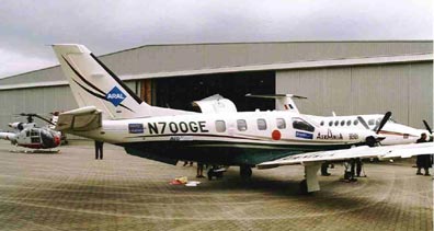
Images and information placed above are from http://www.iol.ie/~asire/photo.html We thank them for the data!
Runway 05/234800 x 150 feet
|
|||||||||||||||||||||||||||||||||||||||||||||||||||||||||||||||||||||||||||||||||||||||||||||||||||||||||||||||||||||||||||||||||||||||||||||||||||||||||||||||||||||||||||||||||||||||||||||||||||||||||||||||||||||||||||||||||||||
| Runway 05 | |
|---|---|
| Surface | ASPHALT |
| True Heading | 041.0 |
| Latitude | 53.293033 53° 17' 34.92" N |
| Longitude | -6.453536 006° 27' 12.73" W |
| Elevation | 319.0 feet 97 meters |
| Slope | -0.3° |
| Landing Distance | 4800 feet 1463 meters |
| Takeoff Distance | 4800 feet 1463 meters |
| Lighting System | HIRL |
| Runway 23 | |
|---|---|
| Surface | ASPHALT |
| True Heading | 221.0 |
| Latitude | 53.302997 53° 18' 10.79" N |
| Longitude | -6.439183 006° 26' 21.06" W |
| Elevation | 305.0 feet 93 meters |
| Slope | 0.3° |
| Landing Distance | 4800 feet 1463 meters |
| Takeoff Distance | 4800 feet 1463 meters |
| Lighting System | HIRL
BF V |
| Runway 11 | |
|---|---|
| Surface | ASPHALT |
| True Heading | 108.0 |
| Latitude | 53.306944 53° 18' 25.00" N |
| Longitude | -6.470278 006° 28' 13.00" W |
| Elevation | 284.0 feet 87 meters |
| Slope | 0.5° |
| Landing Distance | 6001 feet 1829 meters |
| Takeoff Distance | 6001 feet 1829 meters |
| Lighting System | HIRL
A2 |
| Runway 29 | |
|---|---|
| Surface | ASPHALT |
| True Heading | 288.0 |
| Latitude | 53.301961 53° 18' 07.06" N |
| Longitude | -6.444133 006° 26' 38.88" W |
| Elevation | 315.0 feet 96 meters |
| Slope | -0.5° |
| Landing Distance | 5400 feet 1646 meters |
| Takeoff Distance | 6001 feet 1829 meters |
| Displaced Threshold Length | 601 feet 183 meters |
| Lighting System | HIRL
A2 |
| BALDONNEL | |||||
|---|---|---|---|---|---|
| Type | ID | Channel | Freq | Country | State |
| VOR-DME | BAL | 105X | 115.8 | Ireland | - |
| Latitude | Longitude | Airport |
| 53.299894 53° 17' 59.62" N |
-6.447778 006° 26' 52.00" W |
EIME |
The content above was published at Airports-Worldwide.com in 2005.
We don't guarantee the information is fresh and accurate. The data may be wrong or outdated.
For more up-to-date information please refer to other sources.

 |
|
Copyright 2004-2025 © by Airports-Worldwide.com, Vyshenskoho st. 36, Lviv 79010, Ukraine Legal Disclaimer |