|
|
Ngurah Rai International Airport
Bandar Udara Internasional Ngurah Rai |
 |
| IATA: DPS – ICAO: WADD formerly WRRR |
| Summary |
| Airport type |
Public |
| Operator |
PT Angkasa Pura I |
| Location |
Denpasar, Bali, Indonesia |
| Hub for |
- Garuda Indonesia
- Indonesia AirAsia
- Merpati Nusantara Airlines
|
| Elevation AMSL |
14 ft / 4 m |
| Coordinates |
8°44′53″S 115°10′3″E / 8.74806°S 115.1675°E / -8.74806; 115.1675Coordinates: 8°44′53″S 115°10′3″E / 8.74806°S 115.1675°E / -8.74806; 115.1675 |
| Website |
www.ngurahrai-airport.co.id |
| Runways |
| Direction |
Length |
Surface |
| ft |
m |
| 09/27 |
9,842 |
3,000 |
Asphalt |
|
|
|
Asphalt |
Ngurah Rai International Airport (IATA: DPS, ICAO: WADD), also known as Denpasar International Airport, is located in southern Bali, 13 km south of Denpasar. It is named after I Gusti Ngurah Rai, an Indonesian National Hero who died in a puputan (fight to the death) against the Dutch at Marga during the Indonesian Revolution in 1946. Ngurah Rai is Indonesia's third-busiest international airport, after Jakarta's Soekarno-Hatta International Airport and Surabaya's Juanda International Airport. Location
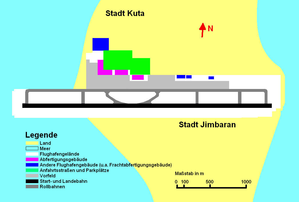
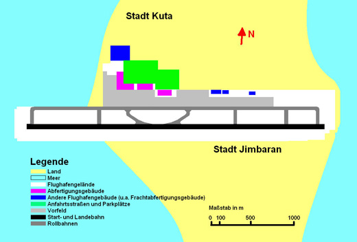
The airport is located is located in Tuban on the Island of Bali between Kuta and Jimbaran and is close to the tourist locations of southern Bali; the resort center of Kuta is 2.5 km north of the airport. The capital of Bali Denpasar is located nearby.
History
 | |
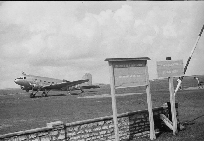
A Dutch DC-3 Dakota at Kuta airfield in 1949 |
When the airfield was established in 1931 at the narrowest point on the southern island of Bali, there are but a few huts short grass runway. North grounding in Tuban village graveyard in the south and vacant land. With that interpretation, with arrivals and departures over the ocean minimal noise even in those places. During the trip, the Japanese in Southeast Asia during the Second World War the airport was on February 19, 1942 in a healthy condition in the hands of the Japanese armed forces. The airport can be taken without a fight, because the people of Bali want to expel the Dutch and Japanese colonial authorities regarded as bad. There was no significant Japanese fighter squadron stationed in Denpasar, although it was in the field of tactical air Well located the distance to the Allied base in Surabaya and cities in northern Australia. However, the Japanese installed on the runway at the airport. After further expansion in 1947 was 1600 meters and a width of 45 meters. At the time the airport was still called Tuban Airport, named after a fishing village. 1959, the first international passengers will be greeted at the airport after the airport has parallel in the early 50's with the international standards contained in ICAO. To allow jets to land in Bali, starting in the West Country for the win. There, they wanted to extend the runway into the sea, because in the east end of the runway, a fishing village along the temple expansion impossible. Today, the machine must go first 750 meters above the actual bank before they turn and run. August 1, 1969 inaugurated the runway was extended by the then Indonesian President Suharto. Extension of the runway causing disruption of natural sand flow. See Special To meet the ever increasing number of passengers can be extended 1965-1969, the international terminal, which at this time to remove the national passenger. After construction work is now the foundation is named Bali's Ngurah Rai International Airport. I Gusti Ngurah Rai was a fighter for independence of Indonesia or Bali. 1978 was the commissioning of building a new international passenger. 2007 ACI announced that Denpasar airport with a 35.7% growth this year, three airports in the world's fastest growing - bigger in that category with an annual passenger volume of 5000000-1
Security
In 2005 the Transportation Security Administration of the United States of America determined that the airport was not meeting the security standards of the International Civil Aviation Administration, however this warning was lifted on 2007-10-11..
Proposed change
A new airport has been proposed to replace Ngurah Rai airport in Jembrana regency in western Bali. However in 2009-2011 a new hall of 100.000 sqm will be built and the existing hall of 56.000 sqm will be renovated.
Masterplan
Forecasts predict for the year 2010 eleven million passengers. Against this background, the operating company has already developed a master plan. This provides for the establishment of a new horseshoe-shaped building for 17 passenger aircraft in the east of the airport. In addition to today's runway to 3,600 meters will be extended, as currently Jumbos full complement of fuel at maximum takeoff weight is not the runway length is sufficient. It rejected an extension of ideas in an easterly direction, as for a road tunnel would be necessary. The local religion forbids the use of tunnels and bridges [6]. Perhaps a second runway is built. This would not be parallel to the present, but this cross. The master plan was, however, from the 12th before the bomb attacks October 2002 and 1 October 2005 in the Balinese town of Kuta created. The airport and Bali's economy, which are almost exclusively dependent on tourism suffer today under the enormous decline in tourists. The area surrounding the airport has no long-term large expansion options, so was the construction of a new airport discussed. In December 2008, the operating company announced that the expansion will begin in early 2009.
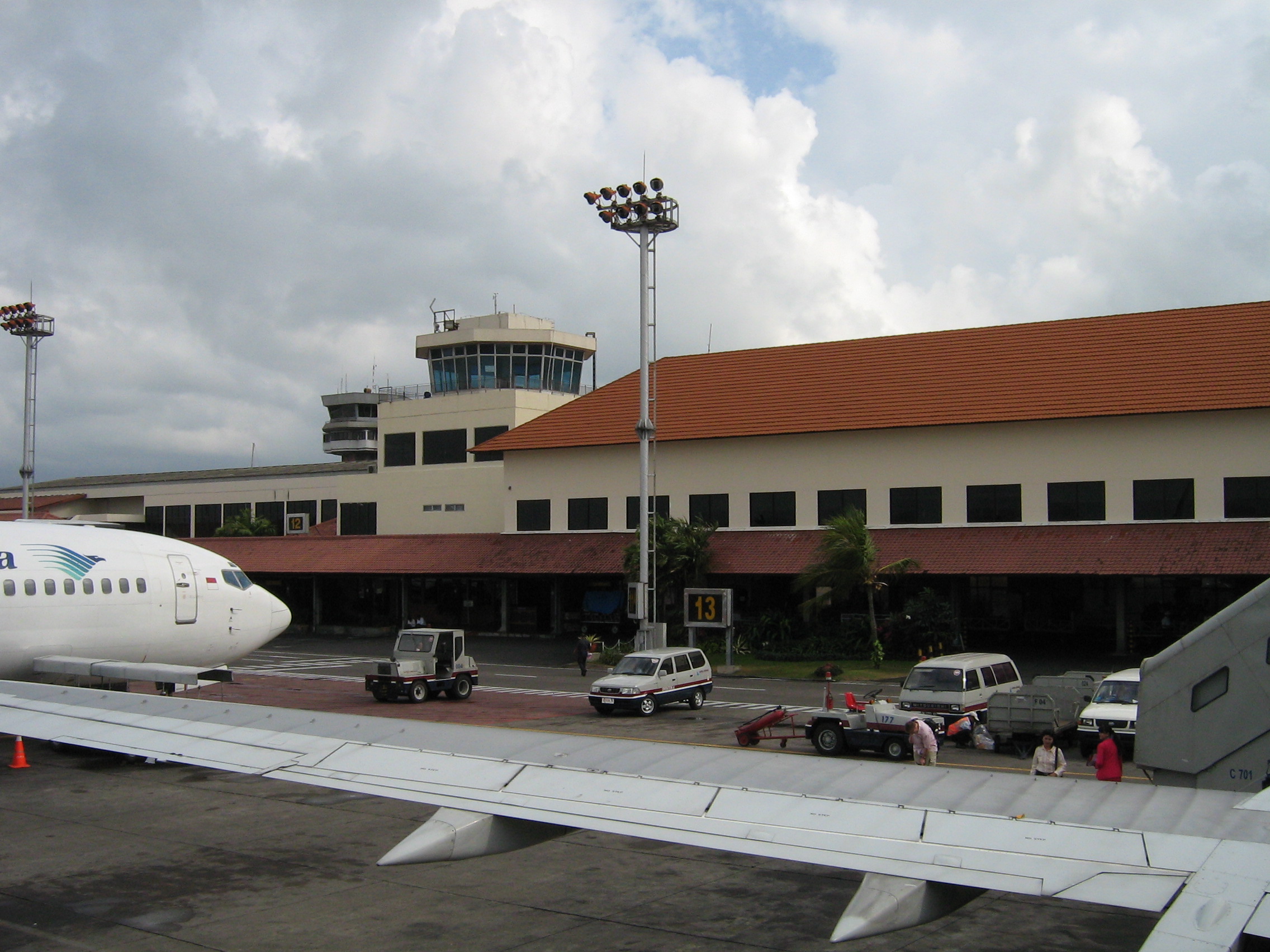
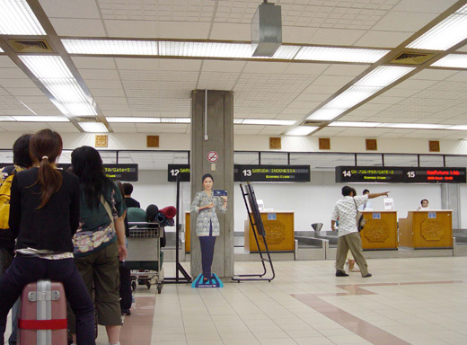
Terminals, airlines and destinations
The Domestic Terminal is located in the old building, while the International Terminal is located in the L shaped terminal. The airport has 17 gates: 3 in the Domestic Terminal, and 14 in the International Terminal. Eight of the international gates have aerobridges. The Domestic Terminal has 35 check in counters, and 2 baggage carousels.
- Domestic Arrival and Departure Terminal Area: 9.039 m²
- International Arrival and Departure Terminal Area: 28.630 m²
- The parking area is 38.358 m².
- The total terminal area is 265.60 Ha.
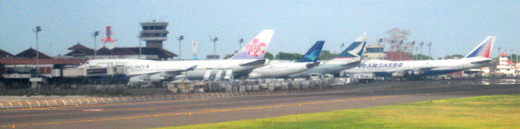 | |
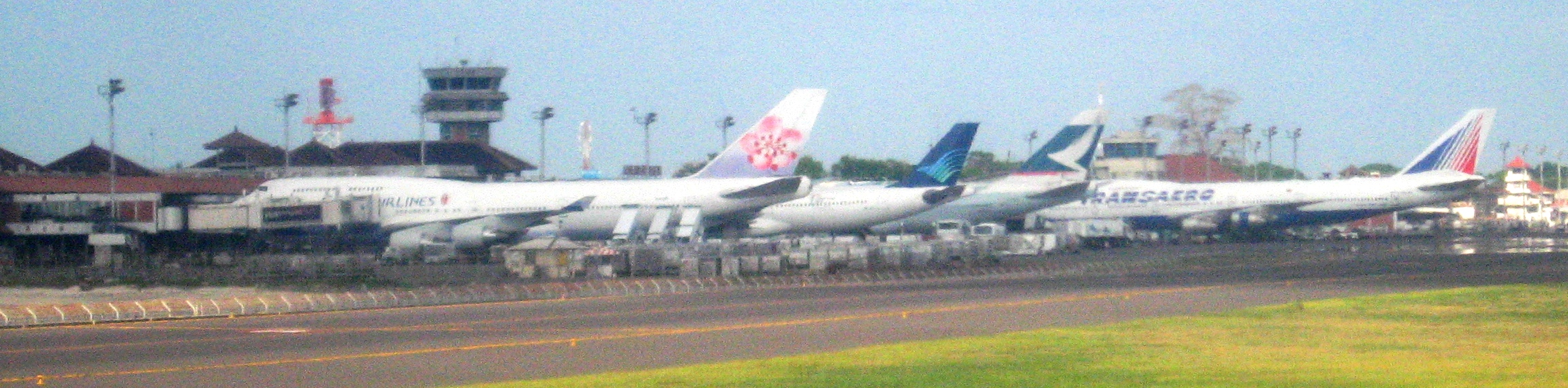
China Airlines, Garuda Indonesia, Cathay Pacific and Transaero parked at the airport |
 | |
International terminal opened in 1978 |
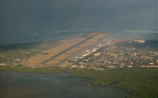 | |
Airport from the air (looking: Southwest) |
 | |
Domestic Terminal |
 | |
International terminal |
 | |
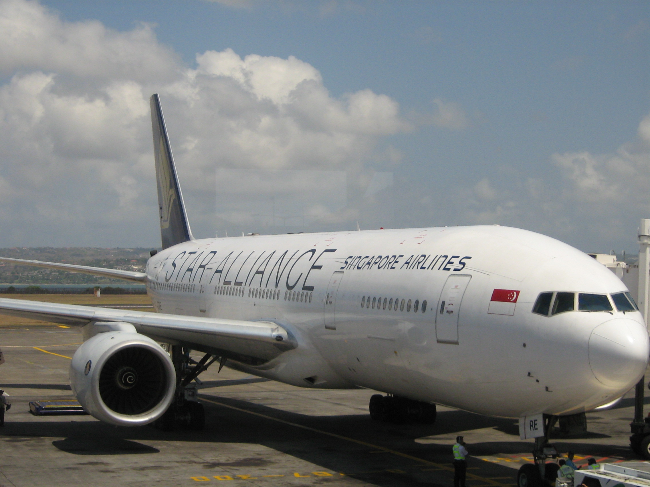
Singapore Airlines In Bali |
| Airlines |
Destinations |
Terminal |
| AirAsia |
Kuala Lumpur |
International |
| Batavia Air |
Jakarta, Labuan Bajo, Surabaya |
Domestic |
| Cathay Pacific |
Hong Kong |
International |
| China Airlines |
Kaohsiung [seasonal], Taipei-Taoyuan |
International |
| China Eastern Airlines |
Shanghai-Pudong |
International |
| EVA Air |
Taipei-Taoyuan |
International |
| Garuda Indonesia |
Jakarta, Makassar, Mataram, Surabaya, Yogyakarta |
Domestic |
| Garuda Indonesia |
Hong Kong, Kuala Lumpur, Melbourne, Nagoya-Centair, Osaka-Kansai, Perth, Seoul-Incheon, Shanghai-Pudong, Singapore, Sydney, Tokyo-Narita |
International |
| Garuda Indonesia operated by Citilink |
Jakarta |
Domestic |
| Hong Kong Express Airways |
Hong Kong |
International |
| Indonesia Air Asia |
Bandung, Jakarta |
Domestic |
| Indonesia AirAsia |
Kuala Lumpur, Perth, Singapore |
International |
| Indonesia Air Transport |
Mataram |
Domestic |
| Japan Airlines |
Osaka-Kansai [ends 1 October], Tokyo-Narita [ends 1 October] |
International |
| Jetstar Airways |
Brisbane, Darwin, Melbourne, Perth, Sydney |
International |
| KLM |
Amsterdam, Singapore |
International |
| Korean Air |
Seoul-Incheon |
International |
| Lion Air |
Jakarta, Kupang, Makassar, Manado, Mataram |
Domestic |
| Malaysia Airlines |
Kuala Lumpur |
International |
| Mandala Airlines |
Jakarta, Surabaya, Yogyakarta |
Domestic |
| Merpati Nusantara Airlines |
Bandung, Bima, Jakarta, Kupang, Mataram, Maumere, Merauke, Surabaya, Waikabubak, Waingapu |
Domestic |
| Merpati Nusantara Airlines |
Dili |
International |
| Pelita Air Service |
Ende, Kupang, Labuan Bajo, Waingapu |
Domestic |
| Qatar Airways |
Doha, Singapore |
International |
| Shanghai Airlines |
Shanghai-Pudong |
International |
| Shenzhen Airlines |
Guangzhou |
International |
| Singapore Airlines |
Singapore |
International |
| Skywest |
Broome [seasonal] , Port Hedland |
International |
| Sriwijaya Air |
Bandung, Benete/Sumbawa, Surabaya |
Domestic |
| Strategic Airlines |
Brisbane, Perth, Port Hedland, Townsville [begins 3 December] |
International |
| Thai AirAsia |
Bangkok-Suvarnabhumi |
International |
| Thai Airways International |
Bangkok-Suvarnabhumi |
International |
| Transaero |
Moscow-Domodedovo |
International |
| Travira Air |
Benete/Sumbawa |
Domestic |
| TransNusa Air Services |
Bima, Mataram |
Domestic |
| Trigana Air Service |
Mataram |
Domestic |
| Uni Air |
Kaohsiung |
International |
| Valuair |
Singapore |
International |
| Virgin Blue operated by Pacific Blue |
Adelaide, Brisbane, Melbourne, Perth, Sydney |
International |
| Wings Air |
Surabaya, Yogyakarta |
Domestic |
Cities with direct international airlinks to Ngurah Rai International AirportArrival and departure routes
In order to get the maximum number of takeoffs and landings per hour, aircraft are set up by air traffic control to approach from the west and depart to the east. Departing aircraft with destinations to the west of Bali will normally turn south after departure before resuming course.
Accidents and Incidents
- April 22, 1974: Pan Am Flight 812, a Boeing 707, crashed into a mountain while preparing for final approach. All 107 passengers and crew were killed.
- 5 October 1978, Douglas C-47A PK-NDI of Merpati Nusantara Airlines caught fire whilst parked and was destroyed.
- February 16, 1998: China Airlines Flight 676 took off from Ngurah Rai. Upon approach to Chiang Kai-shek International Airport in Taipei, Taiwan the aircraft crashed, killing everyone on board.
- March 12, 2009: Batavia Air serving the Surabaya-Kupang route had a minor engine problem. Ten passengers were injured after jumping out of the plane assuming that it was having engine trouble.
References
- Pringle, Robert (2004). Bali: Indonesia's Hindu Realm; A short history of. Short History of Asia Series. Allen & Unwin. ISBN 1-86508-863-3.
External links
- Ngurah Rai Airport Official Website-includes flight information
|