 |
|
| Tezpur Airport

Tezpur Air Force Station
|
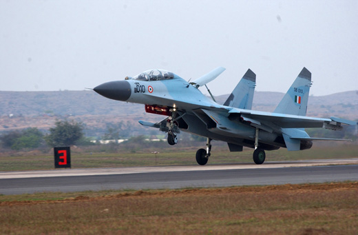 |
| IAF Sukhoi Su-30 combat aircraft |
| IATA: TEZ – ICAO: VETZ |
| Summary |
| Airport type |
Military/Public |
| Owner |
Airports Authority of India |
| Operator |
Indian Air Force |
| Location |
Tezpur |
| Elevation AMSL |
240 ft / 73 m |
| Coordinates |
26°42′44″N 092°47′14″E / 26.71222°N 92.78722°E / 26.71222; 92.78722Coordinates: 26°42′44″N 092°47′14″E / 26.71222°N 92.78722°E / 26.71222; 92.78722 |
| Runways |
| Direction |
Length |
Surface |
| ft |
m |
| 05/23 |
9,010 |
2,746 |
Asphalt |
Tezpur Airport (IATA: TEZ, ICAO: VETZ) is located in Tezpur in the state of Assam, India. It is also known as Salonibari Airport based on the village/township of Salonibari where it is located.
It is also a major Indian Air Force base, with Tezpur Air Force Station being the home of several Sukhoi Su-30 combat aircraft. The location of the aircraft bears great significance since it lies strategically between Bhutan, Tibet, China, Myanmar and Bangladesh. History
The airfield in Tezpur was constructed by the British Royal Indian Air Force during World War II in 1942. It was used by the United States Army Air Force Tenth Air Force as a B-24 Liberator heavy bomber base by the 7th Bombardment Group. After the war, it was subsequently developed into a full-fledged air force base in 1959. Since its inception, it has been one of the most active bases in the Northeast of India with a variety of fixed and rotary wing aircraft operating from here.
The first aircraft that flew at this base were Vampires and Toofani 101 reconnaissance squadron. In fact, in the last 25 years, it was home to the IAF MiG-21 fleet which was used extensively to train rookie pilots for the Indian Air Force. The aircraft continues to serve the air force, operating from other bases in the Northeast.
Airlines and destinations
| Airlines |
Destinations |
| Air India Regional |
Kolkata, Silchar |
The above content comes from Wikipedia and is published under free licenses – click here to read more.
| General Info
|
| Country |
India
|
| ICAO ID |
VETZ
|
| Time |
UTC+5:30
|
| Latitude |
26.709139
26° 42' 32.90" N
|
| Longitude |
92.784739
092° 47' 05.06" E
|
| Elevation |
240 feet
73 meters
|
| Type |
Military
|
| Magnetic Variation |
000° W (01/06)
|
| Operating Agency |
MILITARY
|
| Runways
|
| ID |
Dimensions |
Surface |
PCN |
ILS
|
| 05/23 |
9010 x 150 feet
2746 x 46 meters |
ASPHALT |
- |
NO
|
| Navaids
|
| Type |
ID |
Name |
Channel |
Freq |
Distance From Field |
Bearing From Navaid
|
| VOR-DME |
TEZ |
TEZPUR |
126X |
117.9 |
At Field |
-
|
| NDB |
TZ |
TEZPUR |
- |
208 |
At Field |
-
|
| Supplies/Equipment
|
| Fuel |
Jet A1, without icing nhibitor.
Unknown fuel type or whether there is any fuel.
|
The content above was published at Airports-Worldwide.com in 2010.
We don't guarantee the information is fresh and accurate. The data may be wrong or outdated.
For more up-to-date information please refer to other sources.
|
|


