|
|
Kanpur Airport
कानपुर हवाई अड्डा |
 |
| IATA: KNU – ICAO: VIKA |
| Summary |
| Airport type |
Partially Public |
| Owner |
Indian Air Force |
| Operator |
Airports Authority of India |
| Serves |
Kanpur, Unnao, Etawah, Kanpur Dehat, Hamirpur & Fatehpur in Uttar Pradesh |
| Location |
Kanpur, INDIA |
| Elevation AMSL |
410 ft / 124 m |
| Coordinates |
26°24′10″N 80°24′44″E / 26.40278°N 80.41222°E / 26.40278; 80.41222 |
| Runways |
| Direction |
Length |
Surface |
| ft |
m |
| 09/27 (common use) |
9,000 |
2,743 |
Concrete/Asphalt |
| 01/19 (not for civil use) |
|
|
|
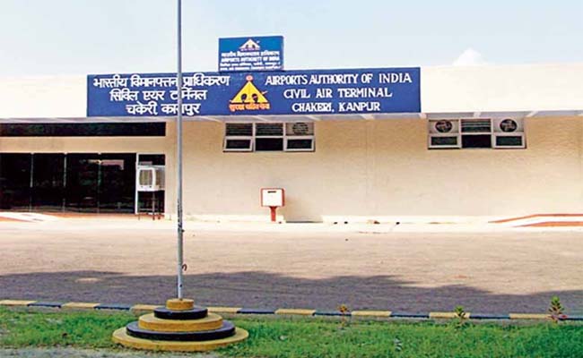
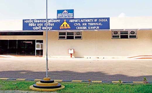
Kanpur Airport (IATA code KNU / ICAO code VIKA) is an airport that was originally designated for the Indian Air Force. In the 1970s, flights operated from this airport regularly to Delhi, Ahmedabad, Allahabad, Kolkata, Banglore, Chennai, Pune and Mumbai. For a long time, passengers of Kanpur, Unnao and Fatehpur have had to travel about 80 kilometers (50 miles) northwards to Amausi Airport in Lucknow, a 2–3 hours drive, for taking a flight to New Delhi, Mumbai or overseas.
Kanpur Airport has seen increased passenger traffic since September 2007 and the terminal has been recently renovated with a new fully air-conditioned passenger hall. Currently Air India is operating a daily flight IC7801/7802 on Delhi-Kanpur-Delhi Sector. More airlines have shown willingness to operate from Kanpur airport as over 50% passengers using Lucknow airport are from Kanpur. Indigo Airlines have recently concluded a passenger survey for starting flights on Mumbai-Kanpur, Kolkata-Kanpur and Bangalore-Kanpur sectors. The airlines may soon announce the launch of these flights. Preparation are in full swing to provide landing facility to A-320/B-737G air crafts by September 2010. Passenger waiting hall is being expanded to accommodate 200 passengers. The airport has been equipped with DVOR/DME navigation equipment and installation of CAT-1 ILS and Night Landing System for landing in low visibility conditions is in final stages and expected to be operational in October 2010. Civil Aviation Ministry's plan for a modern airport terminal on a 25 acre land at the cost of INR 800m is awaiting land transfer from Defense Ministry, which is likely to happen soon. Incidents and Accidents
On the morning of 18 May 1996, a 19 seater Archana Airways D-228 aircraft operating on the Delhi - Kanpur sector touched down late and could not be stopped within the available runway length, ending up beyond the runway. The aircraft hit the boundary wall of the airport and came to a halt. The aircraft sustained major damages, but there was no fire and no injury to persons on board the aircraft. This happened at the Civil airport located right at the heart of the city, which is closed now due to its runway (3000 ft) is unsuitable for civil aircraft and all civil flights now operate from Chakeri Airport. Kanpur has the distinction of having 3 airstrips located respectively at the Chakeri Airport (having 9000 ft runway), Civil Airport located at Kanpur Cantt., and the IIT Airstrip located at IIT Kanpur.
Facilities Available at Airport
- Book stall
- Snack Bar
- Tea Coffee bar
- Juice Counter
- PCO (STD/ISD)
- Drinking Water
- Free Baggage Trolleys
- Wheel chair
- Assistance to physically challenged / Aged / Infirm
- Rest room
- City bus service
- General taxi service
- Car rental service
Airlines and destinations
| Airlines |
Destinations |
| Indian Airlines |
Delhi, Allahabad |
Current Updates
- Preparations are on to commence flights for Mumbai and Kolkata by Dec 2010.
- Air India has upgraded their flight IC7801/IC7802 Delhi-Kanpur-Allahabad-Delhi operating on 42 seater ATR-42 to 70 seater CRJ-200 from September 22,2010.This has cut down the flight duration from 85 minutes to 50 minutes on Delhi-Kanpur sector.
- I.L.S.(Instrument landing system) has been installed at the Kanpur Airport and is scheduled to be tested by end of September 2010. The ILS/NLS will be available for landing of big planes 24 hours.
The above content comes from Wikipedia and is published under free licenses – click here to read more.
| General Info
|
| Country |
India
|
| ICAO ID |
VIKA
|
| Time |
UTC+5:30
|
| Latitude |
26.441444
26° 26' 29.20" N
|
| Longitude |
80.364864
080° 21' 53.51" E
|
| Elevation |
411 feet
125 meters
|
| Magnetic Variation |
000° E (02/06)
|
| Operating Agency |
CIVIL GOVERNMENT, (LANDING FEES AND DIPLOMATIC CLEARANCE MAY BE REQUIRED)
|
| Runways
|
| ID |
Dimensions |
Surface |
PCN |
ILS
|
| 10/28 |
3685 x 135 feet
1123 x 41 meters |
CONCRETE. |
- |
NO
|
| Remarks
|
| OPR HOURS |
Opr HO.
|
The content above was published at Airports-Worldwide.com in 2010.
We don't guarantee the information is fresh and accurate. The data may be wrong or outdated.
For more up-to-date information please refer to other sources.
|
|