 |
|
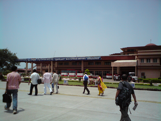
Biju Patnaik Airport
Bhubaneswar Airport |
 |
| IATA: BBI – ICAO: VEBS |
| Summary |
| Airport type |
Public |
| Operator |
Airports Authority of India |
| Serves |
Bhubaneswar |
| Elevation AMSL |
138 ft / 42 m |
| Coordinates |
20°14′40″N 085°49′04″E / 20.24444°N 85.81778°E / 20.24444; 85.81778 |
| Runways |
| Direction |
Length |
Surface |
| ft |
m |
| 05/23 |
4,524 |
1,379 |
Bituminous tar/Asphalt |
| 14/32 |
7,359 |
2,243 |
Bituminous tar/Asphalt |
Biju Patnaik Airport (IATA: BBI, ICAO: VEBS), also known as Bhubaneswar Airport, is situated in the city of Bhubaneswar, Orissa, India. It is currently the only major airport in Orissa. It is named after the former Chief Minister of Orissa Biju Patnaik, who was also a famed aviator and freedom fighter. Planned international airport
In keeping with the rapid pace of industrialization taking place in Orissa, the Airports Authority of India (AAI) has recently announced a plan for the construction of a new integrated international airport complex at Bhubaneswar by 2010. AAI will invest over US $50 million (Rs. 2.5 billion).
The state government of Orissa has provided 70 acres (280,000 m) for the expansion of the runway to 10,500 ft (3,200 m), to handle Boeing 747 aircraft. The runway extension is expected to be commissioned in September 2006. The new terminal building will follow a modular design, with glass glazing, aerobridges with glass walls, and an inline baggage x-ray. The expansion also includes building a parallel taxi track for the airport and enhancing cargo handling facilities that could handle up to 30 aircraft per hour. A commercial complex for multiplex, shopping complex, hotel and other commercial establishments under the public-private partnership (PPP) near the airport, to support 500 passengers at a time.
AAI will also set up a second major airport in the western region of Orissa, at Jharsuguda.
Airlines and destinations
| Airlines |
Destinations |
| Indian Airlines |
Chennai, Delhi, Mumbai |
| IndiGo |
Bangalore, Delhi, Hyderabad, Mumbai |
| jet Airways |
Kolkata |
| JetLite |
Kolkata |
| Kingfisher Airlines |
Bagdogra, Bangalore, Delhi, Guwahati, Kolkata, Mumbai |
The above content comes from Wikipedia and is published under free licenses – click here to read more.
| General Info
|
| Country |
India
|
| ICAO ID |
VEBS
|
| Time |
UTC+5:30
|
| Latitude |
20.244364
20° 14' 39.71" N
|
| Longitude |
85.817781
085° 49' 04.01" E
|
| Elevation |
138 feet
42 meters
|
| Type |
Civil
|
| Magnetic Variation |
000° W (01/06)
|
| Beacon |
Yes
|
| Operating Agency |
CIVIL GOVERNMENT, (LANDING FEES AND DIPLOMATIC CLEARANCE MAY BE REQUIRED)
|
| Operating Hours |
SEE REMARKS FOR OPERATING HOURS OR COMMUNICATIONS FOR POSSIBLE HOURS
|
| Communications
|
TWR
HS
|
125.15
|
| ATIS |
126.8
|
APP
HS
|
123.5
|
| Runways
|
| ID |
Dimensions |
Surface |
PCN |
ILS
|
| 05/23 |
4524 x 150 feet
1379 x 46 meters |
BITUMINOUS, TAR OR ASPHALT MIXED IN PLACE, OILED. |
028FCWT |
NO
|
| 14/32 |
7359 x 150 feet
2243 x 46 meters |
BITUMINOUS, TAR OR ASPHALT MIXED IN PLACE, OILED. |
030FCWT |
YES
|
| Navaids
|
| Type |
ID |
Name |
Channel |
Freq |
Distance From Field |
Bearing From Navaid
|
| VOR-DME |
BBS |
BHUBANESHWAR |
082X |
113.5 |
At Field |
-
|
| NDB |
BS |
BHUBANESHWAR |
- |
302 |
At Field |
-
|
| Supplies/Equipment
|
| Fuel |
Jet A1, without icing nhibitor.
100/130 MIL Spec, low lead, aviation gasoline (BLUE)
|
| Remarks
|
| FUEL |
(NC-100LL, A1)
|
| LGT |
Based on ILS configuration est Rwy 14 apch lgt.
|
| OPR HOURS |
Opr HO, OT O/R 1 hr PN.
|
The content above was published at Airports-Worldwide.com in 2010.
We don't guarantee the information is fresh and accurate. The data may be wrong or outdated.
For more up-to-date information please refer to other sources.
|
|


