|
|
Juan Manuel Galvez Intl Airport |
Juan Manuel Gálvez International Airport
Aeropuerto Internacional Juan Manuel Gálvez
Roatán International Airport
Aeropuerto de Roatán |
 |
IATA: RTB – ICAO: MHRO
+
Juan Manuel Gálvez Intl
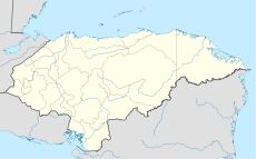
Location of airport in Honduras
|
| Summary |
| Airport type |
Public |
| Operator |
InterAirports |
| Location |
Roatán, Honduras |
| Elevation AMSL |
18 ft / 5 m |
| Coordinates |
16°19′00″N 086°31′22″W / 16.3166667°N 86.52278°W / 16.3166667; -86.52278 |
| Runways |
| Direction |
Length |
Surface |
| m |
ft |
| 07/25 |
2,240 |
7,349 |
Asphalt |
| Source: DAFIF |
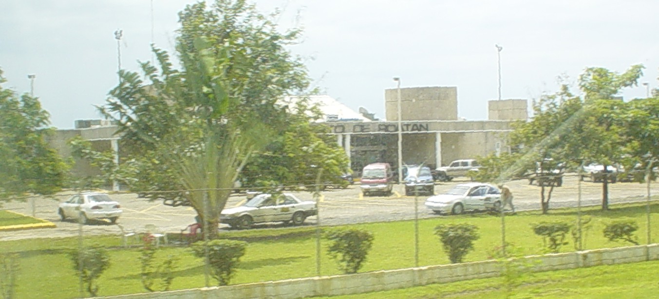
Juan Manuel Gálvez International Airport (Spanish: Aeropuerto Internacional Juan Manuel Gálvez) (IATA: RTB, ICAO: MHRO) is an airport located on the island of Roatán in the Bay Islands Department in Honduras. It serves national and international air traffic of the island. The airport is named for Juan Manuel Gálvez the former president of Honduras. It is also known as Roatán International Airport. Facilities
The airport resides at an elevation of 18 feet (5 m) above mean sea level. It has one runway designated 07/25 with an asphalt surface measuring 2,240 by 45 metres (7,349 × 148 ft).
Airlines and destinations
| Airlines |
Destinations |
| Aerolíneas Sosa |
La Ceiba, Tegucigalpa, San Pedro Sula |
| Blue Panorama Airlines |
Milan-Malpensa |
| Continental Airlines |
Houston-Intercontinental, Newark [seasonal] |
| Delta Air Lines |
Atlanta |
| TACA by Isleña Airlines |
La Ceiba, San Pedro Sula, Tegucigalpa |
| Sunwing Airlines |
Montreal-Trudeau, Ottawa, Toronto-Pearson [All Seasonal] |
| TACA |
Houston-Intercontinental, Miami, San Pedro Sula, San Salvador |
Accidents and incidents
- On 18 March 1990, Douglas DC-3A HR-SAZ of SAHSA overran the runway on landing and ended up in the sea. The aircraft, performing a domestic scheduled passenger service, was damaged beyond repair but all 32 people on board escaped.
The above content comes from Wikipedia and is published under free licenses – click here to read more.
| General Info
|
| Country |
Honduras
|
| ICAO ID |
MHRO
|
| Time |
UTC-6
|
| Latitude |
16.316814
16° 19' 00.53" N
|
| Longitude |
-86.522961
086° 31' 22.66" W
|
| Elevation |
18 feet
5 meters
|
| Type |
Civil
|
| Magnetic Variation |
000° E (01/06)
|
| Beacon |
Yes
|
| Operating Agency |
CIVIL GOVERNMENT, (LANDING FEES AND DIPLOMATIC CLEARANCE MAY BE REQUIRED)
|
| Alternate Name |
ROATAN INTL
|
| Near City |
ROATAN
|
| Island Group |
Roatan I
|
| Operating Hours |
SEE REMARKS FOR OPERATING HOURS OR COMMUNICATIONS FOR POSSIBLE HOURS
|
| Communications
|
| ROATAN TWR |
118.1
|
| GND |
121.6
|
| Runways
|
| ID |
Dimensions |
Surface |
PCN |
ILS
|
| 07/25 |
7349 x 148 feet
2240 x 45 meters |
ASPHALT |
080FAWU |
NO
|
| Navaids
|
| Type |
ID |
Name |
Channel |
Freq |
Distance From Field |
Bearing From Navaid
|
| VOR-DME |
ROA |
ROATAN |
085X |
113.8 |
At Field |
-
|
| NDB |
ROA |
ROATAN |
- |
301 |
At Field |
-
|
| Supplies/Equipment
|
| Fuel |
Unknown fuel type or whether there is any fuel.
|
| Remarks
|
| FUEL |
A1 (Avbl 1200-2400Z, Petronor C504-552-9607, after hrs 2 hr PN C504-995-1285, C504-995-4938 emerg) (NC-100LL)
|
| LGT |
PAPI Rwy 07 GS 4.5 .
|
| OPR HOURS |
Opr 1200-0200Z.
|
| RSTD |
Jet acft must dep 35 min prior to SS.
|
The content above was published at Airports-Worldwide.com in 2010.
We don't guarantee the information is fresh and accurate. The data may be wrong or outdated.
For more up-to-date information please refer to other sources.
|
|