|
|
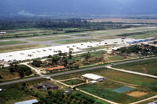
Golosón International Airport
Aeropuerto Internacional Golosón
La Ceiba Airport
Hector C. Moncada Air Base |
 |
| IATA: LCE – ICAO: MHLC
Location of airport in Honduras
|
| Summary |
| Airport type |
Public / Military |
| Operator |
InterAirports |
| Location |
La Ceiba, Honduras |
| Elevation AMSL |
49 ft / 15 m |
| Coordinates |
15°44′32″N 086°51′10″W / 15.74222°N 86.85278°W / 15.74222; -86.85278 |
| Runways |
| Direction |
Length |
Surface |
| m |
ft |
| 07/25 |
3,010 |
9,875 |
Asphalt |
| Source: DAFIF |
Golosón International Airport (Spanish: Aeropuerto Internacional Golosón) (IATA: LCE, ICAO: MHLC) is an airport located on the western side of the city of La Ceiba, in the Atlántida Department on the north coast of Honduras. It is also known as La Ceiba Airport (Aeropuerto de La Ceiba) and Hector C. Moncada Air Base (Base Aérea Hector C. Moncada). Facilities
The airport resides at an elevation of 49 feet (15 m) above mean sea level. It has one runway designated 07/25 with an asphalt surface measuring 3,010 by 45 metres (9,875 × 148 ft).
Airlines and destinations
| Airlines |
Destinations |
| Aerocaribe de Honduras |
Puerto Lempira, Roatan, Utila |
| Aerolíneas Sosa |
Brus Laguna, Guanaja, Puerto Lempira, Roatan, San Pedro Sula, Tegucigalpa, Utila pepa |
| Aviac |
Puerto Lempira, Tegucigalpa, Trujillo |
| CanJet |
Montreal-Trudeau [seasonal] |
| Cayman Airways |
Grand Cayman |
| Central American Airways |
Tegucigalpa, San Pedro Sula, Roatan |
| Lanhsa |
Roatan, Guanaja, San Pedro Sula |
| TACA by Isleña Airlines |
Roatan, San Pedro Sula, Tegucigalpa |
 | |
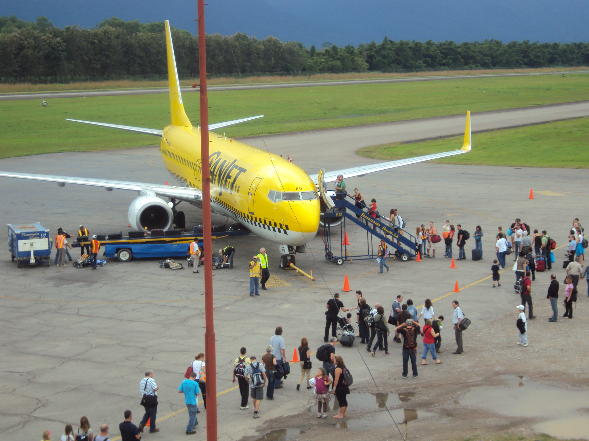
A Canjet Boeing 737-800 at Golosón, 2010. |
Future Airline and Destination
| Airlines |
Destinations |
| Rollins Air |
Roatan, Guanaja, Utila, San Pedro Sula, Puerto Lempira, Tegucigalpa, Grand Cayman, Cancun, Managua(via TGU), Havana(via TGU), Madrid (via RTB), Milan(Via RTB-MAD) |
Cargo airlines
| Airlines |
Destinations |
| DHL Aero Expreso |
Miami [seasonal] |
The above content comes from Wikipedia and is published under free licenses – click here to read more.
| General Info
|
| Country |
Honduras
|
| ICAO ID |
MHLC
|
| Time |
UTC-6
|
| Latitude |
15.742481
15° 44' 32.93" N
|
| Longitude |
-86.853036
086° 51' 10.93" W
|
| Elevation |
49 feet
15 meters
|
| Type |
Joint (Civil and Military)
|
| Magnetic Variation |
000° E (01/06)
|
| Beacon |
Yes
|
| Operating Agency |
MILITARY - CIVIL JOINT USE AIRPORT
|
| Alternate Name |
HECTOR C MONCADA AIR BASE
|
| Near City |
La Ceiba
|
| Operating Hours |
SEE REMARKS FOR OPERATING HOURS OR COMMUNICATIONS FOR POSSIBLE HOURS
|
| International Clearance Status |
Airport of Entry
|
| Communications
|
| TWR |
118.5
|
| GOLOSON RDO |
128.9
|
| GND |
121.9
|
| Runways
|
| ID |
Dimensions |
Surface |
PCN |
ILS
|
| 07/25 |
9875 x 147 feet
3010 x 45 meters |
ASPHALT |
070FBXT |
NO
|
| Navaids
|
| Type |
ID |
Name |
Channel |
Freq |
Distance From Field |
Bearing From Navaid
|
| VOR-DME |
BTO |
BONITO |
082X |
113.5 |
At Field |
-
|
| NDB-DME |
LCE |
LA CEIBA |
054X |
227 |
2.2 NM |
082.7
|
| Supplies/Equipment
|
| Fuel |
Jet A1, without icing nhibitor.
100/130 MIL Spec, low lead, aviation gasoline (BLUE)
|
| Remarks
|
| CAUTION |
Apch Rwy 25 not recommended due to hi terrain fr about 7000' to 2000' prior to rwy thld.
|
| FUEL |
A1 (Avbl 1100-0000Z, Petrolera Del Norte, C504-995-4938. Aftr hrs 30 min PN C504-991-6214, C504-995-4489) (NC-100LL)
|
| OPR HOURS |
Opr 1200-0400Z, OT PPR Honduran AF.
|
| RSTD |
Ovft mil ramp NW of rwy proh.
|
| TFC PAT |
VFR alt 1000'.
|
The content above was published at Airports-Worldwide.com in 2010.
We don't guarantee the information is fresh and accurate. The data may be wrong or outdated.
For more up-to-date information please refer to other sources.
|
|