 |
 |
|
||||
|
Distance and Direction from city: 9 NM North from city. Tel : +30 27360 38395-8
Telephone Directory Air traffic statistics 2000
WEB: http://www.hcaa-eleng.gr/kithira.htm Images and information placed above are from
Runway 02/204794 x 98 feet
|
||||||||||||||||||||||||||||||||||||||||||||||||||||||||||||||||||||||||||||||||||||||||||||||||||||||||||||||||||||||||||||||||||||||||||||||||||||||||||||||||||||||||||||||||||||||||||||||||||||||||||||||
| Runway 02 | |
|---|---|
| Surface | ASPHALT |
| True Heading | 026.0 |
| Latitude | 36.268111 36° 16' 05.20" N |
| Longitude | 23.013200 023° 00' 47.52" E |
| Elevation | 1044.8 feet 318 meters |
| Slope | 0.0° |
| Landing Distance | 4794 feet 1461 meters |
| Takeoff Distance | 4925 feet 1501 meters |
| Overrun Length | 131 feet 40 meters |
| Overrun Surface | ASPHALT |
| Lighting System | MIRL
PAPI |
| Runway 20 | |
|---|---|
| Surface | ASPHALT |
| True Heading | 206.0 |
| Latitude | 36.279967 36° 16' 47.88" N |
| Longitude | 23.020278 023° 01' 13.00" E |
| Elevation | 1042.9 feet 318 meters |
| Slope | 0.0° |
| Landing Distance | 4794 feet 1461 meters |
| Takeoff Distance | 4994 feet 1522 meters |
| Overrun Length | 200 feet 61 meters |
| Overrun Surface | ASPHALT |
| Lighting System | MIRL
PAPI |
| KITHIRA | |||||
|---|---|---|---|---|---|
| Type | ID | Channel | Freq | Country | State |
| TACAN | KTR | 031X | - | Greece | - |
| Latitude | Longitude | Airport |
| 36.302500 36° 18' 09.00" N |
22.951111 022° 57' 04.00" E |
LGKC |
| KITHIRA | |||||
|---|---|---|---|---|---|
| Type | ID | Channel | Freq | Country | State |
| NDB | KIT | - | 372 | Greece | - |
| Latitude | Longitude | Airport |
| 36.276467 36° 16' 35.28" N |
23.015208 023° 00' 54.75" E |
LGKC |
The content above was published at Airports-Worldwide.com in 2005.
We don't guarantee the information is fresh and accurate. The data may be wrong or outdated.
For more up-to-date information please refer to other sources.

 |
|
Copyright 2004-2024 © by Airports-Worldwide.com, Vyshenskoho st. 36, Lviv 79010, Ukraine Legal Disclaimer |
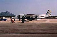 Kithira
Island National Airport
Kithira
Island National Airport 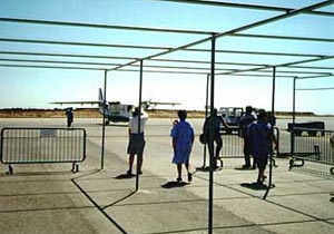 Postal
Address
Postal
Address