 |
|
Moorea Airport
Aéroport de Moorea
Moorea Temae Airport |
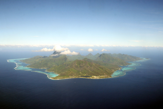 |
| View on approach to Moorea Airport |
IATA: MOZ – ICAO: NTTM
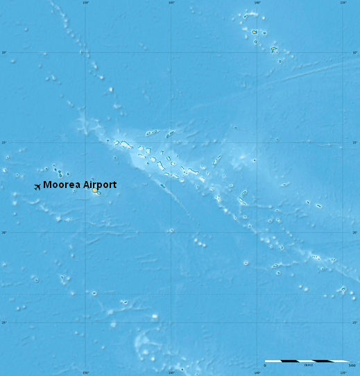 Location of airport in French Polynesia
|
| Summary |
| Airport type |
Public |
| Operator |
SETIL Aéroports |
| Serves |
Moorea, French Polynesia |
| Elevation AMSL |
16 ft / 5 m |
| Coordinates |
17°29′22″S 149°45′44″W / 17.48944°S 149.76222°W / -17.48944; -149.76222 |
| Runways |
| Direction |
Length |
Surface |
| m |
ft |
| 12/30 |
1,237 |
4,058 |
Asphalt |
| Sources: French AIP, UAF, DAFIF |
Moorea Airport (French: Aéroport de Moorea) (IATA: MOZ, ICAO: NTTM) is an airport serving the island of Moorea in French Polynesia. It is also known as Temae Airport or Moorea Temae Airport for its location near the village of Temae in northeastern Moorea. The airport is located 7.5 km (4.0 NM) northeast of Afareitu, the island's main village. It is also 15 km (8.1 NM) west of the island of Tahiti. The airport opened on October 6, 1967. History
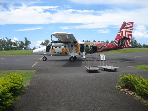 | |
Air Moorea aircraft at Moorea Airport |
- 27 March 1967: Construction of the runway at Moorea‑Temae.
- 6 October 1967: Opening of the Temae airfield.
- 1977: The Moorea-Temae aerodrome is transferred to the SETIL - Société d'Équipement de Tahiti et des Iles (Equipment Company of Tahiti and the Islands).
- 1982: Construction of the existing terminal and adding additional parking spaces.
- 1987: Lengthening the runway to accommodate ATR 42.
- 1990: Construction of a new control tower.
- 2003: Work and upgrading to accommodate ATR 72.
Facilities
The airport resides at an elevation of 16 feet (5 m) above mean sea level. It has one runway designated 12/30 with an asphalt surface measuring 1,237 by 30 metres (4,058 × 98 ft).
Airlines and destinations
| Airlines |
Destinations |
| Air Tahiti |
Bora Bora, Huahine, Papeete, Raiatea Island |
Annual statistics
Annual statistics for Moorea Airport:
|
2005 |
2006 |
2007 |
2008 |
2009 |
| Passengers |
221,888 |
228,813 |
193,033 |
135,144 |
119,602 |
| Cargo (tonnes) |
25 |
30 |
35 |
36 |
32 |
| Aircraft movements |
23,794 |
23 602 |
18,975 |
16,092 |
14,360 |
The above content comes from Wikipedia and is published under free licenses – click here to read more.
| General Info
|
| Country |
French Polynesia
|
| ICAO ID |
NTTM
|
| Time |
UTC-10
|
| Latitude |
-17.489972
17° 29' 23.90" S
|
| Longitude |
-149.761869
149° 45' 42.73" W
|
| Elevation |
9 feet
3 meters
|
| Magnetic Variation |
012° E (01/06)
|
| Operating Agency |
CIVIL GOVERNMENT, (LANDING FEES AND DIPLOMATIC CLEARANCE MAY BE REQUIRED)
|
| Near City |
Temae
|
| Island Group |
Society I
|
| Operating Hours |
SEE REMARKS FOR OPERATING HOURS OR COMMUNICATIONS FOR POSSIBLE HOURS
|
| Communications
|
| TAHITI TWR |
118.1
|
| TAHITI |
128.8
|
| TAHITI APP |
121.3
|
| Runways
|
| ID |
Dimensions |
Surface |
PCN |
ILS
|
| 12/30 |
3871 x 66 feet
1180 x 20 meters |
ASPHALT |
025FAYT |
NO
|
| Navaids
|
| Type |
ID |
Name |
Channel |
Freq |
Distance From Field |
Bearing From Navaid
|
| NDB |
MO |
MOOREA |
- |
377.5 |
At Field |
-
|
| Remarks
|
| CAUTION |
Very strong turb due to wind from S or SW. BASH
|
| LGT |
PAPI Rwy 12 MEHT 49'; Rwy 30, GS 4.0 .
|
| MISC |
Rain fr Nov to Mar.
|
| OPR HOURS |
Opr HX.
|
| RSTD |
180 turns rwy ends only.
|
The content above was published at Airports-Worldwide.com in 2020.
We don't guarantee the information is fresh and accurate. The data may be wrong or outdated.
For more up-to-date information please refer to other sources.
|
|


