 |
 |
|
||||
|
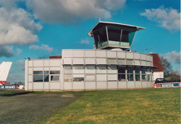
Images and information placed above are from http://www.kolding.dk/koldingair/0020166.asp We thank them for the data!
Runway 01/193301 x 75 feet
|
|||||||||||||||||||||||||||||||||||||||||||||||||||||||||||||||||||||||||||||||||||||||||||||||||||||||||||||||||||||||||||||||||||||||||||||||||||||||||||||||||||||||||||||||||||||||
| Runway 01 | |
|---|---|
| Surface | ASPHALT |
| True Heading | 018.0 |
| Latitude | 55.431131 55° 25' 52.07" N |
| Longitude | 9.328053 009° 19' 40.99" E |
| Elevation | 129.0 feet 39 meters |
| Slope | 0.4° |
| Landing Distance | 3301 feet 1006 meters |
| Takeoff Distance | 3301 feet 1006 meters |
| Lighting System | HIRL
M PAPI |
| Runway 19 | |
|---|---|
| Surface | ASPHALT |
| True Heading | 198.0 |
| Latitude | 55.439744 55° 26' 23.08" N |
| Longitude | 9.332858 009° 19' 58.29" E |
| Elevation | 143.0 feet 44 meters |
| Slope | -0.4° |
| Landing Distance | 3203 feet 976 meters |
| Takeoff Distance | 3301 feet 1006 meters |
| Displaced Threshold Length | 98 feet 30 meters |
| Lighting System | HIRL
M PAPI |
| Runway 08 | |
|---|---|
| Surface | GRASS OR EARTH NOT GRADED OR ROLLED. |
| True Heading | 077.0 |
| Latitude | 55.435558 55° 26' 08.01" N |
| Longitude | 9.325494 009° 19' 31.78" E |
| Elevation | 142.0 feet 43 meters |
| Landing Distance | 2310 feet 704 meters |
| Takeoff Distance | 2310 feet 704 meters |
| Runway 26 | |
|---|---|
| Surface | GRASS OR EARTH NOT GRADED OR ROLLED. |
| True Heading | 257.0 |
| Latitude | 55.437003 55° 26' 13.21" N |
| Longitude | 9.336325 009° 20' 10.77" E |
| Elevation | 141.0 feet 43 meters |
| Landing Distance | 2310 feet 704 meters |
| Takeoff Distance | 2310 feet 704 meters |
The content above was published at Airports-Worldwide.com in 2005.
We don't guarantee the information is fresh and accurate. The data may be wrong or outdated.
For more up-to-date information please refer to other sources.

 |
|
Copyright 2004-2024 © by Airports-Worldwide.com, Vyshenskoho st. 36, Lviv 79010, Ukraine Legal Disclaimer |
 Lufthavnen ejes af Kolding, Vamdrup og Lunderskov kommuner i forening.