 |
|
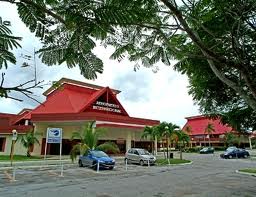
Ignacio Agramonte Intl Airport |
| Ignacio Agramonte International Airport |
IATA: CMW – ICAO: MUCM
|
| Summary |
| Airport type |
Public |
| Operator |
ECASA |
| Location |
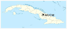
Camaguey |
| Elevation AMSL |
413 ft / 126 m |
| Coordinates |
21°25′13″N 77°50′50″W / 21.42028°N 77.84722°W / 21.42028; -77.84722Coordinates: 21°25′13″N 77°50′50″W / 21.42028°N 77.84722°W / 21.42028; -77.84722 |
| Runways |
| Direction |
Length |
Surface |
| ft |
m |
| 07/25 |
9,843 |
3,000 |
Asphalt |
Ignacio Agramonte International Airport (IATA: CMW, ICAO: MUCM) is an international airport in the central province of Camaguey, Cuba. It serves the cities of Camaguey and Santa Lucia. Airlines and destinations
| Airlines |
Destinations |
| Aerosur |
Miami |
| Air Transat |
Montréal-Trudeau, Toronto-Pearson [seasonal] |
| American Airlines |
Miami |
| American Eagle |
Miami |
| CanJet |
Montréal-Trudeau [seasonal], Toronto-Pearson |
| Cubana de Aviación |
Havana, Montréal-Trudeau, Toronto-Pearson |
| Sky King |
Miami |
| Sunwing Airlines |
Bagotville, Montréal-Trudeau, Quebec City, Toronto-Pearson, Winnipeg |
Note: All flights to the United States are operated as scheduled Special Authority Charters
World War II
During World War II, the airport was used by the United States Army Air Force Sixth Air Force from 1942 until 1944. The 25th Bombardment Group 417th Bombardment Squadron flew B-18 Bolo bombers from the airfield, known as Camaguey Air Base, from 13 April 1942 though August 1943. The squadron flew antisubmarine missions over the northern Caribbean. The base was also used for air-sea rescue missions by the 1st Rescue Squadron.
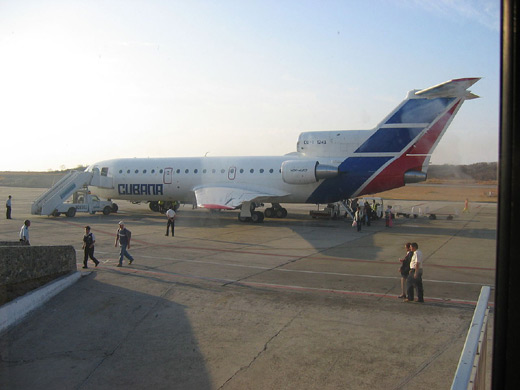
Avión de la Aerocubana de aviación en la plataforma del aeropuerto
Click to enlarge
The above content comes from Wikipedia and is published under free licenses – click here to read more.
| General Info
|
| Country |
Cuba
|
| ICAO ID |
MUCM
|
| Time |
UTC-5(-4DT)
|
| Latitude |
21.420428
21° 25' 13.54" N
|
| Longitude |
-77.847433
077° 50' 50.76" W
|
| Elevation |
413 feet
126 meters
|
| Type |
Civil
|
| Magnetic Variation |
006° W (08/06)
|
| Beacon |
Yes
|
| Operating Agency |
CIVIL GOVERNMENT, (LANDING FEES AND DIPLOMATIC CLEARANCE MAY BE REQUIRED)
|
| Near City |
Camaguey
|
| Operating Hours |
SEE REMARKS FOR OPERATING HOURS OR COMMUNICATIONS FOR POSSIBLE HOURS
|
| Daylight Saving Time |
Last Sunday in March to last Sunday in October
|
| Communications
|
| AGRAMONTE TWR |
118.5
|
| CAMAGUEY APP |
121.3
|
| CAMAGUEY RDO |
126.9
3407
5562
6673
8876
|
| Runways
|
| ID |
Dimensions |
Surface |
PCN |
ILS
|
| 07/25 |
9843 x 148 feet
3000 x 45 meters |
ASPHALT |
057FBXT |
NO
|
| Navaids
|
| Type |
ID |
Name |
Channel |
Freq |
Distance From Field |
Bearing From Navaid
|
| VOR-DME |
UCM |
CAMAGUEY |
088X |
114.1 |
2.8 NM |
255.0
|
| NDB |
UCM |
CAMAGUEY |
- |
370 |
4.9 NM |
074.7
|
| Supplies/Equipment
|
| Fuel |
Jet A1, without icing nhibitor.
100/130 MIL Spec, low lead, aviation gasoline (BLUE)
Unknown fuel type or whether there is any fuel.
|
| Remarks
|
| CAUTION |
Bird haz.
|
| CSTMS/IMG |
1200-0500Z++
|
| FUEL |
Avbl 1200-0500Z++, OT 48hr PN. (NC-100LL, A1)
|
| RSTD |
Acft AUW25 or greater rstd to turning around at rwy ends.
|
The content above was published at Airports-Worldwide.com in 2010.
We don't guarantee the information is fresh and accurate. The data may be wrong or outdated.
For more up-to-date information please refer to other sources.
|
|


