|
|
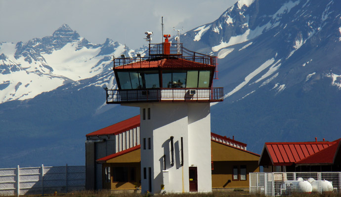
Teniente Julio Gallardo Airport |
Teniente Julio Gallardo Airport (Spanish: Aeródromo Teniente Julio Gallardo), (IATA: PNT, ICAO: SCNT) is an airport serving Puerto Natales, a city in the Magallanes Region of Chile. The airport is 7 kilometres (4.3 mi) north-northwest of Puerto Natales, which is on the Admiral Montt Gulf (es), a long fjord that reaches inland close to the border with Argentina. The airport is 12 kilometres (7.5 mi) from the border.
The Puerto Natales VOR-DME (Ident: PNT) is located 4.9 nautical miles (9.1 km) southeast of the airport.
|
Teniente Julio Gallardo Airfield
|
|
|
|
| Summary |
| Airport type |
Public |
| Serves |
Puerto Natales, Chile |
| Elevation AMSL |
218 ft / 66 m |
| Coordinates |
51°40′12″S
72°31′50″W |
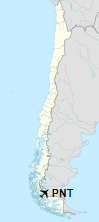
| Map |
Location of Teniente Julio Gallardo Airfield in Chile
|
| Runways |
| Direction |
Length |
Surface |
| m |
ft |
| 10/28 |
1,764 |
5,787 |
Asphalt |
|
Expansion
In 2014 it was announced that the airport would be expanded with the taxiway widened to 23 metres (75 ft) and runway extended to 2,000 metres (6,600 ft) and widened to 45 metres (148 ft). Work is expected to be completed in September 2016 and is being done so that the airport is better able to handle aircraft such as the A320 and Boeing 737 to return scheduled commercial service to Puerto Natales, which it has not had since 2013.
Latest available imagery (2/12/2015) shows a displaced threshold on the southeast end of the runway, limiting runway length to 1,315 metres (4,314 ft).
Airlines and destinations
| Destinations |
| JetSmart |
Santiago de Chile |
| LATAM Chile |
Seasonal: Punta Arenas, Santiago de Chile |
| Sky Airline |
Seasonal: Santiago de Chile |
The above content comes from Wikipedia and is published under free licenses – click here to read more.
| General Info
|
| Country |
Chile
|
| ICAO ID |
SCNT
|
| Time |
UTC-4(-3DT)
|
| Latitude |
-51.671475
51° 40' 17.31" S
|
| Longitude |
-72.528350
072° 31' 42.06" W
|
| Elevation |
217 feet
66 meters
|
| Magnetic Variation |
014° E (01/06)
|
| Beacon |
Yes
|
| Operating Agency |
CIVIL GOVERNMENT, (LANDING FEES AND DIPLOMATIC CLEARANCE MAY BE REQUIRED)
|
| Operating Hours |
SUNRISE TO SUNSET (SR-SS)
|
| Communications
|
NATALES INFO
Opr 1230-2130Z++ Mon-Thu, 1230-2030Z++ Fri, OT O/R.
|
127.7
|
| Runways
|
| ID |
Dimensions |
Surface |
PCN |
ILS
|
| 10/28 |
5786 x 98 feet
1764 x 30 meters |
ASPHALT |
025FAXU |
NO
|
| Navaids
|
| Type |
ID |
Name |
Channel |
Freq |
Distance From Field |
Bearing From Navaid
|
| VOR-DME |
PNT |
PUERTO NATALES |
106X |
115.9 |
4.9 NM |
307.2
|
| Remarks
|
| CAUTION |
Bird haz.
|
| OPR HOURS |
Opr SR-SS.
|
The content above was published at Airports-Worldwide.com in 2020.
We don't guarantee the information is fresh and accurate. The data may be wrong or outdated.
For more up-to-date information please refer to other sources.
|
|