|
|
Ricardo Garcia Posada Airport |
Ricardo García Posada Airport, formerly El Salvador Bajo Airport (IATA: ESR, ICAO: SCES), is an airport serving the copper mining community of El Salvador, in the Atacama Region of Chile.
The airport is in the desert 15 kilometres (9.3 mi) southwest of El Salvador. The runway slopes upward to the east.
|
Ricardo García Posada Airport
El Salvador Bajo Airport
|
|
|
| Summary |
| Airport type |
Public |
| Serves |
El Salvador, Chile |
| Elevation AMSL |
5,240 ft / 1,597 m |
| Coordinates |
26°18′40″S
69°45′55″W |
| Map |
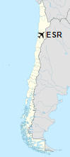
Location of airport in Chile
|
| Runways |
| Direction |
Length |
Surface |
| m |
ft |
| 09/27 |
2,308 |
7,572 |
Asphalt |
|
The above content comes from Wikipedia and is published under free licenses – click here to read more.
| General Info
|
| Country |
Chile
|
| ICAO ID |
SCES
|
| Time |
UTC-4(-3DT)
|
| Latitude |
-26.311128
26° 18' 40.06" S
|
| Longitude |
-69.765200
069° 45' 54.72" W
|
| Elevation |
5240 feet
1597 meters
|
| Magnetic Variation |
000° W (01/06)
|
| Operating Agency |
CIVIL GOVERNMENT, (LANDING FEES AND DIPLOMATIC CLEARANCE MAY BE REQUIRED)
|
| Operating Hours |
SUNRISE TO SUNSET (SR-SS)
|
| Communications
|
AFIS
Scheduled flights only. Call 15 minutes before arr.
|
118.2
|
| Runways
|
| ID |
Dimensions |
Surface |
PCN |
ILS
|
| 08/26 |
7546 x 98 feet
2300 x 30 meters |
ASPHALT |
026FAXT |
NO
|
| Supplies/Equipment
|
| Fuel |
100/130 MIL Spec, low lead, aviation gasoline (BLUE)
|
| Remarks
|
| CAUTION |
Apn rstd to one acft AUW12.
|
| FUEL |
(NC-80, 100LL)
|
| LGT |
PAPI avbl only for sked flt.
|
| OPR HOURS |
Opr SR-SS.
|
| RSTD |
Acft flt plan to arpt ctc 118.2, 15 min before arr.
|
The content above was published at Airports-Worldwide.com in 2020.
We don't guarantee the information is fresh and accurate. The data may be wrong or outdated.
For more up-to-date information please refer to other sources.
|
|