|
|
Panguilemo Airport (Spanish: Aeropuerto Panguilemo, (IATA: TLX, ICAO: SCTL)) is an airport 5 kilometres (3.1 mi) northeast of Talca, capital of the Maule Region of Chile.
|
Panguilemo Airport
Aeropuerto Panguilemo
|
|
|
| Summary |
| Airport type |
Public |
| Serves |
Talca, Chile |
| Location |
Panguilemo |
| Elevation AMSL |
371 ft / 113 m |
| Coordinates |
35°22′40″S
71°36′05″W |
| Map |
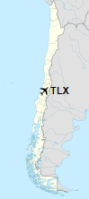
Location of Panguilemo Airport in Chile
|
| Runways |
| Direction |
Length |
Surface |
| m |
ft |
| 03/21 |
1,125 |
3,691 |
Asphalt |
|
The above content comes from Wikipedia and is published under free licenses – click here to read more.
| General Info
|
| Country |
Chile
|
| ICAO ID |
SCTL
|
| Time |
UTC-4(-3DT)
|
| Latitude |
-35.377825
35° 22' 40.17" S
|
| Longitude |
-71.601681
071° 36' 06.05" W
|
| Elevation |
371 feet
113 meters
|
| Magnetic Variation |
005° E (01/06)
|
| Operating Agency |
CIVIL GOVERNMENT, (LANDING FEES AND DIPLOMATIC CLEARANCE MAY BE REQUIRED)
|
| Near City |
Talca
|
| Operating Hours |
SUNRISE TO SUNSET (SR-SS)
|
| Runways
|
| ID |
Dimensions |
Surface |
PCN |
ILS
|
| 03/21 |
3660 x 80 feet
1116 x 24 meters |
ASPHALT |
- |
NO
|
| Remarks
|
| CAUTION |
79' trees 492' N of Rwy 21. Unmarked power lines 39 to 65 feet in hgt located 328 to 492 feet south of thld Rwy 03.
|
| OPR HOURS |
Opr SR-SS.
|
The content above was published at Airports-Worldwide.com in 2020.
We don't guarantee the information is fresh and accurate. The data may be wrong or outdated.
For more up-to-date information please refer to other sources.
|
|