|
Las Tacas Airport Spanish: Aeropuerto de Las Tacas, (ICAO: SCQT) is an airport serving Las Tacas (es), a Pacific coastal resort in the Coquimbo Region of Chile. The airport is 24 kilometres (15 mi) south of La Serena.
Runway length does not include a 195 metres (640 ft) displaced threshold on Runway 35. There is high terrain north of the airport.
The Tongoy VOR-DME (TOY) is located 12.2 nautical miles (22.6 km) south-southwest of the airport.
|
Las Tacas Airport
|
|
|
| Summary |
| Airport type |
Public |
| Serves |
Las Tacas (es), Chile |
| Elevation AMSL |
140 ft / 43 m |
| Coordinates |
30°5′50″S
71°21′50″W |
| Map |
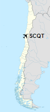
Location of Las Tacas Airport in Chile
|
| Runways |
| Direction |
Length |
Surface |
| m |
ft |
| 17/35 |
900 |
2,953 |
Asphalt |
|
| Helipads |
| Number |
Length |
Surface |
| m |
ft |
| 1 |
13 |
43 |
Asphalt |
|
The above content comes from Wikipedia and is published under free licenses – click here to read more.
| General Info
|
| Country |
Chile
|
| ICAO ID |
SCQT
|
| Time |
UTC-4(-3DT)
|
| Latitude |
-30.096403
30° 05' 47.05" S
|
| Longitude |
-71.364106
071° 21' 50.78" W
|
| Elevation |
140 feet
43 meters
|
| Magnetic Variation |
002° E (01/06)
|
| Operating Agency |
CIVIL GOVERNMENT, (LANDING FEES AND DIPLOMATIC CLEARANCE MAY BE REQUIRED)
|
| Operating Hours |
SUNRISE TO SUNSET (SR-SS)
|
| Runways
|
| ID |
Dimensions |
Surface |
PCN |
ILS
|
| 17/35 |
3590 x 66 feet
1094 x 20 meters |
ASPHALT |
- |
NO
|
| Remarks
|
| CAUTION |
23' hi electrical lines 492' fr thld Rwy 35. Pwr lines at apch Rwy 17. Pwr lines 623' S of thld Rwy 35.
|
| OPR HOURS |
Opr SR-SS.
|
The content above was published at Airports-Worldwide.com in 2020.
We don't guarantee the information is fresh and accurate. The data may be wrong or outdated.
For more up-to-date information please refer to other sources.
|