|
|
Chañaral Airport Spanish: Aeropuerto de Chañaral, (IATA: CNR, ICAO: SCRA) is an airport serving Chañaral, a Pacific coastal city in the Atacama Region of Chile.
There is rising terrain north and south of the airport.
|
Chañaral Airport
|
|
|
| Summary |
| Airport type |
Public |
| Serves |
Chañaral, Chile |
| Elevation AMSL |
97 ft / 30 m |
| Coordinates |
26°19′55″S
70°36′25″W |
| Map |
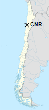
Location of Chañaral Airport in Chile
|
| Runways |
| Direction |
Length |
Surface |
| m |
ft |
| 09/27 |
1,225 |
4,019 |
Asphalt |
|
The above content comes from Wikipedia and is published under free licenses – click here to read more.
| General Info
|
| Country |
Chile
|
| ICAO ID |
SCRA
|
| Time |
UTC-4(-3DT)
|
| Latitude |
-26.332542
26° 19' 57.15" S
|
| Longitude |
-70.607308
070° 36' 26.31" W
|
| Elevation |
97 feet
30 meters
|
| Magnetic Variation |
000° E (01/06)
|
| Operating Agency |
CIVIL GOVERNMENT, (LANDING FEES AND DIPLOMATIC CLEARANCE MAY BE REQUIRED)
|
| Operating Hours |
SUNRISE TO SUNSET (SR-SS)
|
| Runways
|
| ID |
Dimensions |
Surface |
PCN |
ILS
|
| 09/27 |
3985 x 98 feet
1215 x 30 meters |
ASPHALT |
- |
NO
|
| Remarks
|
| OPR HOURS |
Opr SR-SS.
|
The content above was published at Airports-Worldwide.com in 2020.
We don't guarantee the information is fresh and accurate. The data may be wrong or outdated.
For more up-to-date information please refer to other sources.
|
|