|
Nuevo Chaitén Airport Spanish: Aeródromo Nuevo Chaitén, (IATA: WCH, ICAO: SCTN) is an airport serving Chaitén, a town in the Los Lagos Region of Chile. The airport replaces Chaitén Airfield, the airport at Chaitén that was damaged and closed after the 2008 eruption of the Chaitén Volcano. The new airport is 18 kilometres (11 mi) northwest of the town.
After construction began on Nuevo Chaitén Airport in 2013, it assumed the ICAO and IATA codes of the closed airport.
South approach and departures are over the Gulf of Corcovado.
The Chaiten VOR-DME (Ident: TEN) is located on the field.
|
Nuevo Chaitén Airport
|
|
|
| Summary |
| Airport type |
Public |
| Serves |
Chaitén, Chile |
| Elevation AMSL |
95 ft / 29 m |
| Coordinates |
42°46′55″S
72°50′05″W |
| Map |
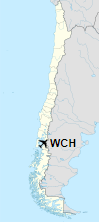
Location of Nuevo Chaitén Airport in Chile
|
| Runways |
| Direction |
Length |
Surface |
| m |
ft |
| 01/19 |
1,200 |
3,937 |
Asphalt |
|
The above content comes from Wikipedia and is published under free licenses – click here to read more.
| General Info
|
| Country |
Chile
|
| ICAO ID |
SCTN
|
| Time |
UTC-4(-3DT)
|
| Latitude |
-42.932808
42° 55' 58.11" S
|
| Longitude |
-72.699114
072° 41' 56.81" W
|
| Elevation |
13 feet
4 meters
|
| Magnetic Variation |
010° E (01/06)
|
| Operating Agency |
CIVIL GOVERNMENT, (LANDING FEES AND DIPLOMATIC CLEARANCE MAY BE REQUIRED)
|
| Operating Hours |
SUNRISE TO SUNSET (SR-SS)
|
| Communications
|
INFO
Opr 1230Z++-SS.
|
126.7
5454
|
| Runways
|
| ID |
Dimensions |
Surface |
PCN |
ILS
|
| 13/31 |
4670 x 65 feet
1423 x 20 meters |
ASPHALT |
- |
NO
|
| Navaids
|
| Type |
ID |
Name |
Channel |
Freq |
Distance From Field |
Bearing From Navaid
|
| NDB |
TEN |
CHAITEN |
- |
234 |
At Field |
-
|
| Remarks
|
| CAUTION |
98' ant lctd 250' NE of rwy. 118' obst lctd 2625' NW thld Rwy 13.
|
| LGT |
PAPI Rwy 13 GS 3.2 .
|
| MISC |
Rwy 31 first 1095' conc, remainder asp.
|
| OPR HOURS |
Opr SR-SS.
|
The content above was published at Airports-Worldwide.com in 2020.
We don't guarantee the information is fresh and accurate. The data may be wrong or outdated.
For more up-to-date information please refer to other sources.
|