|
|
Balmaceda Airport (IATA: BBA, ICAO: SCBA) is an airport next to the village of Balmaceda, serving the Aysén Region of Chile. The airport is 4 kilometres (2.5 mi) west of the Argentina border, it is located 55 km south-east of Coyhaique, the regional capital.
The Balmaceda VOR-DME (Ident: BAL) is located 0.31 nautical miles (0.6 km) off the approach threshold of Runway 09. The Balmaceda non-directional beacon (Ident: BAL) is located on the field.
|
Balmaceda Airport
|
|
|
| Summary |
| Airport type |
Public |
| Location |
Balmaceda, Chile |
| Elevation AMSL |
1,719 ft / 524 m |
| Coordinates |
45°54′58″S
71°41′15″W |
| Map |
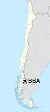
Location of Balmaceda Airport in Chile
|
| Runways |
| Direction |
Length |
Surface |
| m |
ft |
| 09/27 |
2,503 |
8,212 |
Asphalt |
|
Expansion plans
In 2016 works to improve the airfield and expand capacity were commenced consisting of resurfacing the damaged runway surface, the building of a new 30 m wide parallel taxiway, a new control tower, expansion of the apron, and improvements to other administrative structures. These were made with an investment of approximately 27 billion pesos, much of which were national funds intended for the development of remote regions of the country.
In April 2018 the new taxiway entered use as a temporary runway (designated 09L/27R) to enable repair works on the main runway.
Airlines and destinations
| Destinations |
| JetSmart |
Concepcion (begins December 17, 2019) |
| LATAM Chile |
Puerto Montt, Santiago de Chile |
| Sky Airline |
Puerto Montt, Santiago de Chile |
Accidents and incidents
On 8 April 1968, Douglas C-49K CC-CBM of LADECO crashed on approach, killing all 36 people on board. The aircraft was operating a domestic scheduled passenger flight from Los Cerrillos Airport, Santiago.
The above content comes from Wikipedia and is published under free licenses – click here to read more.
| General Info
|
| Country |
Chile
|
| ICAO ID |
SCBA
|
| Time |
UTC-4(-3DT)
|
| Latitude |
-45.916058
45° 54' 57.81" S
|
| Longitude |
-71.689475
071° 41' 22.11" W
|
| Elevation |
1722 feet
525 meters
|
| Type |
Civil
|
| Magnetic Variation |
011° E (01/06)
|
| Beacon |
Yes
|
| Operating Agency |
CIVIL GOVERNMENT, (LANDING FEES AND DIPLOMATIC CLEARANCE MAY BE REQUIRED)
|
| Operating Hours |
SEE REMARKS FOR OPERATING HOURS OR COMMUNICATIONS FOR POSSIBLE HOURS
|
| Communications
|
| TWR |
118.5
|
| RDO |
126.9
5454
|
BALMACEDA GND
1300-2200Z++
|
121.9
|
| Runways
|
| ID |
Dimensions |
Surface |
PCN |
ILS
|
| 09/27 |
8205 x 148 feet
2501 x 45 meters |
ASPHALT |
033FBXT |
NO
|
| Navaids
|
| Type |
ID |
Name |
Channel |
Freq |
Distance From Field |
Bearing From Navaid
|
| VOR-DME |
BAL |
BALMACEDA |
102X |
115.5 |
At Field |
-
|
| NDB |
BAL |
BALMACEDA |
- |
390 |
At Field |
-
|
| Supplies/Equipment
|
| Fuel |
Jet A1, without icing nhibitor.
|
| Remarks
|
| CAUTION |
46' hill lctd 1050' SE thld Rwy 27.
|
| FUEL |
Avbl 1300-2130Z++ OT O/R. (NC-100LL, A1)
|
| LGT |
PAPI Rwy 27 GS 2.8 .
|
| OPR HOURS |
Opr 1200-2200Z++.
|
The content above was published at Airports-Worldwide.com in 2020.
We don't guarantee the information is fresh and accurate. The data may be wrong or outdated.
For more up-to-date information please refer to other sources.
|
|