Saint-Hyacinthe Aerodrome |
Saint-Hyacinthe Aerodrome, (TC LID: CSU3), is located 3 nautical miles (5.6 km; 3.5 mi) west of Saint-Hyacinthe, Quebec, Canada.
The Saint-Hyacinthe Aerodrome is an example of general aviation diversity driven by private management.
Almost all airplanes on floats land on its man-made water basin, parallel to the runway, single and
twin engine conventional aircraft, ultralight two axis, ultralight three axis, aerobatic airplanes,
vintage aircraft and motor gliders fly regularly from the narrow (75 ft (23 m) but well maintained runway.
The newly paved taxiway keeps traffic moving around smoothly.
Weekends with nice weather are particularly busy. Aviation enthusiasts
can admire aerobatics performed in the aerobatic box at the west of the airport, formation flights, low passes, overshoot training etc.
Aviation schools and repair shops are present.
All hangar spaces are sold out and more hangars under construction drive the need for more space for hangars and an extra runway
to permit landings when crosswinds are to strong to permit a safe return in such conditions.
The only runway stays quite busy during the days when strong winds blow perpendicularly to the runway axis. Strong winds are typical of this area, much stronger than nearby
airports, sometime in excess of 40 km/h (22 kn; 25 mph). Crosswinds of this strength rattle the hangars and keep almost everybody grounded.
| Saint-Hyacinthe Aerodrome |
- IATA: none
- ICAO: none
- TC LID: CSU3
|
| Summary |
| Airport type |
Private |
| Operator |
Aeroservices St-Hyacinthe |
| Location |
Saint-Hyacinthe, Quebec |
| Time zone |
EST (UTC−05:00) |
| • Summer (DST) |
EDT (UTC−04:00) |
| Elevation AMSL |
118 ft / 36 m |
| Coordinates |
45°36′24″N
073°00′54″W |
| Map |
|
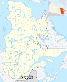
Location in Quebec |
| Runways |
| Direction |
Length |
Surface |
| ft |
m |
02/20 |
3,823 |
1,165 |
Asphalt/Turf |
|
|
Source: Canada Flight Supplement |
The above content comes from Wikipedia and is published under free licenses – click here to read more.
| General Info
|
| Country |
Canada
|
| Latitude |
45.605000
45° 36' 18.00" N
|
| Longitude |
-73.014168
073° 00' 51.00" W
|
| Elevation |
115 feet
35 meters
|
| Magnetic Variation |
015° W (01/06)
|
| Operating Agency |
PRIVATE
|
| Daylight Saving Time |
Second Sunday in March at 0200 to first Sunday in November at 0200 local time (Exception Arizona and that portion of Indiana in the Eastern Time Zone)
|
| Communications
|
| CTAF |
123.2
|
| Runways
|
| ID |
Dimensions |
Surface |
PCN |
ILS
|
| 02/20 |
3800 x 75 feet
1158 x 23 meters |
COMPOSITE, 50 PERCENT OR MORE OF THE RUNWAY LENGTH IS PERMANENT. |
- |
NO
|
| Supplies/Equipment
|
| Fuel |
80/87 octane gasoline, leaded, MIL-L-5572F (RED)
100/130 MIL Spec, low lead, aviation gasoline (BLUE)
|
The content above was published at Airports-Worldwide.com in 2020.
We don't guarantee the information is fresh and accurate. The data may
be wrong or outdated.
For more up-to-date information please refer to other sources.
|


