 |
|
Peterborough Airport, (IATA: YPQ, ICAO: CYPQ), is located 3 nautical miles (5.6 km; 3.5 mi) south-southwest of the city of Peterborough, Ontario, Canada. The airport includes a main 7,000 by 100 ft (2,134 by 30 m) asphalt runway oriented east-west, and a smaller 2,000 by 49 ft (610 by 15 m) paved (2014) runway oriented northwest-southeast. A new terminal building was built in 2011. Aircraft completions company Flying Colours Corp. is the largest tenant at the airport.
The airport is classified as an airport of entry by Nav Canada and is staffed by the Canada Border Services Agency (CBSA). CBSA officers at this airport can handle general aviation aircraft only, with no more than 15 passengers.
Work has been completed to expand an existing 5,000 ft (1,524 m) asphalt runway to 7,000 ft (2,134 m), making the runway capable of handling larger aircraft such as the Airbus A320 and the Boeing 737.
Seneca College relocated its School of Aviation Technology to Peterborough Airport in January 2014, after their former airport Buttonville was scheduled to close. Seneca had 170 students in classes at its new facility in 2014. The $8.6 million contract was awarded to Mortlock Construction Inc. Mortlock significantly expanded an existing building that the city owned at the airport to about 46,000 square feet from 21,000 square feet, and completed the interior of the structure to the college’s specifications with offices, rooms for flight simulators, classrooms, a student lounge, washrooms and a kitchen. Seneca’s School of Aviation and Flight Technology has 19 aircraft to the airport.
| Peterborough Airport |
- IATA: YPQ
- ICAO: CYPQ
- WMO: 71436
|
| Summary |
| Airport type |
Public |
| Operator |
City of Peterborough |
| Serves |
Peterborough, Ontario |
| Location |
Peterborough, Ontario, Canada |
| Time zone |
EST (UTC−05:00) |
| Summer (DST) |
EDT (UTC−04:00) |
| Elevation AMSL |
628 ft / 191 m |
| Coordinates |
44°13′50″N
078°21′48″W |
| Map |
|
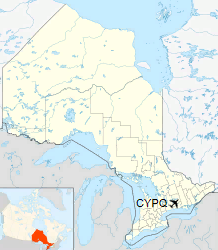
Location in Ontario
|
| Runways |
| Direction |
Length |
Surface |
| ft |
m |
09/27 |
7,000 |
2,134 |
Asphalt |
13/31 |
2,000 |
610 |
Asphalt |
|
| Statistics (2010) |
| Aircraft movements |
27,674 |
|
Tenants
Current
- The Loomex Group, Airport Operators
Airtech Canada Aviation Services - aircraft engineering, manufacturing, and modification company; customer interior for medevac clients
- Flying Colours Corporation - aircraft care and design
- International Aircraft Support & Turbine Engine Sales - parts supplier for the Beechcraft King Air, 1900 Airliner and Pratt & Whitney Gas Turbine engines.
- Turbine Engine Sales - Pratt & Whitney parts supplier
- Kadex Aero Supply - surplus aircraft parts wholesaler
- President Air Charter - business charter
- Rapid Aircraft Repair Incorporated
- Gardens & Fields Restaurant - family dining
- The Loomex Group- Airport operation and management, property management, emergency management training, emergency exercise design, public relations, communication and marketing
- Toronto Avionics - aircraft electronics and avionics repair
- Complete Aviation Services Limited FBO
- Vector Air Limited - executive class air charter service
- W.M. Aeroservice - general aviation maintenance, aircraft repair, private and commercial pilot training
- Seneca College
Former
- Otonabee Airways or (Air Atonabee Limited 1980) 1975-1984
Transportation
The airport is reached by car from Highway 115 via Airport Road. Parking is available on-site, although there are few spaces available.
The above content comes from Wikipedia and is published under free licenses – click here to read more.
| General Info
|
| Country |
Canada
|
| ICAO ID |
CYPQ
|
| Time |
UTC-5(-4DT)
|
| Latitude |
44.230000
44° 13' 48.00" N
|
| Longitude |
-78.363333
078° 21' 48.00" W
|
| Elevation |
628 feet
191 meters
|
| Type |
Civil
|
| Magnetic Variation |
011° W (01/06)
|
| Beacon |
Yes
|
| Operating Agency |
CIVIL GOVERNMENT, (LANDING FEES AND DIPLOMATIC CLEARANCE MAY BE REQUIRED)
|
| Operating Hours |
24 HOUR OPERATIONS
|
| International Clearance Status |
Airport of Entry
|
| Daylight Saving Time |
Second Sunday in March at 0200 to first Sunday in November at 0200 local time (Exception Arizona and that portion of Indiana in the Eastern Time Zone)
|
| Communications
|
CTAF/UNICOM
UNICOM opr 1300-2300Z++.
|
123.0
|
| TORONTO CNTR |
134.25
|
| AWOS |
126.925
|
| Communications Remarks |
|
| CNTR |
(APP/DEP svc)
|
| Runways
|
ID
|
Dimensions |
Surface |
PCN |
ILS
|
| 09/27 |
5000 x 100 feet
1524 x 30 meters |
ASPHALT |
- |
NO
|
| 13/31 |
1850 x 100 feet
564 x 30 meters |
GRASS OR EARTH NOT GRADED OR ROLLED. |
- |
NO
|
| Navaids
|
| Type |
ID |
Name |
Channel |
Freq |
Distance From Field |
Bearing From Navaid
|
| NDB |
YPQ |
PETERBOROUGH |
- |
379 |
4.2 NM |
087.5
|
| Supplies/Equipment
|
| Fuel |
Jet A1, without icing nhibitor.
100/130 MIL Spec, low lead, aviation gasoline (BLUE)
|
| Remarks
|
| CAUTION |
Wildlife haz.
|
| FUEL |
(NC-100LL, A1)
|
| LGT |
ACTIVATE-HIRL, PAPI Rwy 09-27-CTAF. REIL Rwy 09-27 O/R-CTAF. PAPI Rwy 09-27, 12 lgt unit for acft with eye-to-wheel height up to 10'.
|
| MISC |
Rwy 13-31 no win maint. TWEB C905-477-9219, C416-973-8973, C800-387-0444. Ltd ngt win maint Rwy 09-27.
|
| RSTD |
Acft proh fr opr within 302' either side Rwy 09-27.
|
The content above was published at Airports-Worldwide.com in 2018.
We don't guarantee the information is fresh and accurate. The data may
be wrong or outdated.
For more up-to-date information please refer to other sources.
|
|


