 |
|
Niagara Central Dorothy Rungeling Airport |
Niagara Central Dorothy Rungeling Airport or Welland/Niagara Central Dorothy Rungeling Aerodrome, (TC LID: CNQ3), is a registered aerodrome located 3.5 nautical miles (6.5 km; 4.0 mi) west of Welland, Ontario, Canada. Niagara Central accommodates a flight school, skydivers, aerial photographers, itinerant light aircraft and an automatic weather station. It was built in 1940 by the Royal Canadian Air Force as part of the British Commonwealth Air Training Plan and served as the relief airfield for the No. 6 Service Flying Training School in nearby Dunnville, Ontario.
The airport is the home of the 87th Eagle Squadron of the Royal Canadian Air Cadets who have training and administration space in the airports former meeting place of Welland Fire Company Number 1. The Southern Ontario Gliding Centre (SOGC) of the Royal Canadian Air Cadets also utilize the airport for spring and fall familiarization flights for the cadets.
|
Niagara Central Dorothy Rungeling Airport. |
In 1995, various members of Fonthill Branch 613 of the Royal Canadian Legion lobbied to have the airport renamed "Bud Kerr Welland Airport" in recognition of a local World War II Spitfire fighter pilot, but were unsuccessful. In 2015 the airport was renamed Niagara Central Dorothy Rungeling Airport, in honour of the legendary Canadian pilot Dorothy Rungeling, CM .
Niagara Central Dorothy Rungeling Airport
Welland/Niagara Central Dorothy Rungeling Aerodrome |
- IATA: none
- ICAO: none
- TC LID: CNQ3
|
| Summary |
| Airport type |
Public |
| Operator |
Niagara Central Airport Commission |
| Location |
Welland, Ontario |
| Time zone |
EST (UTC−05:00) |
| Summer (DST) |
EDT (UTC−04:00) |
| Elevation AMSL |
584 ft / 178 m |
| Coordinates |
42°58′48″N
079°19′29″W |
| Website |
www.centralairport.ca |
| Map |
|
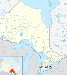
Location in Ontario
|
| Runways |
| Direction |
Length |
Surface |
| ft |
m |
05/23 |
3,493 |
1,065 |
Asphalt |
16/34 |
2,663 |
812 |
Asphalt |
|
| Statistics (2010) |
| Aircraft movements |
23,341 |
|
|
Source: Canada Flight Supplement
Movements from Statistics Canada. |
|
Niagara Central Dorothy Rungeling Airport. |
Environment Canada automated weather station
|
Niagara Central Dorothy Rungeling Airport. |
Skydivers landing
|
Niagara Central Dorothy Rungeling Airport. |
Public areas
The above content comes from Wikipedia and is published under free licenses – click here to read more.
| General Info
|
| Country |
Canada
|
| Latitude |
42.979168
42° 58' 45.00" N
|
| Longitude |
-79.324722
079° 19' 29.00" W
|
| Elevation |
586 feet
179 meters
|
| Magnetic Variation |
010° W (01/06)
|
| Beacon |
Yes
|
| Operating Agency |
MUNICIPAL
|
| Daylight Saving Time |
Second Sunday in March at 0200 to first Sunday in November at 0200 local time (Exception Arizona and that portion of Indiana in the Eastern Time Zone)
|
| Communications
|
CTAF/UNICOM
UNICOM opr ltd hr.
|
123.5
|
| TORONTO TRML |
133.4
253.1
|
| BUFFALO APP |
126.5
|
| Communications Remarks |
|
| TCA |
(APP-North, DEP-Northbound).
|
| A/D |
(APP-South, DEP-Southbound).
|
| Runways
|
ID
|
Dimensions |
Surface |
PCN |
ILS
|
| 05/23 |
3500 x 100 feet
1067 x 30 meters |
ASPHALT |
- |
NO
|
| 16/34 |
2570 x 50 feet
783 x 15 meters |
ASPHALT |
- |
NO
|
| Supplies/Equipment
|
| Fuel |
80/87 octane gasoline, leaded, MIL-L-5572F (RED)
100/130 MIL Spec, low lead, aviation gasoline (BLUE)
|
The content above was published at Airports-Worldwide.com in 2018.
We don't guarantee the information is fresh and accurate. The data may
be wrong or outdated.
For more up-to-date information please refer to other sources.
|
|


