 |
|
Moosonee Airport, (IATA: YMO, ICAO: CYMO), is located 2 nautical miles (3.7 km; 2.3 mi) north-east of Moosonee, Ontario, Canada.
The Moosonee Airport was officially opened in May 1970 and a new terminal building was constructed in July 1991, that houses the airport management office and washrooms.
There are several small buildings and hangars at the airport. There are no other facilities at the airport.
The airport handles propeller or turbo prop aircraft only and helicopters from two helipads next to the terminal building.
| Moosonee Airport |
- IATA: YMO
- ICAO: CYMO
- WMO: 71398
|
| Summary |
| Airport type |
Public |
| Operator |
The Corporation of the Town of Moosonee |
| Location |
Moosonee, Ontario |
| Time zone |
EST (UTC−05:00) |
| Summer (DST) |
EDT (UTC−04:00) |
| Elevation AMSL |
30 ft / 9 m |
| Coordinates |
51°17′31″N
080°36′30″W |
| Website |
www.moosoneeairport.com |
| Map |
|
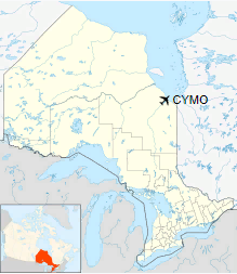
Location in Ontario
|
| Runways |
| Direction |
Length |
Surface |
| ft |
m |
06/24 |
4,004 |
1,220 |
Asphalt |
14/32 |
3,554 |
1,083 |
Gravel/Asphalt |
|
| Statistics (2010) |
| Aircraft movements |
23,981 |
|
Airlines and destinations
| Airlines |
Destinations |
| North Star Air |
Attawapiskat, Kashechewan, Fort Albany |
| Air Creebec |
Attawapiskat, Fort Albany, Kashechewan, Peawanuck, Timmins, Waskaganish |
| Thunder Airlines |
Attawapiskat, Fort Albany, Kashechewan, Peawanuck, Timmins |
| Wabusk Air |
Air Ambulance contractor with ORNGE, cargo, charter service |
Tenants
- CHC Helicopter for Ontario Air Ambulance
The above content comes from Wikipedia and is published under free licenses – click here to read more.
| General Info
|
| Country |
Canada
|
| ICAO ID |
CYMO
|
| Latitude |
51.291111
51° 17' 28.00" N
|
| Longitude |
-80.607778
080° 36' 28.00" W
|
| Elevation |
30 feet
9 meters
|
| Magnetic Variation |
013° W (01/06)
|
| Beacon |
Yes
|
| Operating Agency |
CIVIL GOVERNMENT, (LANDING FEES AND DIPLOMATIC CLEARANCE MAY BE REQUIRED)
|
| Daylight Saving Time |
Second Sunday in March at 0200 to first Sunday in November at 0200 local time (Exception Arizona and that portion of Indiana in the Eastern Time Zone)
|
| Communications
|
TIMMINS RDO
Opr 1200-0200Z++. |
122.5 |
| CTAF |
122.5 |
| TORONTO CNTR |
133.725
225.075 |
| AWOS |
124.8 |
MF
Ltd hr ctc CTAF. |
122.5 |
| Communications Remarks |
|
| RCO |
(RCO)(Remote Aerodrome Advisory Service)(APP DEP CON svc) |
| CTAF |
(RCO)(Flight Information Service Enroute) |
| AWOS |
(YMO) |
| Runways
|
ID
|
Dimensions |
Surface |
PCN |
ILS |
| 06/24 |
4000 x 100 feet
1219 x 30 meters |
ASPHALT |
016FCYU |
NO |
| 14/32 |
3500 x 100 feet
1067 x 30 meters |
COMPOSITE, LESS THAN 50 PERCENT OF THE RUNWAY LENGTH IS PERMANENT. |
008FCZT |
NO |
| Navaids
|
| Type |
ID |
Name |
Channel |
Freq |
Distance From Field |
Bearing From Navaid |
| VOR-DME |
YMO |
MOOSONEE |
076X |
112.9 |
At Field |
- |
| NDB |
MO |
MOOSONEE |
- |
224 |
At Field |
- |
| Supplies/Equipment
|
| Fuel |
Jet B, Wide cut turbine fuel, Without icing inhibitor.
100/130 octane gasoline, leaded, MIL-L-5572F (GREEN) |
The content above was published at Airports-Worldwide.com in 2018.
We don't guarantee the information is fresh and accurate. The data may
be wrong or outdated.
For more up-to-date information please refer to other sources.
|
|


