 |
|
Fort Frances Municipal Airport |
Fort Frances Municipal Airport (IATA: YAG, ICAO: CYAG) is located 2.2 nautical miles (4.1 km; 2.5 mi) northwest of Fort Frances, Ontario, Canada.
The airport is classified as an airport of entry by Nav Canada and is staffed by the Canada Border Services Agency (CBSA). CBSA officers at this airport can handle general aviation aircraft only, with no more than 15 passengers.
| Fort Frances Municipal Airport |
|
|
| Summary |
| Airport type |
Public |
| Operator |
Town of Fort Frances |
| Location |
Fort Frances, Ontario |
| Time zone |
CST (UTC−06:00) |
| Summer (DST) |
CDT (UTC−05:00) |
| Elevation AMSL |
1,123 ft / 342 m |
| Coordinates |
48°39′16″N
093°26′26″W |
| Map |
|
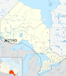
Location in Ontario
|
| Runways |
| Direction |
Length |
Surface |
| ft |
m |
12/30 |
4,493 |
1,369 |
Asphalt |
|
| Statistics (2010) |
|
|
Airlines and destinations
| Airlines |
Destinations |
| Bearskin Airlines |
Kenora, Thunder Bay, Winnipeg |
The above content comes from Wikipedia and is published under free licenses – click here to read more.
| General Info
|
| Country |
Canada
|
| ICAO ID |
CYAG
|
| Time |
UTC-6(-5DT)
|
| Latitude |
48.654167
48° 39' 15.00" N
|
| Longitude |
-93.439722
093° 26' 23.00" W
|
| Elevation |
1125 feet
343 meters
|
| Type |
Civil
|
| Magnetic Variation |
000° E (01/06)
|
| Beacon |
Yes
|
| Operating Agency |
MUNICIPAL
|
| Operating Hours |
24 HOUR OPERATIONS
|
| International Clearance Status |
Airport of Entry
|
| Daylight Saving Time |
Second Sunday in March at 0200 to first Sunday in November at 0200 local time (Exception Arizona and that portion of Indiana in the Eastern Time Zone)
|
| Communications
|
CTAF/UNICOM
UNICOM opr ltd hr.
|
122.8
|
| MINNEAPOLIS CNTR |
120.9
|
| AWOS |
120.0
|
| Communications Remarks |
|
| CNTR |
(APP/DEP svc)
|
| AWOS |
(At Falls Intl)
|
| Runways
|
ID
|
Dimensions |
Surface |
PCN |
ILS
|
| 03/21 |
2600 x 75 feet
792 x 23 meters |
ASPHALT |
- |
NO
|
| 12/30 |
4500 x 100 feet
1372 x 30 meters |
ASPHALT |
031FCZT |
NO
|
| Navaids
|
| Type |
ID |
Name |
Channel |
Freq |
Distance From Field |
Bearing From Navaid
|
| VORTAC |
INL |
INTERNATIONAL FALLS |
047X |
111 |
5.5 NM |
344.0
|
| NDB |
YAG |
FORT FRANCES |
- |
376 |
4.5 NM |
116.6
|
| Supplies/Equipment
|
| Fuel |
Jet B, Wide cut turbine fuel, Without icing inhibitor.
100/130 MIL Spec, low lead, aviation gasoline (BLUE)
|
| Remarks
|
| CAUTION |
1430' twr 1.3 NM S lgtd.
|
| FUEL |
(NC-100LL, A1, B - Avbl 1300-0300Z++ Sun-Fri; 1300Z++-SS Sat, OT PN rqr C807-274-9841. Call out fee may be levied.)
|
| LGT |
ACTIVATE-PAPI, MIRL, REIL Rwy 12-30 and LIRL Rwy 03-21- 122.7. PAPI Rwy 12-30, 12 lgt unit for acft with eye-to-wheel hgt up to 10'.
|
The content above was published at Airports-Worldwide.com in 2018.
We don't guarantee the information is fresh and accurate. The data may
be wrong or outdated.
For more up-to-date information please refer to other sources.
|
|


